VISITORCENTERAND MARKETSPACESFOR
1.
2.SITE ANALYSIS
3.MOOD BOARD
4.DESIGN PROCESS
5.SITE PLAN
6.VISITOR CENTER
A)P PLANS
b)SECTIONS
C)RENDERS
7.VISITOR CENTER INTERIORS
A)EXHIBITION HALL -II
B)AUDITORIUM
C)LIBRARY
D)BOUTIQUE
8.MARKET SPACE
A)PLAN
B)SECTIONS
C)RENDERS
9.CAFETERIA
A)PLAN
B)SECTIONS
C)RENDERS
The Chaya Someswara Swamy Temple is an ancient Hindu temple located in Panagal, a village near Nalgonda in the state of Telangana, India. It is dedicated to Lord Shiva and is renowned for its exquisite architecture and historical significance.
HISTORY:
The temple was constructed during the 11th century by the Kakatiya dynasty rulers, who were great patrons of art and architecture. The Kakatiya dynasty played a significant role in the development of art and architecture in the region, and the Chaya Someswara Swamy Temple stands as a testament to their architectural prowess. It is built during the rule of kunduru cholas and prataparudra I of Kakatiya dynasty.


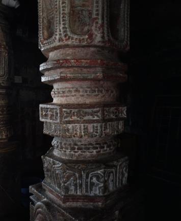
ARCHITECTURE:
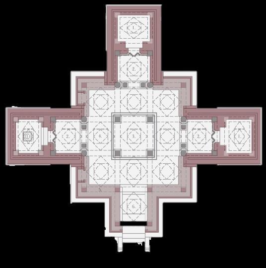
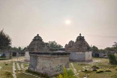
The Chaya Someswara Swamy Temple is a fine example of the Kakatiya style of architecture, characterized by intricate carvings, exquisite sculptures, and intricate stonework. The temple complex consists of several structures including a main shrine dedicated to Lord Shiva, surrounded by smaller shrines dedicated to various deities such as Lord Vishnu and Surya.
One of the unique features of the temple is its "chaya" or shadow effect, which is created by the positioning of pillars and walls in such a way that they cast shadows resembling the outlines of various gods and goddesses during different times of the day. This architectural marvel showcases the advanced understanding of geometry and astronomy possessed by the Kakatiya architects.
The temple also features a mandapa (hall) with intricately carved pillars, a shikhara (tower) adorned with sculptures depicting scenes from Hindu mythology, and a large courtyard where devotees gather for religious ceremonies and festivals.
PRINCIPLES:
The architectural principles employed in the construction of the Chaya Someswara Swamy Temple reflect the religious beliefs and cultural values of the Kakatiya dynasty. The temple is designed to evoke a sense of reverence and awe in the devotees, with its grandeur and beauty serving as a manifestation of the divine.
The intricate carvings and sculptures found throughout the temple complex are not merely decorative but also serve a symbolic purpose, depicting scenes from Hindu mythology and conveying spiritual teachings to the devotees. The layout of the temple is carefully planned to facilitate the rituals and ceremonies associated with worship, while also providing space for meditation and contemplation.
Location - Panagal, Nalgonda, Telangana, India.
Site area - 4 acres.
Soil type - sandy loam texture.
Coordinates - 17.077236_N_79.287336_E.
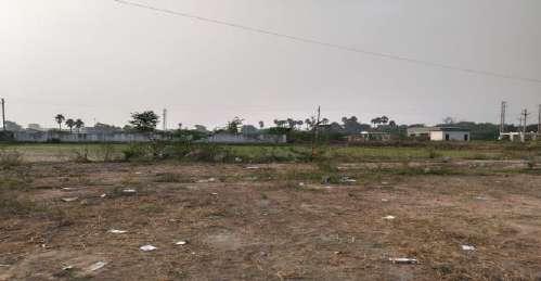
Site Surrounding - Agricultural land and Graveyard.
Proximity :-

The two historical heritage sites Venkateshwara swamy temple and paccala someshwara temple is located 1 km away from the site.
Bus stop of panagal village accessible at 750 m from the site.
Panagal reservoir is just 500 m from the site.
2.3 km Nalgonda bus stand away from the chaya someshwara temple. Nalgonda railway station is at a distance of 4 km from chaya someshwara temple.
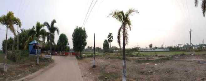
Climatic Conditions :-
The district's yearly temperature is 30.22ºC (86.4ºF) and it is 4.25% higher than India's averages. Nalgonda typically receives about 105.69 millimeters (4.16 inches) of precipitation and has 119.01 rainy days (32.61% of the time) annually.
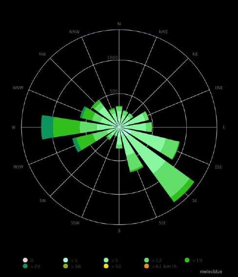
Wind Rose Map Of Nalgonda:-
The wind rose for Nalgonda shows how many hours per year the wind blows from the indicated direction. Example SW: Wind is blowing from South-West (SW) to North-East (NE). Cape Horn, the southernmost land point of South America, has a characteristic strong west-wind, which makes crossings from East to West very difficult especially for sailing boats


Solar data for the Location Geo data for the Location
Dawn: 05:43:20 Height: 214m
Sunrise: 06:04:52 Latitude: N 17°4'41.96'' 17.07832°
Sun peak level: 12:15:43
Longitude: E 79°17'44.03'' 79.29556°
Sunset: 18:26:49 Time zone: Asia/Kolkata IST
Dusk: 18:48:22
Duration: 12h21m57s
Altitude: 58.34°
Shadow length: 0.62 at an object level: 1m S
Public transport is at 1km distance.
Site surrounded by lot of green spaces. Less sound pollution.
W O Entry and exit is from one road. Narrow roads to reach. Poor signage boards.
Opportunities of future development.
One of the well known place in nalagonda leads to increase in visitors count.
T Threats of flooding due to the nala passage beside the site.


