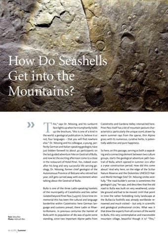
How Do Seashells Get into the Mountains? » T
his,” says Dr. Nössing, and his sunburnt face lights up when he triumphantly holds up the brochure, “this is one of a kind in the world: a geological publication in, believe it or not, four languages – that you will find nowhere else.” Dr. Nössing and his colleague, a young, perfectly German and Italian-speaking geologist, have just bidden farewell to about 40 participants on the last guided adventure hike on Geotrail of Bulla, and now let the exciting afternoon come to a close in the restaurant of Hotel Pinei. Yes, indeed: even after his long and very successful life serving geology, Dr. Nössing, former chief geologist of the Autonomous Province of Bolzano who retired last year, still gets carried away with excitement when talking about the Geotrail of Bulla.
Text: Silvia Rier Photo: Helmuth Rier
10 ALPE | Summer
Bulla is one of the three Ladin-speaking hamlets of the municipality of Castelrotto and lies rather isolated beyond Pinei Pass (1,437m). Since time immemorial this has been the cultural and language borderline within Castelrotto: here German language and customs prevail, there Ladin or Rhaeto-Romanic. In previous centuries the hamlet of Bulla with its population of 180 was of quite some standing, since two important Alpine paths from
Castelrotto and Gardena Valley intersected here. Pinei Pass itself has a lot of mountain pasture characteristics: particularly the unique scent, drawn by warm summer rays from the sparse, thin Alpine grass with its numerous, curative herbs, is potentially addictive and pure happiness. So here, on this passage, serving as both a separating and a connecting element between two culture groups, starts the geological adventure path Geo trail of Bulla, which opened in summer 2011 after a 2-year construction period. How did this come about? And why here, on the edge of the Sciliar Nature Reserve and the Dolomites UNESCO Natural World Heritage Site? Dr. Nössing smiles wistfully. “The road builder’s sorrow is sometimes the geologist’s joy,” he says, and describes that the old road to Bulla was built on very weathered, unstable ground and had to be moved. Until that point in time the rather forbidding rocky landscape at the Bullaccia foothills was already worldwide renowned and much visited – but only in scientific and geological professional circles. What was it that drew the experts from all corners of the world to Bulla, this very contemplative and inaccessible mountain village, beautiful though it is? “This,”
The Geotrail of Bulla: geological history, written in stone and as enthralling as an action thriller
says Dr. Nössing, “is on account of the so-called Bulla Profile, a geological outcrop which is one of the most beautiful in the country.” Indeed, in the geological succession of this Bulla Profile nothing less than a geological super worst case scenario and the changes for the environment it induced are established: this large-scale event, named and known as Permian-Triassic boundary, caused 90% of all the life forms then existing to be eradicated from the face of the earth around 252 million years ago – the end of the world. Try to imagine this enormous period of time: 252 million years (and this only takes us to more recent geological history…). Yes, a geological excursion is always a lesson in modesty. During construction work for the new road it became clear that this “Cinema of Geological History” could also be developed and made accessible for a larger audience without much effort, and that is why early in 2006 a top team of geologists around Prof. Rainer Brandner (Institute for Geology and Paleontology at Innsbruck University) and Dr. Lorenz Keim (State Office for Geology and Building Material Testing) began to develop and build a geological learning path around
this Bulla Profile. The vision behind it? To bring the Dolomites UNESCO Natural World Heritage Site, the world-famous Pale Mountains, closer to the people, to tell the story of the formation of this uniquely magnificent mountain world and, last but not least, to explain about the natural world we live in. According to its mandate the Geotrail does not have any noteworthy difficulties; it can in any case be hiked by both children and elderly persons without problems as long as they are reasonably experienced at hiking in the mountains. In its upper part the path runs on top of an age-old cultural trail, the Troj d’Ancion (also Contoter Trail), loops in the idyllic hamlet of Bulla and returns on the old, dismantled Bulla Road back down to the starting point. The Geotrail is lined and divided by eight well-designed display boards; each reviews and presents a geological topic: you can see how rocks and rock packages form, understand their deformation, movement and formation, marvel over world-shattering events such as the Permian-Triassic boundary and the rock slide of Pontives… and risk that one or another view of the world comes tumbling down, also due to the fact »
Join in for a guided geological excursion at the Geotrail Bulla with Dr. Ludwig Nössing every Wednesday in July and August. The guided tour starts at 1.30 p.m.. Registration and information at the tourist office of Castelrotto.
Summer | ALPE 11
World-famous: the Bulla Profile, a nearly complete record of the biggest mass extinction in history around 252 million years ago
Post Scriptum Dr. Lorenz Keim, driving force and shaping figure behind “Geotrail of Bulla”, died in an avalanche in spring 2011. He lives on in “his” Geotrail, unforgotten.
12 ALPE | Summer
that this “land of ours in the mountains” was once located several thousand kilometers to the South, about where Niger is today, and therefore virtually “immigrated”. However, not even the most beautiful display board can replace a competent guided walk, if only for the simple reason that you cannot ask display boards questions. Collateral effects of the geological circular hike on the “Geotrail”? Of course: new and breathtaking panoramic views of the “most beautiful architecture of the world” open up behind every bend; unique insights into the Dolomites become accessible, as Dr. Nössing
highlights with verve, and as a welcome bonus the guide points out the most beautiful floral decorations, able to thrive in this barren rocky landscape and along the Troj d’Ancion for many years because the trail was neglected more and more after the beginning of widespread car ownership. After approximately four hours the hiker is back at Pinei Pass in the late afternoon. He breathes in the unmatched Alpine scent once more and sets out back home. If you would like to extend this geological afternoon to a more extensive day hike, then you just include the tour “Castelrotto-San Michele-Pinei Pass” in the morning. «