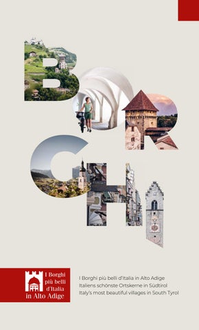
I Borghi più belli d’Italia in Alto Adige
Italiens schönste Ortskerne in Südtirol
Italy’s most beautiful villages in South Tyrol
IT Vipiteno, Chiusa, Castelrotto, Egna e Glorenza fanno parte dell‘esclusiva associazione di “I Borghi più belli d’Italia”, creato nel 2002 dall’Associazione Nazionale Comuni Italiani per valorizzare il patrimonio culturale, storico e ambientale dei piccoli centri. L‘associazione comprende oltre 375 comuni che soddisfano rigorosi criteri di qualità architettonica, valorizzazione delle tradizioni ma soprattutto, sviluppo sociale e turismo etico. I borghi in Alto Adige, infatti, non si distinguono solo per le loro mura medievali o le chiese colme di tesori, ma anche per il loro “genius loci”: un patrimonio indescrivibile di atmosfere, profumi e sapori, botteghe tipiche e squisite specialità locali che danno forma a uno stile di vita appagante da “gustare” con tutti i sensi.
DE Sterzing, Klausen, Kastelruth, Neumarkt und Glurns gehören zur exklusiven Vereinigung der „I Borghi più belli d‘Italia“ (Italiens schönste Ortskerne), der 2002 vom Nationalen Verband der italienischen Gemeinden gegründet wurde, um das kulturelle, historische und ökologische Erbe kleiner Ortschaften zu fördern. Die Vereinigung umfasst mehr als 375 Gemeinden in ganz Italien, die strenge Kriterien in Bezug auf Architektur, Traditionen, soziale Entwicklung und ethischen Tourismus erfüllen. Die Ortskerne in Südtirol zeichnen sich nicht nur durch ihre mittelalterlichen Mauern oder ihre Kirchen aus, sondern auch durch ihren „genius loci“: eine unbeschreibliche Mischung aus Charme, Atmosphäre, typischen Geschäften und exquisiten lokalen Spezialitäten, die ein besonderes Lebensgefühl prägen.
EN Sterzing, Klausen, Kastelruth, Neumarkt and Glurns are part of the exclusive association of „Italy‘s Most Beautiful Villages“ created in 2002 by the National Association of Italian Municipalities to promote the cultural, historical, and environmental heritage of small villages. The association includes more than 375 municipalities that meet strict criteria for architecture, tradition, social development, and ethical tourism. The villages in South Tyrol are not only distinguished by their medieval walls, or their churches full of treasures, but also by their „genius loci“: an indescribable heritage of atmospheres, scents, and tastes, typical stores, and delicious local specialties that shape a fulfilling lifestyle to be „tasted“ with all the senses.
PUBLISHER: Tourism associations Sterzing, Klausen, Kastelruth, Neumarkt and Glurns.
CONCEPT & DESIGN: Minedesign, Klausen. TEXT: Participating tourism associations. PRINT: A. Weger, Brixen.
FOTO: Alex Filz, Alex Moling, Fabian Leitner, Ivan Bortondello, Tina Sturzenegger, Angelika Schwarz; KONI Studios; Wolfgang Gafriller; TG Südtirols Süden: Thomas Monsorno; Helmuth Rier; Werner Dejori; TG Sterzing Pfitsch Freienfeld; Philipp Niederholzer
All places are accessible by public transport
4. EGNA | NEUMARKT
INFOPOINT NEUMARKT - EGNA
Portici 28 Lauben
39044 Egna/Neumarkt T +39 0471 810 231 info@neumarkt-egna.it neumarkt-egna.it
TOURIST INFO SÜDTIROLS SÜDEN
Piazza Centrale 5 Hauptplatz
39040 Ora/Auer T +39 0471 810 231 info@suedtirols-sueden.info | suedtirols-sueden.info
5. GLORENZA | GLURNS
TOURIST INFO OBERVINSCHGAU
Torre della chiesa Tauferer Tor Turm
39020 Glorenza/Glurns T +39 0473 831 097 glurns@ferienregion-obervinschgau.it ferienregion-obervinschgau.it
TOURIST INFO GLURNS MARKETING
Piazza del Municipio 1 Rathausplatz
39020 Glorenza/Glurns | T +39 0473 831 288 info@glurnsmarketing.it glurns.eu
Mit dem Rad zu Südtirols schönsten Ortskernen
Erlebe Südtirol von seiner charmantesten Seite
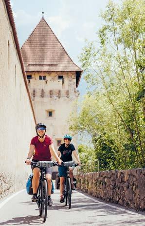
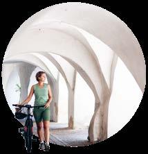
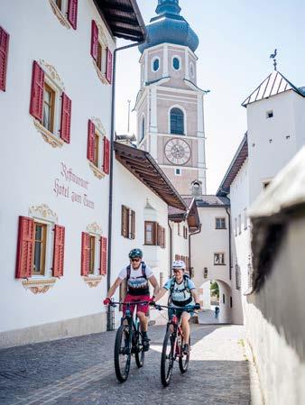
– auf zwei Rädern und mit allen Sinnen. Gut ausgebaute Radwege führen durch sanfte Hügellandschaften, vorbei an Weinbergen, Wiesen und historischen Städten und Dörfern, die zu den „schönsten Ortskernen Italiens“ gehören.
Ob Kastelruth, Neumarkt, Glurns, Klausen oder Sterzing – diese fünf „Borghi più belli d’Italia“ bezaubern mit verwinkelten Gassen, malerischen Plätzen und einer Atmosphäre, die Geschichte atmet.
Die Touren laden ein zum Entschleunigen, Genießen und Entdecken: Regionale Köstlichkeiten, Südtiroler Handwerkskunst und ein herzliches Willkommen warten entlang der Strecke.
Ein Erlebnis für alle, die gerne aktiv unterwegs sind – und dabei das Besondere suchen.
In bici tra i borghi più belli dell’Alto Adige
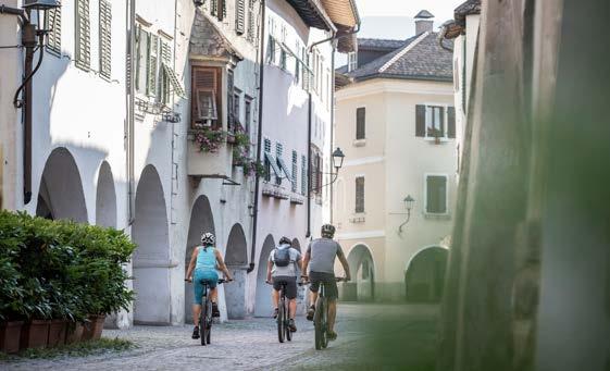
Scopri l’Alto Adige nella sua forma più autentica – in sella alla tua bici e con tutti i sensi. Piste ciclabili ben curate ti conducono tra dolci colline, vigneti, prati e borghi storici riconosciuti come i „Borghi più belli d’Italia“.
Castelrotto, Egna, Glorenza, Chiusa e Vipiteno: cinque gemme che incantano con loro vicoli pittoreschi, piazze suggestive e un’atmosfera ricca di storia e tradizione.
Questi itinerari invitano a rallentare, assaporare e scoprire: specialità locali, artigianato autentico e la calorosa ospitalità altoatesina ti accompagneranno lungo il cammino.
Un’esperienza indimenticabile per chi ama pedalare e lasciarsi sorprendere dalla bellezza.
KOMOOT COLLECTION ZU DEN RADROUTEN BORGHI IN BICI BIKE TOURS
Cycling to South Tyrol’s
Most Beautiful Villages

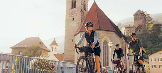
Discover South Tyrol at its most charming – on two wheels and with all your senses. Well-maintained cycling paths guide you through gentle hills, vineyards, meadows, and historic villages officially named among the “Most Beautiful Villages of Italy.” Kastelruth, Neumarkt, Glurns, Klausen and Sterzing are five hidden gems, each offering winding alleys, picturesque squares, and a timeless atmosphere steeped in history.
These routes invite you to slow down, savor local delicacies, explore traditional crafts, and enjoy the warm South Tyrolean hospitality. A perfect experience for all who love to ride – and discover something truly special.
Ritratto della città
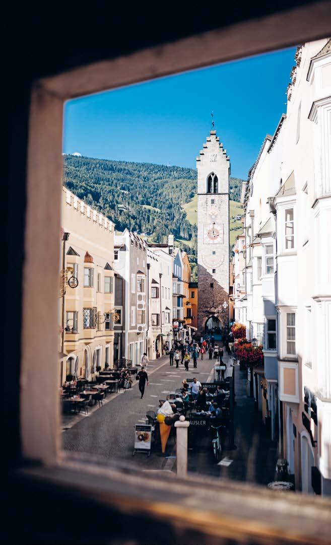
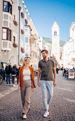
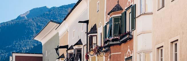
Magnifiche case tradizionali con i classici “Erker”, piazze medievali e uno sfondo montano che sembra quasi di poterlo toccare: la cittadina di Vipiteno nel nord dell’Alto Adige incanta i suoi visitatori con il suo fascino incomparabile. La città alpina sulla strada del Brennero è dominata dal suo monumento più importante, la Torre delle Dodici, alta ben 46 metri. La stazione a valle della funivia di Monte Cavallo, la montagna di casa dei vipitenesi, si trova a pochi minuti a piedi dal centro storico. Così cultura, delizie culinarie e attività sportive si combinano perfettamente.
Un po‘ di storia
La stazione stradale “Vipitenum” risale all’epoca romana. Seguì un insediamento dei “Bajuwaren”, ovvero tribù germaniche originarie della Boemia, in seguito stanziate in Baviera. Vipiteno viene menzionate da queste popolazioni per la prima volta nel 1180, Il principe regnante conte Meinhard II concesse i diritti di città a Vipiteno intorno al 1280. Un devastante incendio distrusse mondo edifici nel 1443 e da allora quella parte della città che venne quindi ricostruita è stata rinominata Città Nuova. Si estende dalla Torre delle Dodici fino a Piazza Fuori Porta ed è considerata la strada più bella del Tirolo. Le maestose case cittadine risalgono al periodo di massimo splendore dell’attività mineraria tra il XV e il XVI secolo e offrono ancora oggi un incantevole paesaggio urbano.
Da non perdere
> Chiesa di Santo Spirito e Municipio
> Museo Multscher, museo Civico e Chiesa Parrocchiale
> Castel Tasso
Cosa fare a Vipiteno
> Visite guidate della città: da maggio ad ottobre tutti i venerdì alle ore 16
> Feste delle lanterne a Vipiteno, tutti i mercoledì di luglio e agosto
> Sagra dei canederli
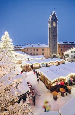
> Mercatino di Natale di Vipiteno
> Informazioni: vipiteno.com/events
Prodotti tipici
> Yogurt di Vipiteno / Latteria Sociale di Vipiteno
> Krapfen vipitenesi, Canederli
Stadtportrait
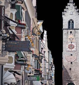
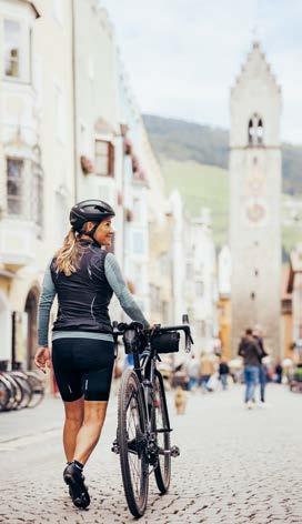
Prächtige Bürgerhäuser mit ihren charakteristischen „Erkern“, mittelalterliche Plätze und eine Bergkulisse, die zum Greifen nahe scheint: Die Fuggerstadt Sterzing im Norden Südtirols bezaubert ihre Besucher mit ihrem unvergleichlichen Charme. Überragt wird die Alpinstadt an der Brennerstraße von ihrem Wahrzeichen, dem 46 Meter hohen Zwölferturm. Die Talstation des Haus- und Freizeitbergs Rosskopf befindet sich nur wenige Gehminuten vom historischen Stadtzentrum von Sterzing entfernt - so lassen sich Kultur, Kulinarik und sportliche Aktivitäten optimal verbinden.
Kleine Geschichtskunde
Bereits zur Römerzeit gab es die Straßenstation „Vipitenum“. Danach erfolgte eine Ansiedlung der Bajuwaren, woraus sich die urkundlich erstmals 1180 erwähnte Ortschaft Sterzing entwickelte. Landesfürst Graf Meinhard II verlieh Sterzing um 1280 das Stadtrecht. Ein verheerender Brand zerstörte 1443 viele Gebäude, der folglich wiedererrichtete neue Stadtteil heißt seither Neustadt. Diese erstreckt sich vom Zwölferturm bis zum Untertorplatz und gilt als die schönste Straße Tirols. Die stattlichen Bürgerhäuser stammen aus der Blütezeit des Bergbaues im 15. und 16. Jahrhundert und bieten noch heute ein zauberhaftes Stadtbild.
Sollte man besuchen
> Heilig Geist Kirche und Rathaus im Stadtzentrum
> Multscher Museum im Deutschhaus und Stadtpfarrkirche
> Burg Reifenstein
Was ist los in Sterzing
> Stadtführungen: Mai - Oktober freitags 16:00 Uhr
> Sterzinger Laternenpartys
> Knödelfest
> Weihnachtsmarkt
> Infos: sterzing.com/events
Typische Produkte
> Sterzinger Joghurt / Milchhof
Sterzing
> Sterzinger Krapfen, Knödel sterzing.com
Town portrait
Splendid town houses with their distinctive „oriels“, medieval squares and a mountain backdrop that seems close enough to be touched: the Fugger town of Sterzing in the north of South Tyrol enchants its visitors with its unparalleled charm. The Alpine town on the Brenner road is dominated by its landmark, the 46-meter-high tower „Zwölferturm”. The valley station of our local mountain and leisure area „Rosskopf“ is located just a few minutes‘ walk from the historic town center of Sterzing - a perfect combination of culture, culinary delights and sporting activities.
Brief history
Already in Roman times there was the road station called „Vipitenum“. Afterwards the Bavarians settled in the region and the village of Sterzing was first mentioned in official documents by the year 1180. The sovereign Count Meinhard II granted Sterzing the town title around 1280. In 1443 a devastating fire destroyed many buildings, and the consequently rebuilt new part of the town has since been called “Neustadt”. This new part extends from the Zwölferturm to the Untertorplatz square and is considered the most beautiful street in Tyrol. The stately town houses date back to the heyday of mining in the 15th and 16th centuries and still offer an enchanting townscape today.
Must-sees
> Heilig Geist church and town hall
> Multscher Museum and town parish church
> Reifenstein Castle
What’s going on in Sterzing
> Guided tours: May - October Fridays 4:00 p.m.
> Sterzing lantern parties
> dumpling festival
> Christmas market
> Info: sterzing.com/events
Local cuisine
> Sterzinger yogurt / Milchhof Sterzing
> Sterzinger „Krapfen“, Knödel (dumplings)
Ritratto della città
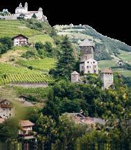
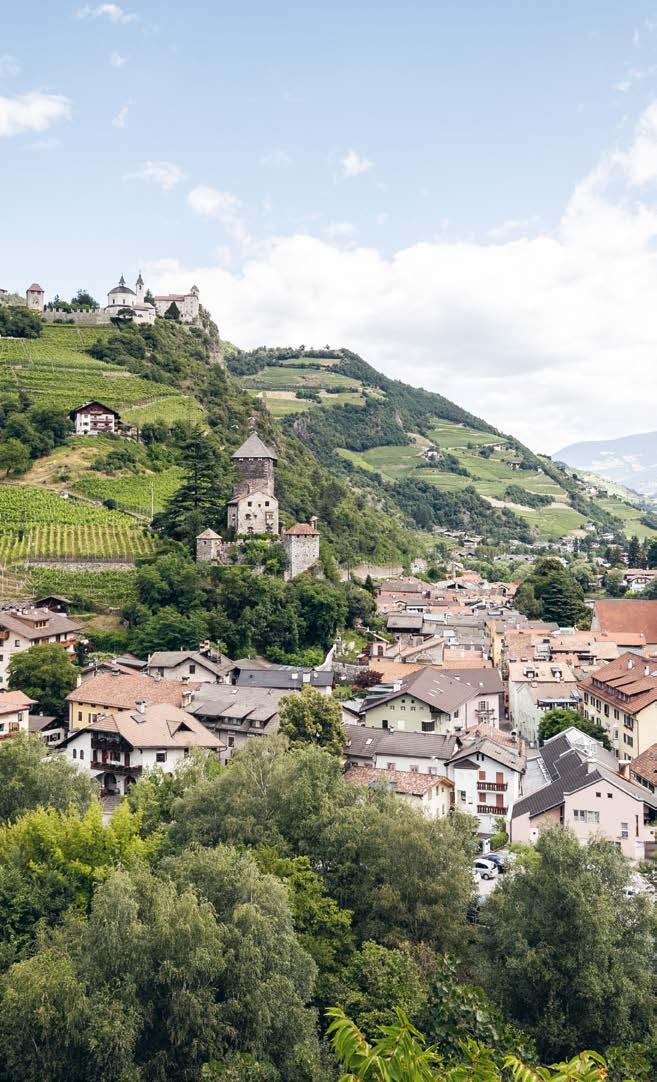
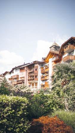
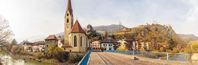
Chiusa, la città degli artisti, si trova nel cuore della Valle Isarco, circondata da castagneti e vigneti. La cittadina con le sue case di origine medievale, le loro facciate merlate e i bovindi tipici (“Erker”), le chiese gotiche e la grande offerta di prodotti artigianali e specialità tipiche, incanta i suoi visitatori oggi come molti secoli fa. La città ha attratto un gran numero di artisti famosi in passato, tra questi anche Albrecht Dürer, che si innamorò di Chiusa alla fine del Quattrocento.
Un po‘ di storia
Il piccolo borgo, sovrastato dal monastero di Sabiona, è menzionato nel 1027 come “Clausa sub Sabiona sita” e, poco dopo, nel 1028, come stazione doganale. Nel XIV secolo il suo nome, grazie al traffico commerciale tra mondo latino e germanico, acquista enorme importanza tanto che, nel 1308, viene denominata “stat”, ovvero città. Tra 1350 e 1550, Chiusa vive un periodo di grande fioritura grazie all’attività mineraria. A partire dalla seconda metà del XIX secolo, il turismo culturale porta un ulteriore periodo di prosperità. Tra il 1874 e il 1914 a Chiusa soggiornano più di 300 artisti che contribuirono a diffondere in tutta Europa la sua immagine di cittadina romantica.
Da non perdere
> Monastero di Sabiona con le chiese
> Museo Civico di Chiusa con il Tesoro di Loreto
> Punto panoramico „Pietra di Dürer“
Cosa fare a Chiusa
> Visite guidate: luglio & agosto giovedì ore 10:00
> Mercati mensili
> Festival del Vino Sabiona a maggio
> Festa del Törggelen in autunno
> Il Borgo Natalizio di Chiusa
> Informazioni: chiusa.info
Prodotti tipici
> Vino bianco, castagne, „Törggelen“
Stadtportrait
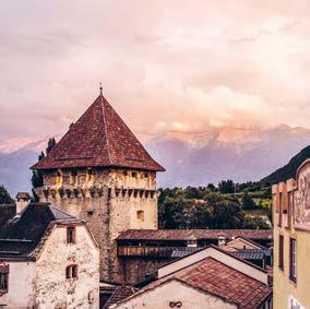
Das Künstlerstädtchen Klausen liegt romantisch, umgeben von Kastanienhainen und Weinbergen im Herzen des Eisacktals. Das mittelalterliche Stadtbild mit den schmucken Häusern und ihren mit Zinnen gekrönten Fassaden und den breiten Erkern, den gotischen Kirchen und den schicken, inhabergeführten Boutiquen, typischen Spezialitäten und mondäner Lebensart bezaubert seine Besucher heute wie vor vielen Jahrhunderten. Denn schon in Vergangenheit hat der Ort eine Reihe bekannter Künstler angelockt, darunter auch Albrecht Dürer, der sich im 15. Jahrhundert in das kleine Städtchen verliebte.
Kleine
Geschichtskunde
Der mächtige Säbener Klosterberg überragt das mittelalterliche Klausen. Der Ort wird 1027 erstmals urkundlich als „Clausa sub Sabiona sita“ erwähnt, bereits 1028 wird ihm die Zollstätte übertragen. Der Handels- und Reiseverkehr über den Brenner bestimmten die Entwicklung des Ortes. 1308 wird die Bezeichnung „stat“ zum ersten Mal verwendet.
Zwischen 1350 und 1550 erlebt Klausen eine erste Blütezeit durch den Bergbau. Ab der zweiten Hälfte des 19. Jahrhunderts setzt mit dem Kulturtourismus eine weitere Blütezeit ein. Zwischen 1874 und 1914 besuchten über 300 Künstler den Ort und verbreiteten ihre Eindrücke über Klausen in der ganzen Welt.
Sollte man besuchen
> Kloster Säben mit seinen Kirchen
> Stadtmuseum mit dem Loretoschatz
> Aussichtspunkt Dürerstein
Was ist los in Klausen
> Stadtführungen: Juli, August & September mittwochs um 10:00 Uhr
> Monatliche Märkte
> Weißweinfestival Sabiona im Mai
> Gassltörggelen im Herbst
> Klausner Gassladvent
> Infos: klausen.it/events
Typische Produkte
> Weißwein, Kastanien, „Törggelen“ klausen.it
Town portrait
The artistic town of Klausen lies in the heart of the Eisacktal Valley, surrounded by chestnut groves and vineyards. The medieval townscape with its neat houses and its facades crowned with battlements and wide oriels, the Gothic churches and the elegant owner-managed boutiques and typical specialties enchants its visitors today as it used to do many centuries ago. The town attracted several famous artists in the past, including Albrecht Dürer, who fell in love with the small town in the 15th century.
Brief history
The little town of Chiusa/Klausen, internationally known as the town of artists is dominated by the monastery of Säben/Sabiona. In the 14th century its name, due to the commercial traffic between the Latin world and the Germanic world, became so important that in 1308 it was called a ‘city’. From 1350 to 1550, the town flourished, marking a second period of great splendour for Chiusa with the rise of mining. From the second half of the 18th century the town enjoyed a new period of prosperity linked to cultural tourism. Between 1874 and 1914 more than 300 artists stayed in Klausen and contributed to spreading its image as a romantic town throughout Europe.
Must-sees
> Monastery Säben/Sabiona with the churches
> City Museum of Klausen with the Treasure of Loreto
> Viewpoint Dürerstein stone
What’s going on in Klausen
> Guided city visit: on request
> Monthly markets
> White wine festival Sabiona in May
> Gassltörggelen in autumn
> Christmas Village
> Information: klausen.it/events
Local cuisine
> White wine, chestnuts, „Törggelen“
Ritratto del paese
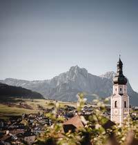
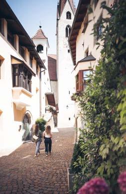
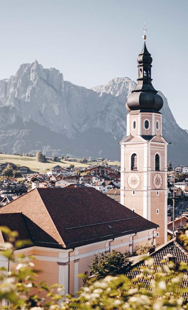
Castelrotto, il più esteso comune a vocazione turistica della regione dolomitica Alpe di Siusi, comprende ben undici frazioni su un territorio con un dislivello di circa 2.000 metri, da San Vigilio a 720 m all’Alpe di Siusi, l’altipiano più vasto d’Europa, a 2.563 m.
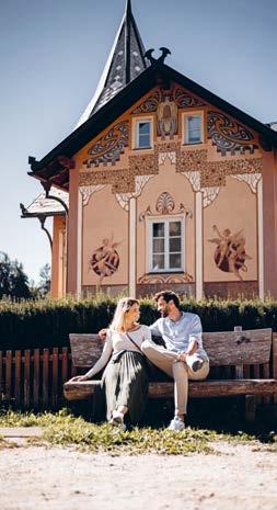
Oltre a un affascinante centro storico, edifici con facciate affrescate e numerosi negozi, Castelrotto vanta una vivace vita culturale. Da non perdere Monte Calvario, la chiesa parrocchiale e il campanile barocco (il terzo per altezza in Alto Adige).
Un po‘ di storia
Il nome “Castelrotto” apparve per la prima volta nel X secolo. D’origine latina, deriva probabilmente da “Castellum Ruptum” (castello diroccato), i cui resti sono visibili nella cappella di Sant’Antonio su Monte Calvario.
Avendo pianta medievale, le attività si svolgono intorno alla piazza principale.
Le antiche dimore signorili testimoniano che i residenti non erano semplici contadini ma ricchi signori. La chiesa parrocchiale di San Pietro e Paolo con il suo campanile barocco è simbolo di prosperità e un punto di riferimento per tutto il paese.
Da non perdere
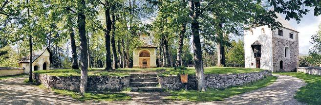
> Monte Calvario con le sue cappelle
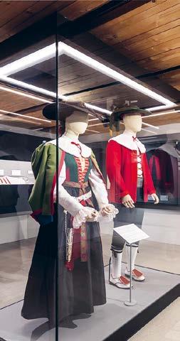
> Museo dei Costumi Tradizionali all’interno della Residenza Laechler
> L’Alpe di Marinzen, un’area ricreativa con parco giochi
> L’Alpe di Siusi, l’altipiano più vasto d’Europa
Cosa fare a Castelrotto
> Natale in montagna - mercatino (dicembre)
> Il matrimonio contadino (gennaio)
> Notti delle streghe (luglio e agosto)
> Il Borgo dei desideri (agosto)
> Eventi e mercati tutto l‘anno kastelruth.com/events
Prodotti tipici
> Krapfen di Castelrotto, strudel di mele e canederli allo speck
Dorfportrait
Kastelruth ist der größte Ferienort der Dolomitenregion Seiser Alm. Die Gemeinde umfasst einen Hauptort mit elf Fraktionen und ein Gebiet mit einem Höhenunterschied von rund 2.000 Höhenmetern: von 720 m in St. Vigil auf die Seiser Alm, größten Hochalm Europas, mit 2.563m. Das Dorfbild begeistert durch einen historischen Ortskern, Gebäuden mit wunderschönen bemalten Fassaden sowie zahlreichen Geschäften. Sehenswert sind auch der Kofel, eine Naherholungszone mitten im Dorf, die klassizistische Pfarrkirche und der barocke Kirchturm (dritthöchster Südtirols). Kastelruth hat ein lebendiges Dorfleben mit viel Charme und einer gepflegten und gelebten Kultur.
Kleine Geschichtskunde
Der Name „Kastelruth“ tauchte erstmals im 10 Jahrhundert auf. Die Namensherkunft ist im lateinischen zu suchen und geht vermutlich auf das Wort „Castellum Ruptum“ (zerstörte Burg) zurück, dessen Mauerreste noch in der Kapelle des Hl. Antonius am Kofel zu finden sind. Das Dorfbild ist typisch mittelalterlich, in dem sich alles Leben rund um den Dorfplatz ansiedelte. Die alten stattlichen Herrenhäuser im Dorfzentrum, weisen darauf hin, dass hier keine einfachen Bauern, sondern reiche Herren residierten. Zeichen des Wohlstands und Wahrzeichen des gesamten Dorfs ist die Pfarrkirche St. Peter und Paul mit ihren barocken freistehenden Glockenturm.
Sollte man besuchen
> Kofel/Kalvarienberg mit Kapellen
> Trachtenmuseum im Ansitz Laechler
> Marinzenalm - Naherholungsgebiet mit Kinderspielplatz
> Seiser Alm - Europas größte Hochalm
kastelruth.com
Was ist los in Kastelruth
> Kastelruther Bergweihnacht (Dezember)
> Bauernhochzeit (Januar)
> Hexennächte (Juli und August)
> Il Borgo dei desideri - einen Abend vollerKunst, Kultur und Gemeinschaft (August)
> Events & Märkte das ganze Jahr kastelruth.com/events
Typische Produkte
> Kastelruther Krapfen, Apfelstrudel, Speckknödel
Village’s portrait
Being the largest tourist destination of the Dolomites Region Seiser Alm, the eleven areas of Kastelruth stretch from St. Vigil (720 m) up to the Seiser Alm, Europe’s largest high Alpine pasture (2,563 m), covering an altitude range of roughly 2,000 m.
A vibrant town with living traditions, Kastelruth is home to a fascinating historic centre, beautifully frescoed buildings and numerous shops. Sights worth seeing include the Kofel hill, a relaxing destination in the town centre, the parish church and the baroque bell tower (3rd highest in South Tyrol).
Brief history
The name “Kastelruth” dates back to the 10th century and is probably derived from the Latin “Castellum Ruptum” (ruined castle), the remains of which can still be seen today in the St. Anthony chapel on the Kofel hill.
The town was designed in customary mediaeval style, with all life revolving around the village square. The ancient stately manors in the town centre indicate that its inhabitants were no mere farmers, but affluent aristocrats. The St Peter & Paul church with its baroque tower is a symbol of prosperity and the emblem of the town.
Must-sees
> Kofel hill and its chapels
> Traditional costume museum in the Laechler manor
> Marinzenalm leisure area with playground
> Seiser Alm – Europe’s largest high Alpine pasture
What’s going on in Kastelruth
> Christmas market (December)
> Farmers‘ wedding (January)
> Witches‘ nights (July and August)
> Il Borgo dei desideri - an evening full of art, culture and community (August)
> Events & markets all the year aroundkastelruth.com/eventss
Local cuisine
> Kastelruth doughnuts (“Krapfen”), apple strudel, speck dumplings
Ritratto del paese
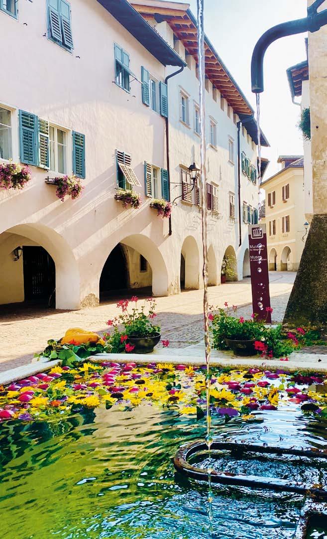
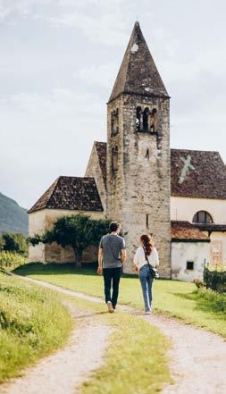
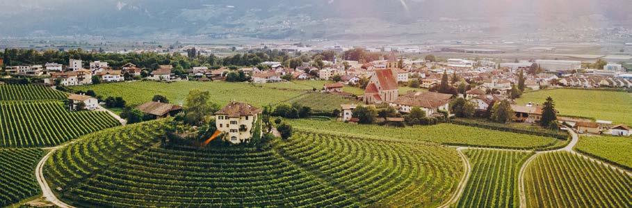
Egna si trova nel soleggiato Sud del Alto Adige, a metà strada tra Bolzano e Trento, circondata da vigneti e meleti ai piedi del Parco Naturale Monte Corno. Il comune comprende il centro principale di Egna e le frazioni di Vill, Mazzon, Laghetti e San Floriano. Già nel Medioevo, grazie alla sua posizione geografica strategica, Egna era un fiorente centro commerciale e oggi rappresenta il fulcro culturale ed economico della Bassa Atesina. Egna è particolarmente nota come importante zona del Pinot Nero e come punto di partenza di numerosi percorsi tematici, come il Sentiero del Dürer, il Sentiero Schwarz-Weiss e il Percorso del Pinot Nero. Da visitare è il centro storico con i suoi portici di 500 metri, i numerosi negozi, le dimore signorili e i magnifici cortili interni. Egna combina cultura, natura e piacere in un’esperienza unica.
Un po‘ di storia
L’esistenza di un insediamento nella zona dell’attuale Comune di Egna è documentata già in età romana nella mappa stradale risalente al III secolo d.C. denominata “Itinerarium Antonini”. Divenuto Enna nel 1018 e Egna nel 1170, nel 1189 il borgo fu devastato da un grave incendio. Il principe-vescovo Corrado di Beseno, vista la posizione geograficamente favorevole, si adoperò affinché il centro abitato fosse immediatamente ricostruito: Egna fu fondata il 13 ottobre 1189, il che le conferisce il titolo di mercato più antico del Tirolo storico. A dare grande prosperità alla comunità fu soprattutto la concessione del “diritto di fermo e di deposito delle merci”. Egna rimase fino al XVI secolo il porto fluviale più importante della regione; qui tutto il legname proveniente dalla Val di Fiemme veniva caricato su grandi zattere per essere trasportato sul fiume Adige.
Da non perdere
> Il centro storico e i vigneti di Mazzon
> I punti panoramici sulla Kanzel e sulle colline di Castelfeder
> Klösterle, un ospizio medievale
> Museo di cultura popolare
Cosa fare a Egna
> Visite guidate: aprile-ottobre
> Tutto l’anno eventi e mercati
> Laubenfest: Più antica festa di paese in Alto Adige. Primo fine settimana di agosto
> Calendario eventi su neumarkt-egna.it, suedtirols-sueden.info
Prodotti tipici
> Pinot nero, mele
Dorfportrait
Neumarkt liegt im sonnigen Südtiroler Unterland, zwischen Bozen und Trient, umgeben von Weinbergen und Apfelplantagen am Fuße des Naturparks Trudner Horn. Die Gemeinde umfasst den Hauptort Neumarkt sowie die Dörfer Vill, Mazon, Laag und St. Florian. Bereits im Mittelalter war der Ort dank seiner geografisch günstigen Lage ein florierendes Handelszentrum und ist heute der kulturelle und wirtschaftliche Mittelpunkt des Südtiroler Unterlandes. Besonders bekannt ist Neumarkt als bedeutender Standort des Blauburgunders und als Ausgangspunkt zahlreicher Themenwege wie dem Dürerweg, dem Schwarz-Weiß-Weg und dem Blauburgunderweg. Sehenswert ist der alte Ortskern mit seinen langen Lauben, herrschaftlichen Ansitzen und prächtigen Innenhöfen. Neumarkt vereint Kultur, Natur und Genuss zu einem einzigartigen Erlebnis.
Kleine Geschichtskunde
Bereits auf der bekannten Straßenkarte „Itinerarium Antonini“ aus dem 3. Jahrhundert nach Christi Geburt ist auf dem Gebiet der heutigen Gemeinde Neumarkt eine Siedlung dokumentiert. Die Gründungsurkunde der Gemeinde Neumarkt ist mit 13. Oktober 1189 datiert, dies macht die Marktgemeinde Neumarkt zum ältesten Markt Tirols. Während des Mittelalters förderte die wachsende Bedeutung als Zentrum des Durchzuges von Warenverkehr zu Land und auf dem Fluss die urbanistische und wirtschaftliche Entwicklung des Ortes. Neumarkt blieb bis zum 16. Jahrhundert der bedeutendste Flusshafen der Region, hier wurde nämlich sämtliches Holz aus dem Fleimstal zu großen Flößen gebunden, um auf der Etsch verfrachtet zu werden.
Sollte man besuchen
> Den historischen Ortskern
> Die Weinberge in Mazon
> Aussichtspunkt Kanzel und den Hügel Castelfeder
> Hospiz Klösterle
> Das Museum für Alltagskultur
Was ist los in Neumarkt
> Stadtführungen: April - Oktober
> Events & Märkte das ganze Jahr
> Laubenfest: Das älteste Dorffest Südtirols, erstes Augustwochenende
> Infos: neumarkt-egna.it, suedtirols-sueden.info
Typische Produkte
> Blauburgunder (Pinot Noir), Äpfel
Village’s portrait
Neumarkt/Egna is located in the sunny South Tyrolean Lowlands, halfway between Bolzano and Trento, surrounded by vineyards and apple orchards at the foot of the Trudner Horn Nature Park. The municipality includes the main town of Neumarkt as well as the villages of Vill, Mazon, Laag, and St. Florian. As early as the Middle Ages, thanks to its strategically favorable location, Neumarkt was a thriving trade center and is today the cultural and economic hub of the South Tyrolean Lowlands. Neumarkt is particularly known as an important Pinot Noir region and as the starting point for various themed trails, such as the Dürer Trail, the Black and White Trail, and the Pinot Noir Trail. The historic town center, with its 500-meterlong arcades, numerous shops, stately residences, and magnificent courtyards, is well worth a visit. Neumarkt combines culture, nature, and enjoyment into a unique experience.
Must-sees
> The historic centre
> The vineyards in Mazzon
Brief history
The existence of a settlement in the area of the current municipality of Egna was already documented in Roman times on the well-known street map, the Antonine Itinerary, from the 3rd century AD. Neumarkt/Egna was founded on October 13th, 1189, which gives the town the title of the oldest market in historic Tyrol. During the middle ages, its growing importance as a center for commercial traffic by water or land favored the urban and economic development of the village. Egna remained the most important river port of the region until the 16th century.
> The viewpoints on the Kanzel and from the Castelfeder hills
> Hospice „Klösterle“
> Museum of Everyday culture
What’s going on in Neumarkt
> Guided visits: april-october
> Events and markets all year long
> Laubenfest: Traditional Festival at the first weekend of august
> See the events’ list on neumarkt-egna.it, suedtirols-sueden.info
Local cuisine
> Pinot Noir, apples
neumarkt-egna.it suedtirols-sueden.info
Ritratto della città
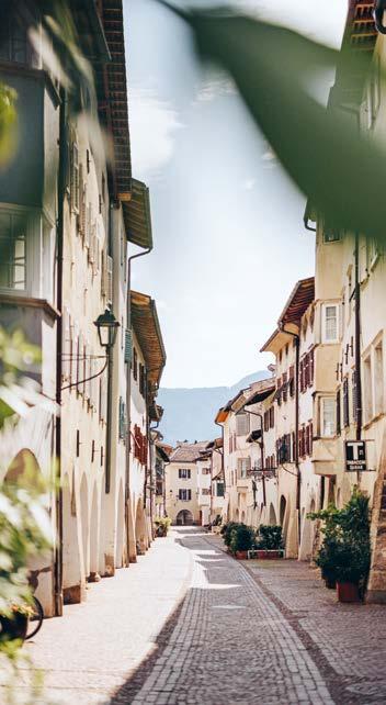
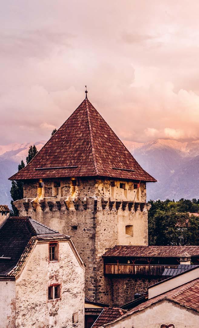
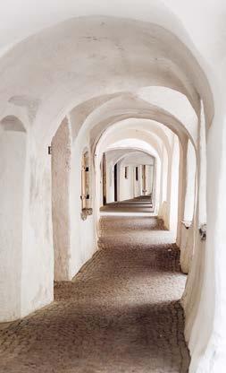
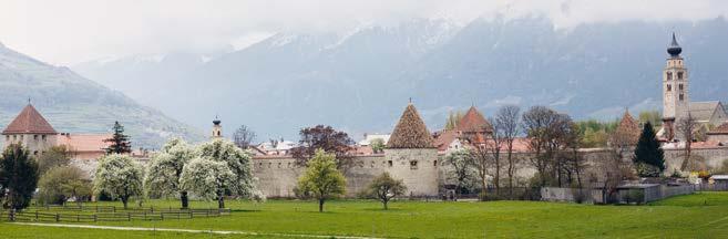
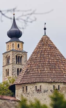
Glorenza, la più piccola città dell’Alto Adige, incanta con la sua atmosfera medievale. La cinta muraria perfettamente conservata, tre possenti porte turrite, i portici, i vicoli stretti e palazzi eleganti fanno di Glorenza un gioiello storico. Poco è cambiato del XVI secolo e così si può sentire la ricca storia della città in ogni angolo. Vi invitiamo nella nostra bella città per condividere con voi impressioni magiche, festival storici, eventi spettacolari e attrazioni culturali.
Un po‘ di storia
Glurnis o Glurns è un nome d’origine preromano o reto-romano. Il suo significato è “ischia delle avellane”, ovvero “golena degli ontani” o “dei noccioli”. Glorenza fu menzionato per la prima volta in documenti già nel 1163. Il conte Meinardo II ha fondato la città di Glorenza (1304) donandole già nell‘anno 1291 il diritto di mercato per S. Bartolomeo. Grazie alla sua posizione strategica al confine con la Svizzera, Glorenza divenne presto un centro commerciale e visse un boom economico. La città ha il suo aspetto attuale soprattutto all‘imperatore Massimiliano I, che la fece ricostruire dopo la sua distruzione da parte dei Grigioni. Glorenza alla fine si impoverì a causa di varie catastrofi. Nel 20° secolo il turismo ha poi portato a una nuova fioritura.
Da non perdere
> Museo Torre di Sluderno con il camino di ronda
> Mostra/Museo Torre di Paul Flora
> Via Portici e il mulino
> Chiesa Parrocchiale di S. Pancrazio
Cosa fare a Glorenza
Visite guidate medioevali:
> dicembre-aprile, lunedì ore 16:00
> luglio-agosto, lunedì ore 10:30
> luglio-agosto, mercoledì ore 10:30
> luglio-agosto, giovedì ore 20:30
> Calendario eventi su glorenza.eu/it
Prodotti tipici
> Prodotti della pera Pala, albicocche, „Vinschger Schneamilch“ (dolce tipico della Val Venosta), „Vinschger Paarl“, Puni-Whisky
Stadtportrait
Glurns, die kleinste Stadt Südtirols, verzaubert mit ihrem charmanten, mittelalterlichen Flair. Die vollständig erhaltene Stadtmauer, die drei malerischen Tortürme, die Laubengänge, die engen Gassen und die edlen Bürgerhäuser machen aus Glurns ein historisches Juwel. Seit dem 16. Jh. spürt man die bewegte Geschichte der ehemaligen Handelsstadt in jeder Ecke. Wir laden Sie in unsere schöne Stadt ein und teilen mit Ihnen magische Eindrücke, historische Feste, eindrucksvolle Events und kulturelle Highlights.
Kleine Geschichtskunde
Was ist los in Glurns
Mittelalterliche Stadtführungen:
> Dezember-April, montags 16:00 Uhr
> Mai-Oktober, montags 10:00 Uhr
> Juli-Sept., mittwochs 10:00 Uhr
> Juli-August, donnerstags 20:30 Uhr
> Infos: glurns.eu/de
Sollte man besuchen
> Museum Stadtgeschichte Schludernser Torturm mit Zugang zum Wehrgang
> Ausstellung/Museum
Paul Flora Turm
> Stadtmühle und Laubengasse
> Pfarrkirche St. Pankratius
Klein aber oho Glurns. Der Name Glurns oder Glurnis ist vorrömischen oder rätoromanischen Ursprungs und bedeutet so viel wie Hasel- oder Erlenau. Bereits 1163 wurde Glurns erstmals urkundlich erwähnt. 1291 verlieh Meinhard II. das Marktrecht und setzte den Bartholomäusmarkt in Glurns als Konkurrenz zum bischöflichen Markt in Müstair (CH) ein. 1304 wurde Glurns erstmals als Stadt erwähnt. Dank seiner strategischen Lage an der Grenze zur Schweiz wurde Glurns bald zum Handelszentrum und erlebte eine wirtschaftliche Blüte. Sein heutiges Aussehen verdankt das Städtchen vor allem Kaiser Maximilian I., der es nach der Zerstörung durch die Bündner wieder aufbauen ließ. Glurns verarmte schließlich durch verschiedene Katastrophen.
Im 20. Jh. führte der Tourismus dann zu einer neuen Blüte.
Typische Produkte
> Palabirnenprodukte, Marillen, Vinschger Schneamilch, Vinschger Paarl, Puni-Whisky
Town portrait
Glurns, the smallest town of South Tyrol, will enchant you with its charming, medieval atmosphere. The fully preserved town walls, the three picturesque gate towers, the arcades as well as the narrow alleys and noble houses make Glurns a historical jewel. Since the 16th century Glurns has hardly changed and even today you can sense the history of this former trading town at every corner. We invite you in our beautiful city and are pleased to show you its magical impressions, historical festivals, great events and cultural highlights.
Brief history
ferienregion-obervinschgau.it glurns.eu
Must-sees
> Museum Schluderns gate tower with battlement
> Exhibition and museum Church Gate
Tower Paul Flora
> Town mill and the arcades
> St. Pancras Parish Church
What’s going on in Glurns
> Medieval city tours on request
> “Pala Pear Days” in September
> Theme Markets - May, August - December
> See the events’ list glorenza.eu/en
Local cuisine
> Pala pear products, “Vinschger” apricots, “Vinschger” snow milk, „Vinschger Paarl“, Puni-Whisky
Glurns, small but might. The name Glurns or Glurnis traces its origin to pre-Roman or Rhaeto Romanic time and means hazel or alder meadow. Glurns was first mentioned in a document already in 1163. In 1291 Meinhard II granted the market right and established the Bartholomew market in Glurns as a competitor to the bishop’s market in Müstair (CH). In 1304 Glurns was first mentioned as a town. Thanks to its strategic location on the border with Switzerland, Glurns soon became a trading centre and experienced an economic prosperity. The town owes its current appearance especially to Emperor Maximilian I, who rebuilt Glurns after the destruction by Grisons. Afterwards, however, Glurns became impoverished by various catastrophes. In the 20th century tourism led to a renewed upswing.
borghialtoadige borghi_altoadige