AEROMETREX 3D FOR MINING 3DREALITYMESHMODELS,TRUE ORTHOS,DTMsAND VISUALISATION FOR VOLUMECALCULATIONS,CHANGE DETECTION,SAFETY INDUCTIONS, SITE PLANNING, AND MORE. Aerometrex’s high-resolution 3D reality models provide mining operations with detailed, photorealistic site intelligence that supports safer planning and smarter decision-making. Our 3D datasets enable teams to remotely inspect assets, measure distances, areas and elevations, track site change over time, and improve communication between technical, operational and executive stakeholders - reducing site visits while increasing clarity, safety and operational efficiency. Beyond operational insights, our custom cinematic video visualisations equip executives with powerful storytelling tools to confidently showcase projects, build trust, and drive meaningful engagement with communities, investors and key stakeholders.
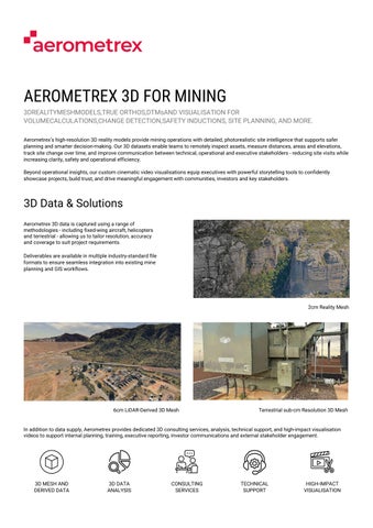
3D Data & Solutions Aerometrex 3D data is captured using a range of methodologies - including fixed-wing aircraft, helicopters and terrestrial - allowing us to tailor resolution, accuracy and coverage to suit project requirements. Deliverables are available in multiple industry-standard file formats to ensure seamless integration into existing mine planning and GIS workflows.
2cm Reality Mesh
6cm LiDAR-Derived 3D Mesh
Terrestrial sub-cm Resolution 3D Mesh
In addition to data supply, Aerometrex provides dedicated 3D consulting services, analysis, technical support, and high-impact visualisation videos to support internal planning, training, executive reporting, investor communications and external stakeholder engagement.
3D MESH AND DERIVED DATA
3D DATA ANALYSIS
CONSULTING SERVICES
TECHNICAL SUPPORT
HIGH-IMPACT VISUALISATION