Start: Hautajärvi or Sallantie (Ristikallio)
Finish: Rukatunturi Fell
Distance: 51 mi (82 km)
Time: from 4 to 8 days
Difficulty: easy-medium
Accommodation: tents and shelters
Finland is an immense green and blue country: more than 70% is covered in forest, and there are more than 188,000 lakes and numerous islands. The country’s 40 national parks are distributed throughout the territory, in Lapland to the north, in the lake district, along the coasts, and on the archipelagos. These uncontaminated places are home to thousands of wild animals and birds: it is estimated that there are about 1,500 brown bears in the forests of Finland. The country is also home to rare species: for example, on the Saimaa lake it is possible to see the ringed seal, one of the species at the greatest risk of extinction in the world.
The midnight sun in summer, the northern lights from September to March, and the pure air instill the desire to fully experience the magic of nature. Finland is one of the best destinations in Europe for hiking: it is also popular with people who practice Nordic walking, the total body version of walking, performed with specially designed walking poles, similar to ski poles. It is also considered one of the most environmentally friendly countries in the world: its battle in favor of widespread eco-sustainability centers on the elimination of coal, gas, and fossil fuels as energy sources.
Taivalköngäs
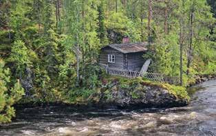
18 An abandoned fisherman’s house on the Oulankajoki River.
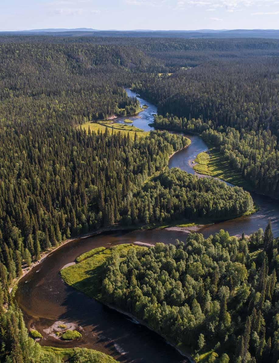
19 Aerial view of the boreal forest, or taiga, one of the main terrestrial biomes in the Oulanka park. It mainly comprises conifers.
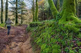
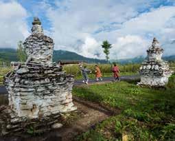
There is much to see along the Karhunkierros Trail, which winds through the Oulanka National Park, in the northeast of the country: rivers, rapids, cliffs, forests, pinewoods, meadows, moose, and reindeer. Also known as the Bear’s Trail or the Bear’s Ring, the walk can be divided into four sections, each with some challenging parts. The hike can start from various points; here we suggest two—Hautajärvi and Sallantie. If you keep up your pace, you can complete the trail in four days. You can also follow part of the itinerary in a canoe.
Days 1–2
Days 3–4
Days 5–6
Eco because: The Oulanka National Park is renowned for its biodiversity. Considerable attention is paid to the preservation of the environment: in fact, along the Karhunkierros Trail, there are numerous recycling stations, where visitors can deposit metal, glass, plastic, and paper, or even dangerous waste like batteries.
The walk that links Milngavie—a quiet village northwest of Glasgow—to Drymen will give you a sample of the diverse landscapes you will meet along the West Highland Way. Following small lochs and rivers, you reach Drymen, near Loch Lomond—the largest lake in the UK—in the Loch Lomond and the Trossachs National Park. Drymen is the stopping place for the night and your gateway to the Highlands.
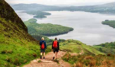
The second day you enter the Highlands, in the area of Loch Lomond. First, you arrive at Conic Hill to enjoy the view of Loch Lomond, one of the most enchanting in Scotland. The trail descends from the hill toward Balmaha, one of the preferred stops for hikers because it is about halfway along the path. The final part of this stage runs along the banks of Loch Lomond for about 19 miles (30 km). It is worth making a short detour to see the crannog at Strathcashel Point.
Crannogs are mysterious artificial islands from the Neolithic period, built in the lakes and rivers or in the sea by piling rocks on top of each other. The day ends in Rowardennan, where you can stay in a hotel, a youth hostel, or a castle.
When to go: From April to October.
How to get there: The nearest international airport is Glasgow. To reach Milngavie, which is about 12 miles (20 km) away, take a train or a bus.
What to pack: Tent, sleeping bag, suitable equipment for rainy weather (jacket and pants). Hiking boots, warm clothing. Waterproof coverings for cameras and video equipment. Hat and sunscreen. First-aid kit and insect repellent. Canteen and food for a couple of days.
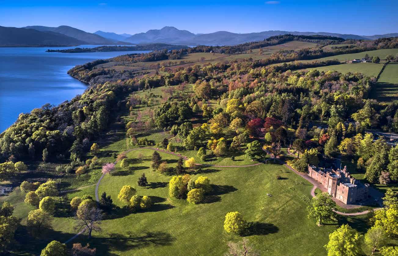
26–27 Loch Lomond with Balloch Castle. Balloch Castle Country Park, recognized as a national park in 1980, has 200 acres (80 ha) of walled gardens, nature walks, and guided walks.
27 top Another spectacular view of Loch Lomond, the largest lake in Great Britain, where you can go on a boat or kayak trip or windsurf.
27 bottom Panoramic view of Butter Bridge over Kinglas Water in Loch Lomond National Park.
The island of Great Britain comprises three countries, each with its own character. England is vast and diverse, with large cities, villages, country landscapes, steep mountains, wild moors, ancient forests, and lonely windswept cliffs. The panoramas of Scotland, many of which are wild and picturesque, are the ideal destination for losing one’s sense of time and place, in perfect harmony with nature. Wales, on the other hand, is particularly famous for its beautiful nature, its renowned coastal resorts, and its silent countryside with unspoiled valleys, rolling hills, and craggy mountains.
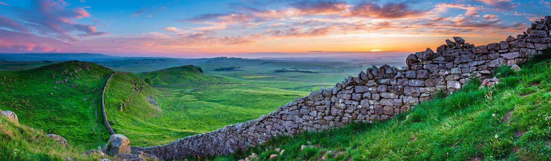
Hadrian’s Wall is a UNESCO World Heritage Site, a spectacular testimony of the Roman invasion, dating from the late 2nd century AD. It was a stone fortified wall that separated the Roman province of Britannia from Caledonia, a territory corresponding more or less to present-day Scotland. Situated in one of the most beautiful and least tamed areas of the country, with its extraordinary wildlife, the wall runs coast to coast below the border between Scotland and England, and includes regularly spaced turrets and milecastles. The National Trail follows the wall from Wallsend on the east coast of England to Bowness-on-Solway on the west coast. The signposting of the path is impeccable: just follow the acorn signs.
Start: Wallsend
Finish: Bowness-on-Solway
Distance: 84 mi (135 km)
Time: 6 days
Difficulty: easy/medium
Accommodation: B&Bs
Giorno 1
Giorno 2
Giorno 3
Giorno 4 Giorno 5 Giorno 6
Eco because: This trail across wild and solitary moors is open only to hikers: bicycles and horses would damage the grassy trail.
Giorno 1 Giorno 2 Giorno 3 Giorno 4 Giorno 5 Giorno 6
Start: Gambarie
Finish: Stilo/Bivongi or Serra San Bruno
Distance: 87 mi (140 km)
Time: 7 days
Difficulty: easy/medium
Accommodation: refuges, hostels, guest houses, farm holiday
48 top The state forest in Alto Aspromonte. It is notable for its tree species, of considerable size and many centuries old.
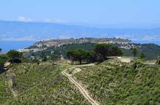
48 bottom In the distance, beyond the Strait of Sicily, you can see the city of Messina on the coast: it can be reached by ferry from Villa San Giovanni.
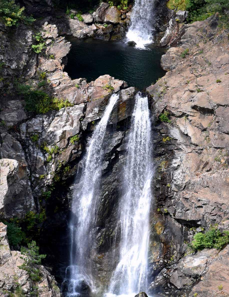
49 The Amendolea falls (known as Maesano) are three tiers, which each end in a hollow dug out by the incessant action of water on the rock. They are an impressive sight.
At the southern tip of Italy, Calabria is surrounded by the waters of the Ionian Sea and the Tyrrhenian Sea: this enchanting land has many emerald coasts and a mountainous core, with the chains of the Lucanian and Calabrian Apennines and the plateaus of Serra, Aspromonte, and Sila. This rocky treasure is all to be discovered: it preserves a number of woods greatly exceeding that of the other Southern regions, and its hinterland, harsh and wild, with many water courses, is still partly dedicated to pastoral activities.
One way to discover Calabria is to follow the Sentiero del Brigante trail, identified and marked by the GEA (the Aspromonte Trekkers’ Group), and included in the Parco dell’Aspromonte plan as a thematic path. The reason for its unusual name (“Brigand’s Path”) lies in place names evoking the figures of rebels and brigands who in the past found refuge in these mountains. The itinerary travels along the ridge between the Parco Nazionale dell’Aspromonte, marked by great biodiversity, and the Parco Naturale Regionale delle Serre, a protected nature area.
Day 1
2
3
4
5
6
7
Eco because: It is a trail in the footsteps of rebels, brigands, and fugitives of every era, through areas of great natural interest. This land has a strong identity and authenticity: an unexpected welcome awaits you in these mountains that for too long have been considered hostile and impenetrable.
Start: Chefchaouen
Finish: Bab Taza
Distance: 35 mi (56 km)
Time: 5 days
Difficulty: medium
Accommodation: gîtes and tents
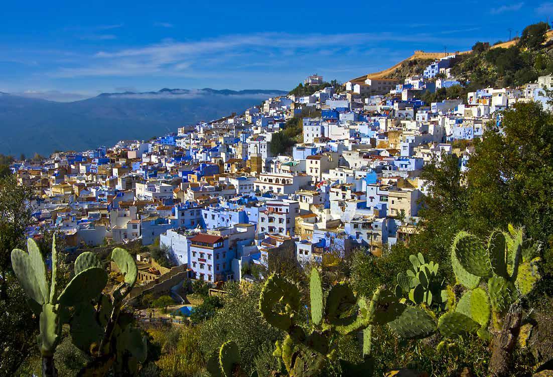
62–63 Chefchaouen rests in a small valley. The oldest part of the town rises toward the top of the mountain: at the highest point, you find the sources of the Ras al-Ma waterfalls.
Eco because: The itinerary presented here is one of the best introductions to the Rif mountains. It allows direct contact with the local people, who host hikers in their simple homes for the night.
The beauty of the Moroccan landscape is peerless: Africa, Europe, and the Middle East blend here in a fascinating combination. Lapped by the waters of the Mediterranean and the Atlantic, this African country is the meeting point of multiple influences: a magical place, in which diversity matches a commitment toward the environment. The Moroccan Responsible Tourism Charter and the Moroccan Sustainable Tourism Awards have been established here to guarantee the sustainability of the tourist industry, according to precise standards. In this favorable context, a growing number of companies and tourist destinations have been recognized for their environmental responsibility. Local organizations, supported by the government, set up structures for rural tourism (like the gîtes, basic apartments, and hostels) and manage the routes and training for guides.
MAROCCO
Among the regions of this country, Tangier-Tétouan-Alhoceima proposes several zero-impact trips, profiting from its natural landscapes and the protection of its biodiversity. It is a haven for marine and terrestrial fauna and migratory birds, with beaches, waterfalls, canyons, and snow-capped mountains. The coast lies between the Atlantic and the Mediterranean, near the Rif, the greenest mountains in Morocco: springtime, with the blaze of wildflowers, is one of the most pleasant times to walk here. An irresistible attraction for anyone who loves hiking.
Giorno 1
Giorno 2
Giorno 3
Giorno 4
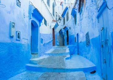
63 This blue town was founded in 1471 by Andalusian and Muslim exiles: for this reason, the old part recalls Andalusian towns, with uneven narrow streets.
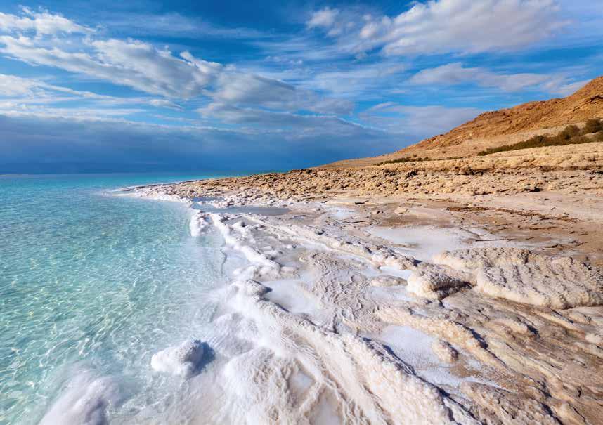
78 The Dead Sea is situated in the deepest depression on Earth. It has been produced by the evaporation of water over millennia.
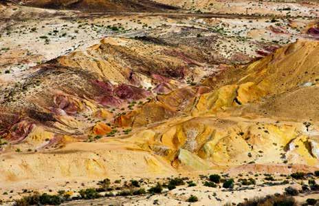
79 left The Makhtesh Katan. The makhtesh is a kind of crater typical of the Negev Desert with steep rocky walls surrounding a deep closed valley. It contains a variety of rocks of different colors.
79 right The Timna Park. From the high points, you enjoy a colorful view, with shades ranging from red to yellow, depending on light reflections and the composition of the terrain.
DAY 21: Even Sapir–Netiv Ha’Lamed Heh
DAY 22: Netiv Ha’Lamed Heh–Beit Guvrin
DAY 23: Beit Guvrin–Tel Keshet
DAY 24: Tel Keshet–Kibbutz Dvir
On the edge of the Negev Desert, you find the Pura Nature Reserve, where a river flows and there are various types of flowers, paths, and a small lake.
DAY 25: Kibbutz Dvir–Meitar
DAY 26: Meitar–Amasa
In this stage, you reach Yatir, the largest natural forest in Israel, created by the Keren Kayemeth LeIsrael (KKL), the oldest ecological organization in the world. Founded in 1901, it works for the reclamation and reforesting of the land in Israel and develops technologies and skills in various sectors, from agriculture to scientific research, to the struggle with desertification.
DAY 27: Amasa–Arad (Dead Sea)
Arad is the entrance to the Dead Sea, the salt lake in the deepest depression on Earth, 1,388 feet (400 m) below sea level. One can float with no effort because of its high salinity, and swimming in it is considered therapeutic, as is its mud. From Arad you enter the Negev Desert.
DAY 28: Arad–Be’er Efe
Rosh Zohar is a good panoramic look-out point over the Dead Sea.
DAY 29: Be’er Efe–Meizad Tamar
DAY 30: Meizad Tamar–Summit of Makhtesh Katan
You have a spectacular view from Makhtesh Katan; makhtesh are river basins of varying size..
DAY 31: Makhtesh Katan–Oron
DAY 32: Oron–Mador (night camping area)
The fittest can climb Mount Karbolet for a spectacular view.
DAY 33: Mador (nca)–Akev (nca)-Midreshet Ben Gurion
Ben Gurion’s tomb is the place where the Israeli statesman is buried, but also the center of the environmental research and enhancement of the desert desired by him.
DAY 34: Akev (nca)–Hava (nca)
Today you reach Ein Shabiv, a real oasis with many shady trees.
DAY 35: Hava (nca)–Miztpe Ramon
DAY 36: Miztpe Ramon–Gevanim (nca)
DAY 37: Gevanim (nca)–Gev Holit (nca)
DAY 38: Gev Holit (nca)–Zofar
DAY 39: Zofar–Barak (nca)
DAY 40: Barak (nca)–Zihor
DAY 41: Zihor–Shizafon
DAY 42: Shizafon–Shaharut
DAY 43: Shaharut–Elifaz (Timna Park)
Timna Park is an area of archaeological value in the Negev Desert, where there are copper mines that operated from the sixth millennium BC to the Middle Ages.
DAY 44: Elifaz–Raham-Etek (nca)
On this stage, you encounter the spectacular Pillars of Solomon, limestone formations up to 160 feet (50 m) high.
DAY 45: Raham-Etek (nca)–Yehoram (nca)
DAY 46: Yehoram (nca)–Almon/Eilat
On the last day of the trail, you climb Mount Shelomo for a breathtaking view of Eilat and the Red Sea. You have arrived at the end of your journey in Israel!
IN ISRAEL, TOO, THE RULE IN SUSTAINABLE TRAVELING IS LEAVE NO TRACE. FOR EXAMPLE, IT IS ALWAYS BETTER TO TAKE A BAG TO COLLECT TRASH, TO BE PUT WHERE POSSIBLE IN THE CORRECT CONTAINER. DO NOT PICK WILD FLOWERS OR BRANCHES TO MAKE CAMPFIRES, WHICH CAN ONLY BE LIT IN THE SPACES ASSIGNED. IT IS FORBIDDEN TO PITCH A TENT OUTSIDE THE SPACES ALLOWED.
Useful Websites info.goisrael.com israeltrail.net
Start: Cusco
Finish: Cusco
Distance: 43 mi (70 km)
Time: 5 days
Difficulty: medium, but it is necessary to acclimatize before starting the trek
Accommodation: lodges ( tambos)
Eco because: This trek is part of a program of ecotourism organized with the local communities of Josefina and Chillca, who actively take part and offer hospitality in their comfortable eco-lodges. The participants are accompanied by pack llamas belonging to local shepherds from the Chillca community, who are proud to share their land and the spirit of their world with travelers.
In Peru, nature expresses an incredible variety of ecoregions (11) and habitats (84). It is a paradise for anyone who loves adventure and wants to undertake a trek: thanks to the many trails and snow-capped peaks, excursionists can choose from more than 932 miles (1,500 km) of highland, with mountains, lakes, volcanoes, canyons, and gorges. These natural wonders are also combined with the archaeological remains of pre-Columbian civilizations.
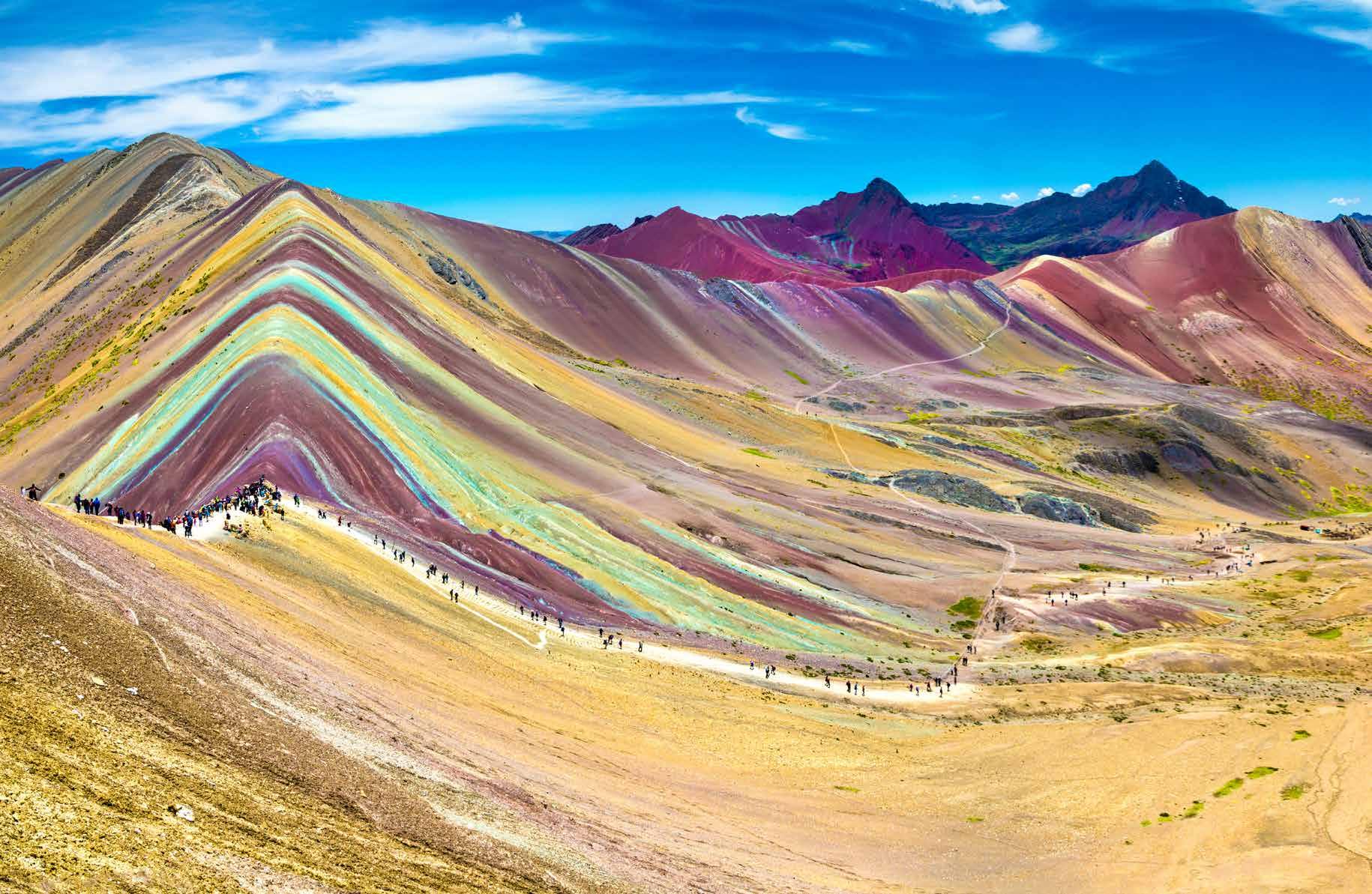
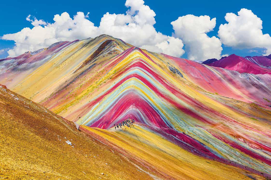
Among the many treks in the Cordillera de Vilcanota, the one we propose here is the five-day circular trek of Camino del Apu Ausangate, in the vicinity of the highest sacred mountain of the Cusco region. Snowy peaks, wide valleys, wonderful lakes add to the opportunity to understand the shepherd’s way of life and to explore one of the least polluted mountain ecosystems in the world. The trail lies at more than 16,404 feet (5,000 m) above sea level and is generally not very busy, passing through shepherds’ villages. In addition to the llamas, excursionists can see alpacas, vicunas, spur-winged geese, and, if they are lucky, the incredible Andean condor. The colorful spectacle of the hills is priceless: the mineral layers of rock show red stripes from the oxidized iron, yellow from the ferrous sulfide, purple brown produced by goethite or oxidized limonite, and green created by chlorite. Baggage is carried by llamas, and the itinerary ends with two sections on horseback for those who do not wish (or cannot) walk. During the trek, daily meals are provided at the tambos (Andean lodges), prepared by expert cooks who will introduce you to a variety of delicious dishes and Peruvian products.
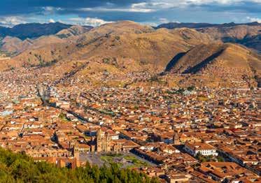
93 In the past, Cusco, situated in the Peruvian Andes, was the capital of the Inca Empire. Today, it is famous for its archaeological ruins and Spanish colonial architecture.
Start: Manchugang
Finish: Monastery of Tharpaling
Distance: 14 mi (22 km)
Time: 3 days
Difficulty: easy
Accommodation: tents
BUTHAN - OWL TRECK
Giorno 1
Giorno 2
Giorno 3
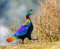
138 bottom The Himalayan monal, a brightly colored pheasant that lives in the forests, is generally extremely shy and elusive. It has a pair of hidden horns on the sides of its head.
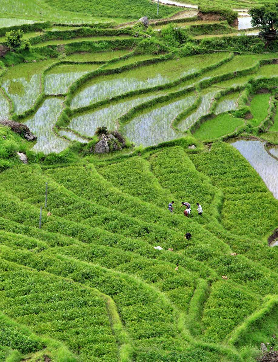
139 Fields and terraces used to grow rice. Rice is a subsistence crop for all the country, and only 1% is put on the market. Red rice is unique: it is grown manually without chemical fertilizers or pesticides.
Bhutan, “the land of the thunder dragon,” is a Himalayan kingdom where Buddhist culture and tradition blend with increasing globalization. The Bhutanese are very proud of the respect they show to nature: even the constitution states that each of them is an administrator of natural resources and the environment. Tourists immediately perceive this attitude and are led to behave with respect for the environment and the animals, without intruding on the local traditions and culture.
This trek crosses the valleys of the district of Bumthang, the cultural center of the country. It is a journey through forests of blue pine, birch, maple, red pine, juniper, bamboo, and numerous species of rhododendron, nestling in immense spaces and evocative silences. Traditional buildings act as religious, military, bureaucratic, administrative, and social centers, playing a fundamental role in the peculiarities of Bhutanese Buddhism. As you walk along these quiet ridges in the mountains of Bumthang, you can admire the incomparable panoramas of Mount Gangkhar Puensum, the highest peak in the world to remain unclimbed. The avian fauna in this area is varied and contains pleasant surprises, like the beautiful, multicolored western horned tragopan, a pheasant commonly seen during the mating season between April and May. The nights are punctuated by the hooting of the owls that give their name to the tour: The Owl Trek.
- OWL TRECK
Giorno 1
Giorno 2
Giorno 3
Monastero di Tharpaling
Eco because: Bhutan is the example of responsible tourism par excellence. The rule for the flow of visitors is clear: small numbers and high income. That is to say, only a limited number of visitors can enter the country each year, and for every day of their stay, they must pay a government tax “for the protection of the nation’s culture,” of which 37% goes directly to the state for medical welfare and education.
Start: Newburyport
Finish: Newburyport
Distance: 84 mi (136 km)
Time: 3 days
Difficulty: easy
Accommodation: hotels
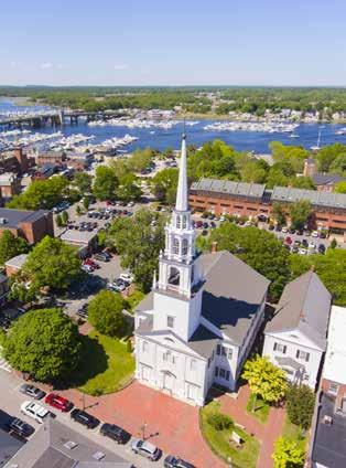
258 The architecture of the old town of Newburyport, which was once an important trading port and center for silver working, has not changed much in 200 years.
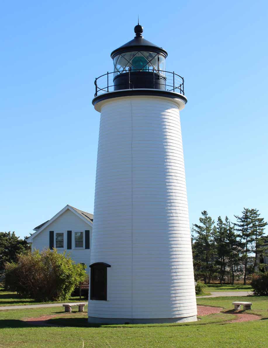
259 The Plum Island Lighthouse, the only one remaining on the island, marks the narrow entrance of the mouth of the Merrimack River.
Massachusetts has a lengthy tradition of government measures aimed at preserving the environment. Along the roads you encounter solar panels and wind turbines, tangible proof of the use of renewable energy sources. Hotels and restaurants are making considerable effort to reduce the consumption of energy and water, limit the production of waste, and provide a healthy environment for guests and employees. In the restaurant sector, local farmers and growers are involved in the production of delicious “zero miles” food. The Natural Resources Defense Council (NRDC) has recently nominated Boston the greenest city on the East Coast. The availability of public and private transport for car-free travelers within Boston and in many other areas of the state is also good, and there are plenty of easy bike paths.
The itinerary we suggest here is in the Great Marsh area, a saltwater marsh in New England that extends from Cape Ann in the northeast of Massachusetts to the southwestern coast of New Hampshire. It is an internationally important reserve and contributes to the preservation of many nesting and migrating birds. This unique complex of natural ecosystems adds ecological, economic, recreational, and cultural value to the daily life on the coast and inland.
Eco because: It is an easy bike tour through diverse habitats: beaches, dunes, mudflats, salt flats, and coastal forests. You can do some bird watching in the Parker River National Wildlife Refuge, which has more than 300 species of birds, and there are also mammals, reptiles, amphibians, insects, and rare plants.