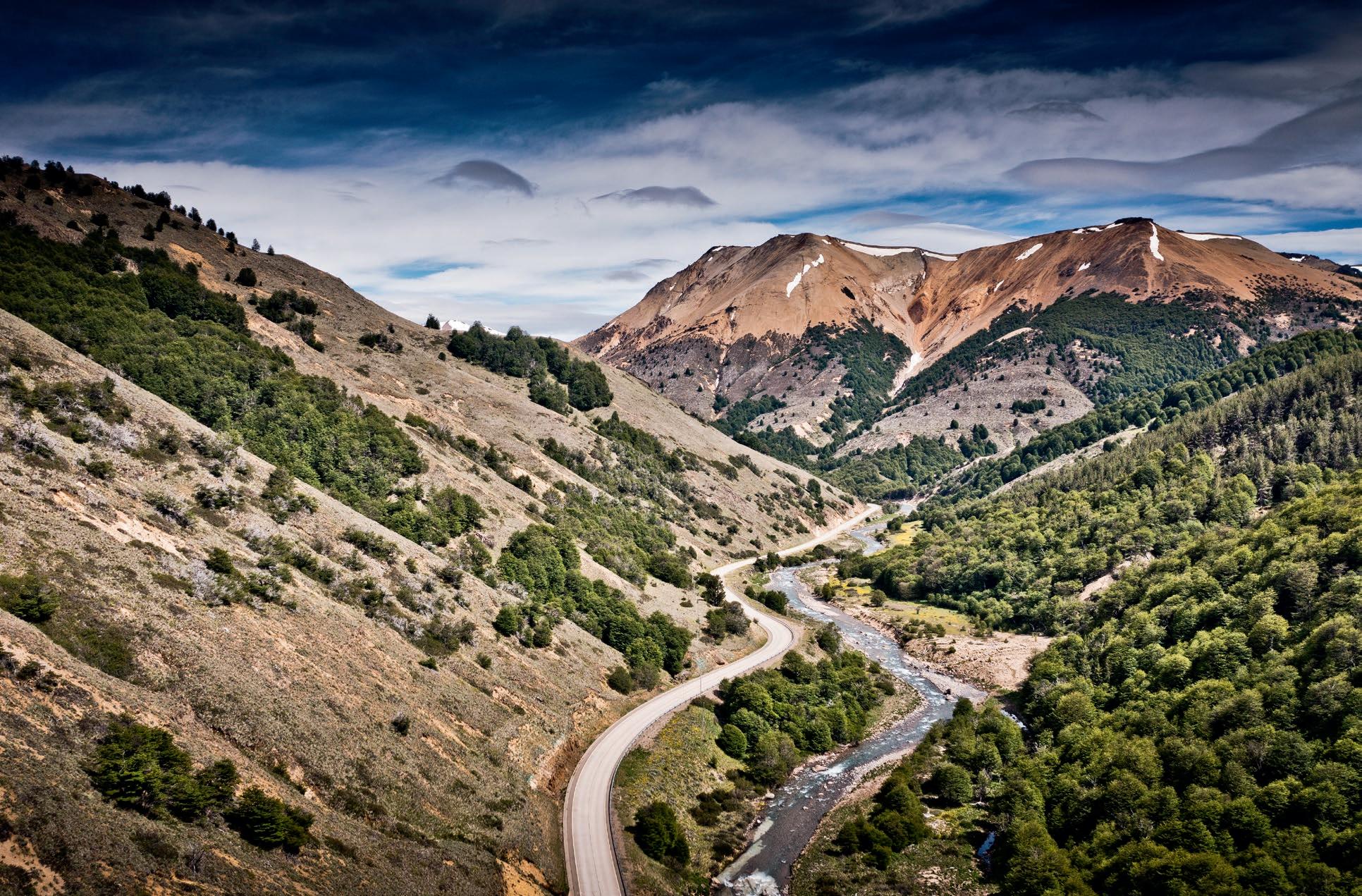


Mit dem 320-Kilometer-Ausflug über die Anden, hinüber nach Bariloche, setzen wir einen ganz bewussten Auftakt an den Beginn unserer Reise durch Patagonien. Anstatt der „Carretera Austral“ nach Süden zu folgen, ziehen wir nach Osten, gegen den Strich der Berge. Auf dem Weg in die „Schweiz Argentiniens“ überqueren wir den Anden-Hauptkamm in ganzer Breite und gelangen am östlichen Fuß des Gebirges bis an die weiten Ebenen der argentinischen Pampa. Nicht nur die spannende Fahrt in den Kurven der Nationalparks macht diesen Auftakt-Abstecher für uns zur Pflicht, auch der Besuch Bariloches ist einen Umweg wert. Die Stadt steht beinahe sinnbildlich für die Geschichte Patagoniens: Mit den deutlich wahrnehmbaren Einflüssen deutscher Einwanderer, ihrer Geschichte als ehemaligem Handelsposten im Land der Ureinwohner und der heutigen Leuchtturm-Rolle im Outdoor-Tourismus spiegelt die DepartamentoHauptstadt der Provinz Rio Negro das Werden vieler Städte Patagoniens wider. Zurück am Ausgangspunkt, in Puerto Montt, geht die eigentliche Fahrt nach Süden los – mit einer Etappe entlang der Fjorde am Pazifik. Fährschiffe spielen hier immer wieder eine prägende Rolle, das Déjà-vu für Norwegen-Fans ist unausweichlich.
The 320-kilometer journey across the Andes to Bariloche is a very deliberate curtain-raiser to our journey through Patagonia. Instead of following the “Carretera Austral” south, we head east, in the opposite direction to the mountains. On the way to the “Switzerland of Argentina” we cross the entire width of the main Andes ridge, eventually reaching the eastern foot of the mountains and the wide plains of the Argentine pampas. This initial detour is made worthwhile for us not just by the exciting curves as we drive through the national park, but also by the chance to visit Bariloche. The city is almost symbolic of the history of Patagonia: With the clearly perceptible influences of German immigrants, its history as a former trading post among the indigenous populations and its modern flagship role in outdoor tourism, the capital of the Rio Negro province reflects the development of many of Patagonia’s cities and towns. Back at our starting point in Puerto Montt, the actual journey south begins with a stage that closely follows the Pacific fjords. Ferries play a formative role, so that a feeling of déjà vu is inevitable for Norway fans.
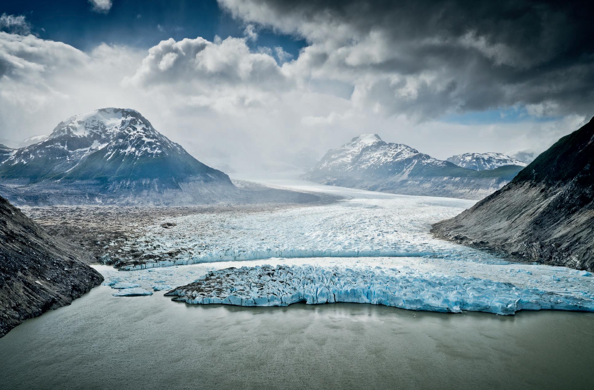
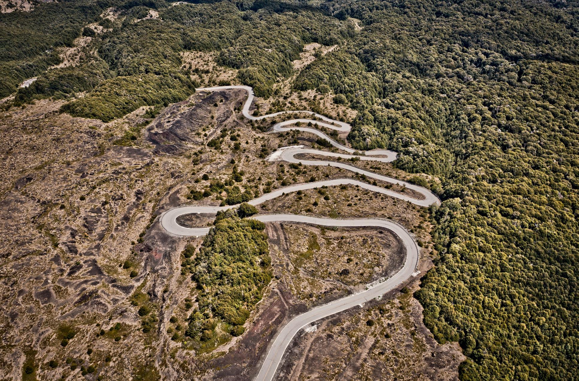
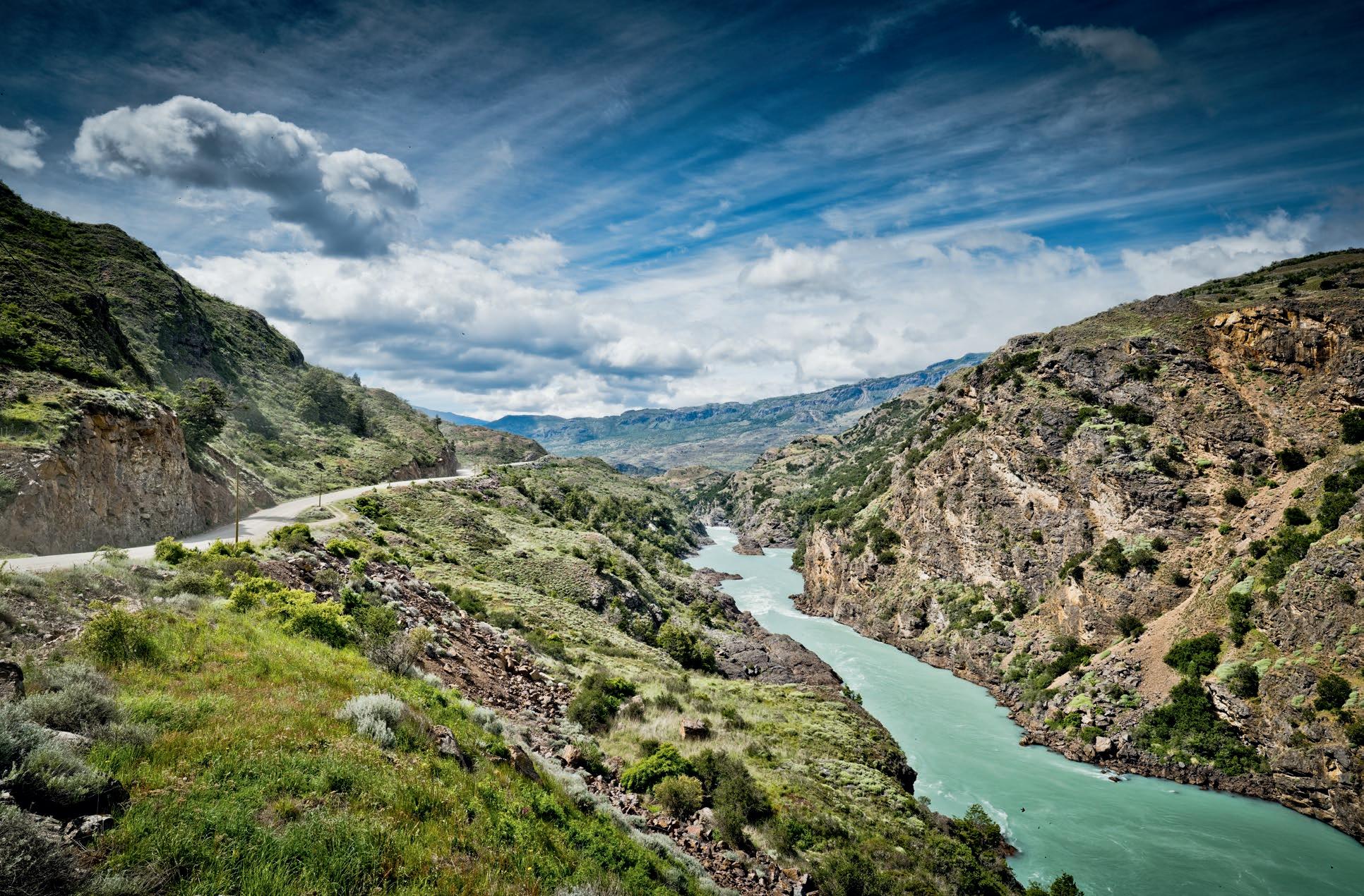
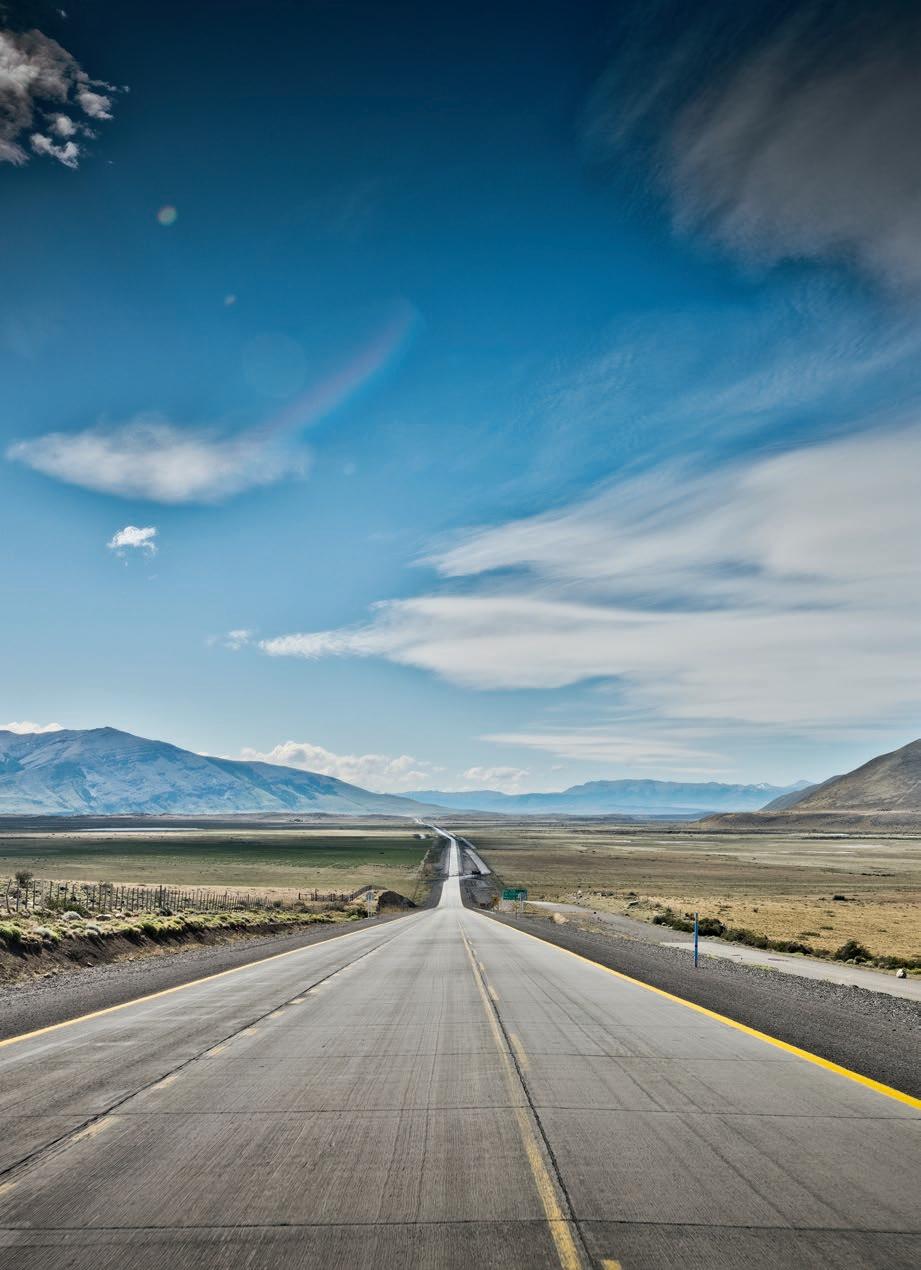
Rund 750 Kilometer liegen zwischen Chaitén am Golf von Corcovado und den Gletschergebieten rund um Cochrane, im Süden der Region de Aisén. Wer diese Strecke auf der Carretera Austral befahren möchte, sollte sich auf mehrere Tagesetappen und eine abwechslungsreiche Gangart einstellen. Weite Teile der Strecke sind immer wieder nicht asphaltiert, führen durch menschenleere Gebiete und über anspruchsvolles Terrain. Im Norden wird die Straße von Vulkanen eskortiert, strebt dann vorbei am Corcovado-Nationalpark durch die Región de los Lagosbis zum Puyuhuapi-Fjord, der vom Pazifik her weit ins Landesinnere einschneidet. Hier ändert sich die Richtung der Fernstraße, sie überquert in mehreren Zügen den Anden-Hauptkamm, bis sie bei Coyhaique am östlichen Fuß des Gebirgszugs angelangt ist. Durch die Región de Aysén geht es nun weiter nach Süden, rund um den riesigen Lago General Carrera, der in seinem östlichen, argentinischen Teil „Lago Buenos Aires“ genannt wird, dann wieder etwas weiter ins Hochgebirge zurück. In Cochrane haben wir das Ziel unserer Etappe erreicht – und auch beinahe das Ende der Carretera Austral.
A distance of around 750 kilometers lies between Chaitén on the Gulf of Corcovado and the glacier fields around Cochrane, in the south of the Aisén region. If you intend to drive this route on the Carretera Austral, you should be prepared for a number of daily stages and a varied pace. Large parts of the route are unpaved and lead through desert areas and across challenging terrain. In the north, the road runs past several volcanoes, then traverses the Corcovado National Park and the Región de los Lagos to reach the Puyuhuapi Fjord, which cuts far inland from the Pacific. The direction of the highway changes here, crossing the main Andes ridge in several stretches until it arrives at Coyhaique at the eastern foot of the mountain range. Passing through the Región de Aysén we continue south, around the huge Lago General Carrera, the eastern, Argentinian part of which is called “Lago Buenos Aires”, then head back a little further into the high mountains. In Cochrane we reach the end of this particular stage – and almost the end of the Carretera Austral.