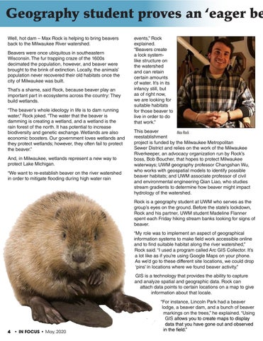
Geography student proves an ‘eager be Well, hot dam – Max Rock is helping to bring beavers back to the Milwaukee River watershed. Beavers were once ubiquitous in southeastern Wisconsin. The fur trapping craze of the 1600s decimated the population, however, and beaver were brought to the brink of extinction. Locally, the animals’ population never recovered their old habitats once the city of Milwaukee was built. That’s a shame, said Rock, because beaver play an important part in ecosystems across the country: They build wetlands. “The beaver’s whole ideology in life is to dam running water,” Rock joked. “The water that the beaver is damming is creating a wetland, and a wetland is the rain forest of the north. It has potential to increase biodiversity and genetic exchange. Wetlands are also economic boosters. Our government loves wetlands and they protect wetlands; however, they often fail to protect the beaver.” And, in Milwaukee, wetlands represent a new way to protect Lake Michigan. “We want to re-establish beaver on the river watershed in order to mitigate flooding during high water rain
events,” Rock explained. “Beavers create a lock systemlike structure on the watershed and can retain certain amounts of water. It’s in its infancy still, but as of right now, we are looking for suitable habitats for those beaver to live in order to do that work.” This beaver Max Rock reestablishment project is funded by the Milwaukee Metropolitan Sewer District and relies on the work of the Milwaukee Riverkeeper, an advocacy organization run by Rock’s boss, Bob Boucher, that hopes to protect Milwaukee waterways; UWM geography professor Changshan Wu, who works with geospatial models to identify possible beaver habitats; and UWM associate professor of civil and environmental engineering Qian Liao, who studies stream gradients to determine how beaver might impact hydrology of the watershed. Rock is a geography student at UWM who serves as the group’s eyes on the ground. Before the state’s lockdown, Rock and his partner, UWM student Madeline Flanner spent each Friday hiking stream banks looking for signs of beaver. “My role was to implement an aspect of geographical information systems to make field work accessible online and to find suitable habitat along the river watershed,” Rock said. “I used a program called Arc GIS Collector. It’s a lot like as if you’re using Google Maps on your phone. As we’d go to these different site locations, we could drop ‘pins’ in locations where we found beaver activity.” GIS is a technology that provides the ability to capture and analyze spatial and geographic data. Rock can attach data points to certain locations on a map to give information about that locale.
4 • IN FOCUS • May, 2020
“For instance, Lincoln Park had a beaver lodge, a beaver dam, and a bunch of beaver markings on the trees,” he explained. “Using GIS allows you to create maps to display data that you have gone out and observed in the field.”