Landscape architectural approaches to revitalize coastal habitats in a high-dense tropical city
NUS School of Design and Environment | Department of Architecture LA4701 MLA Studio: Quarter, 14 Aug - 20 Nov 2017
| Fan Lei Helen | Gao Chen Chen | Kong Lingchang | Kuan Wai Tuck Victor | Lam Si Yun Swan
Liu Xiaolei | Nur Azilla Bte Nazli | Wang Hanfeng | Wang Zhe | Xu Linxin | Xu Yuexin Yao Haomu | Yong Keng-Whye, Raymond Tutor: Hwang Yun Hye | Melissa Yip Sui Ling
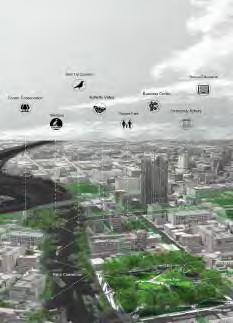
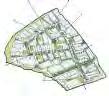
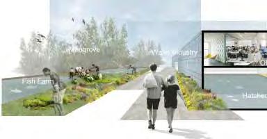
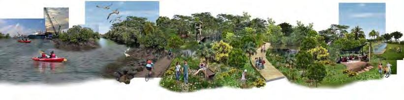
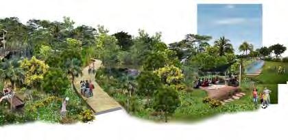
RE-IMAGING SUNGEI PANDAN LANDSCAPE
Landscape architectural approaches to revitalize coastal habitats in a high-dense tropical city
Hwang Yun Hye
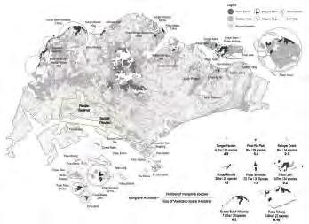
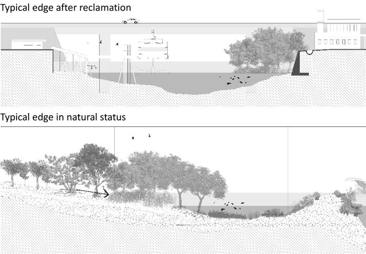
LOSS OF COASTAL HABITAT OF SINGAPORE
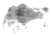
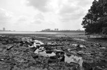
Situated in the tropics, one-and-a-half degrees north of the equator, Singapore is an island nation located in one of the most species-rich regions in the world. The land was originally covered by primary rainforests, mangroves and freshwater forests, harbouring thousands of floral and faunal species in a complex tropical ecosystem (H. T. Tan, Chou, Yeo, & Ng, 2007). In the mangrove forest alone, 56 of 70 of the world’s mangrove species could be found in Singapore, the most numerous in Southeast Asia (Yang, Lim, Sheue, & Yong, 2011). However, the clearing of land for settlements, starting from the late 1800s and continuing into post-war urbanization in the 1960s, have resulted in widespread deforestation, leaving less than 5% of the original habitats intact (Ng, Corlett, & Tan, 2011). Over the years, these local habitats are projected to further decreased and deteriorated as they become increasingly fragmented due to urban growth (Brook, Sodhi, & Ng, 2003; Corlett, 1992). Almost all of Singapore’s shorelines have been drastically modified to meet industrial, residential, water resource and recreational demands. Most of the natural sandy shores and river mouths on intertidal shores have been reclaimed, losing 65% of original coral reefs and decreasing mangrove forests coverage from 13% of the total land area in the 1820’s to 0.5% in 2011 (Yee, Ang, Teo, Liew, & Tan, 2010). These massive changes and fragmentation of the coastal ecosystem disrupts aquatic ecosystem processes, and decreases water quality (Friess, 2016a). According to the 2008 Master Plan and 2011 Concept Plan, however land development in Singapore continues unabated and planned land reclamation will result in additional losses of 33% of the existing mangrove area. It is apparent that many of eth natural coastal habitat face to shrinking area, increasing fragmentation, and encroaching by urban expansions (Lai, Loke, Hilton, Bouma, & Todd, 2015). This occurs in the context of climate change, which brings about mounting environmental pressures such as sea level rise, altered hydrological regimes and sediment supply (Burkett, 2012).
However, this does not mean that all coastal habitats are dead or we should stop the land development. As calls for conservation are often seen as impractical in the economically-driven state, alternative landscape architectural approaches are needed to address the social and ecological consequences of rapid development. It is unhelpful to see economic development and environmental conservation in a zero-sum game, where a clear winner or loser emerges in any contestation over a land lot slated for development. Instead, we look to find means of reconciling these objectives that are currently framed in opposition to each other and develop design strategies that could address both economic and environmental concerns.
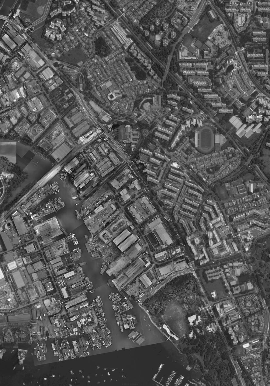
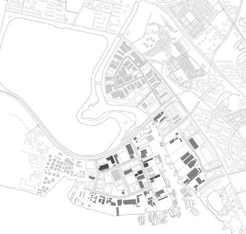
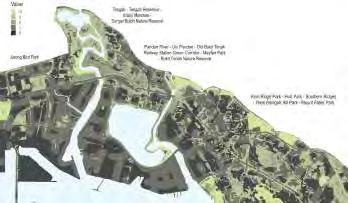
SUNGEI PANDAN
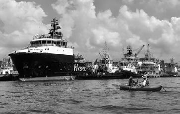
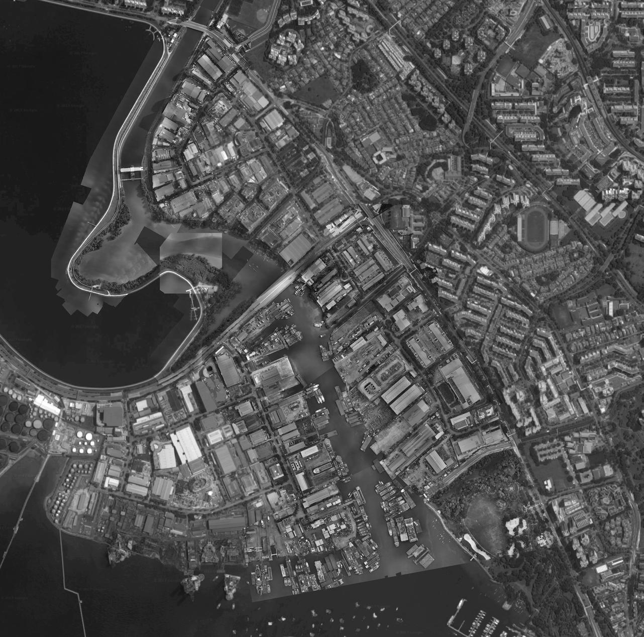
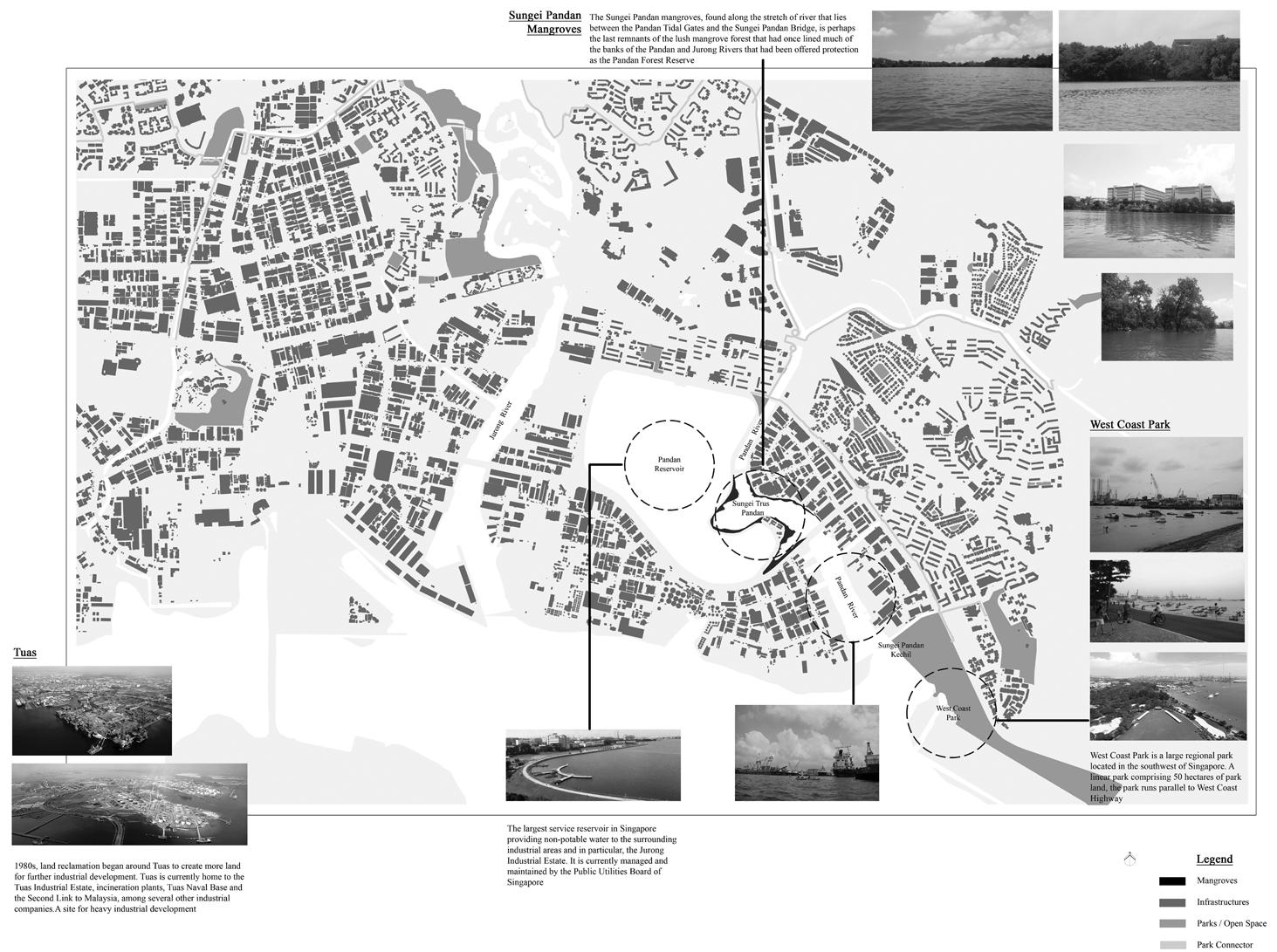
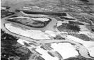
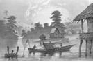
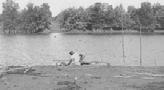
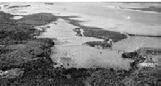
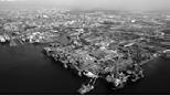
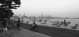
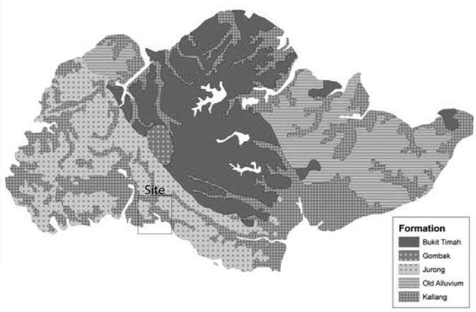
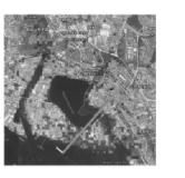
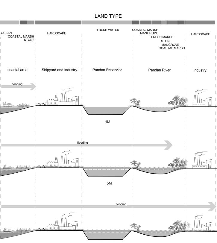
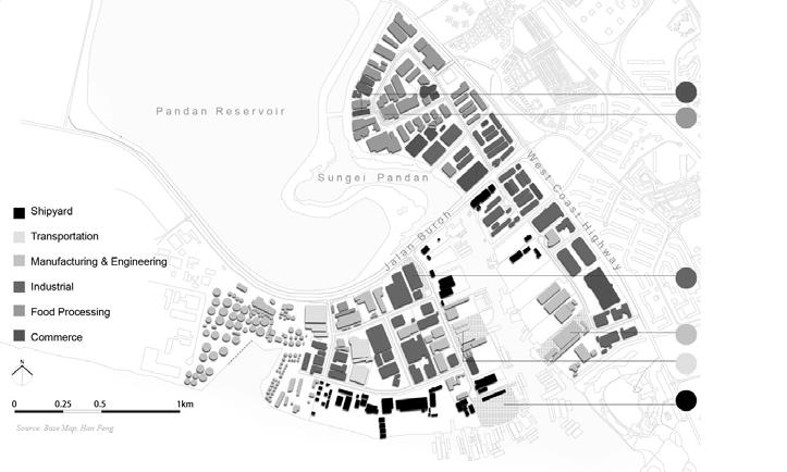
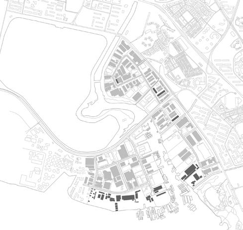
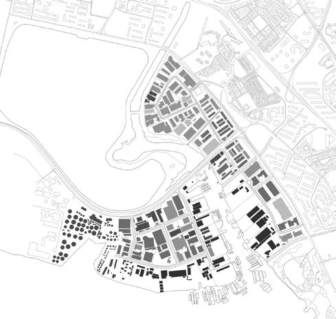
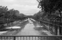
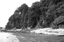
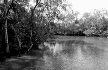
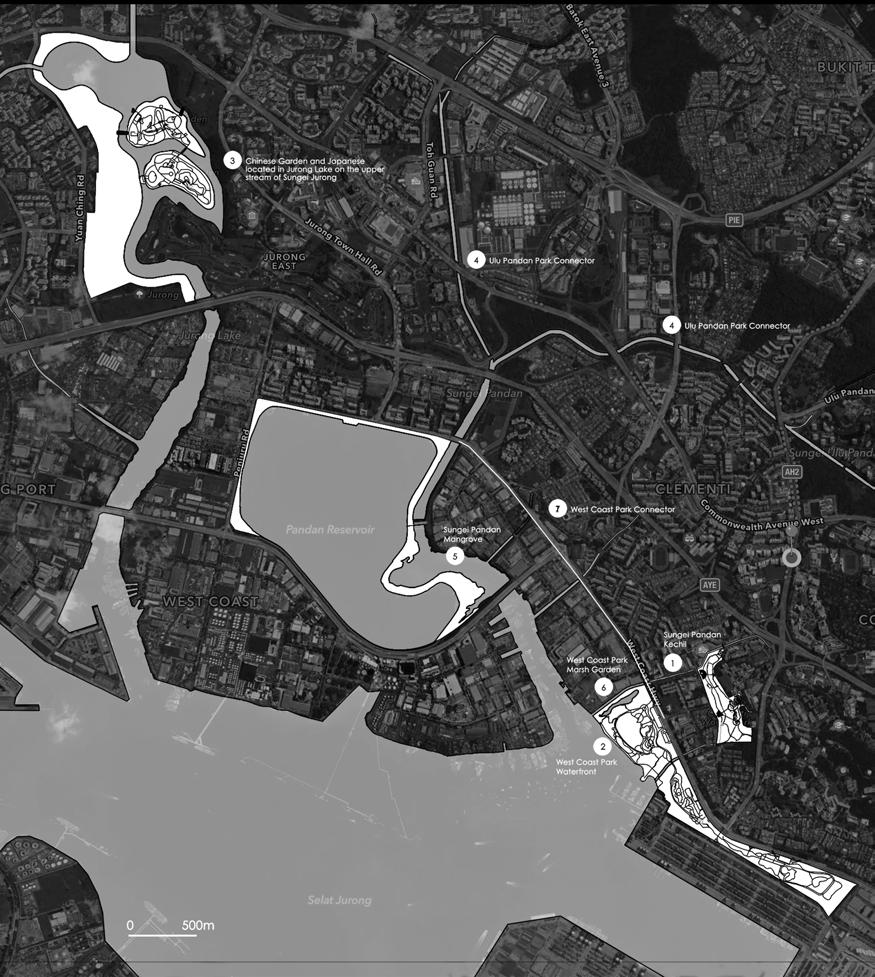
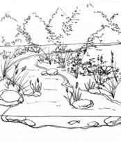
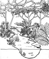
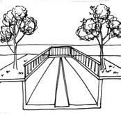
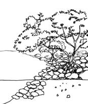
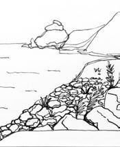
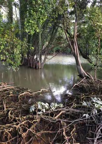
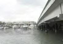
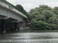
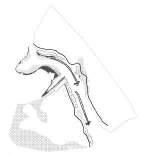
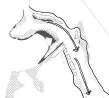
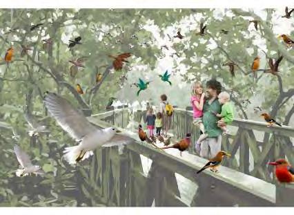
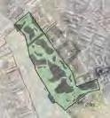
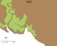
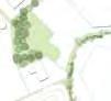
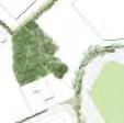
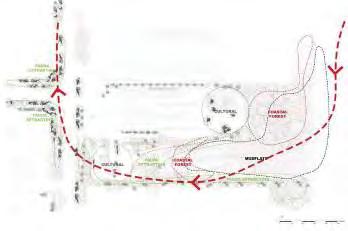
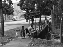
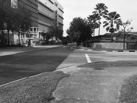
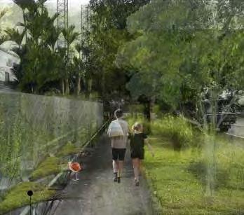
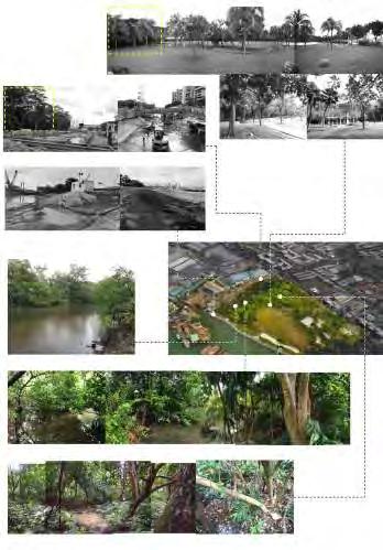
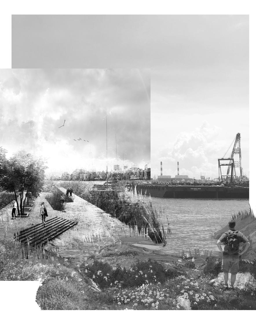
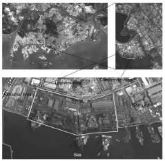
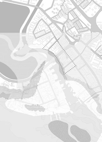
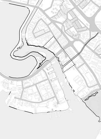
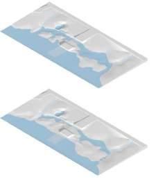
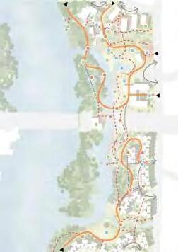
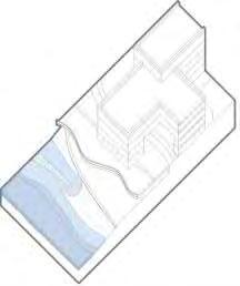
While existing mangrove forests are mainly located along the northern coast, originally the southwest shore had the largest mangrove forested areas in the main land of Singapore. Sungei Pandan is a remnant mangrove forest located along the stretch of Pandan river. It lies between the Pandan Tidal Gates and the Sungei Pandan Bridge. Of the original 219 hectare mangrove forest, only 9ha remain, in the form of an isolated strip within the industrial business zone in the Jurong district. The river has been dammed to form the Pandan reservoir with conventional engineering treatments that disrupts flow and separates the stream into two parts with distinct characteristics. The upper reaches of the river has been canalised with cemented banks and beds – it runs to the PIE and branches out to Sungei Ulu pandan at AYE. Across the PIE, with a continuation of Ulu Pandan Park Connector to Bukit Batok Nature Park, Sungei Pandan provides opportunities for nature walks and birdwatching. The lower part of the river still opens out to the sea, remains relatively natural ecosystem with stands of various mangroves including rare Apiapi Jambu, and became a home of avian residents of the watery forest and other mangrove fauna species. Besides a rich diversity of flora and fauna, the Sungei Pandan provided livelihood opportunities for a village of 135 human inhabitants many of whom was fishermen or prawn farmers before the area has been cleared in 1960’s. Sporadic informal fishing and bird watchers can still be spotted along the riverside, offering a vestige of the old kampong life that once thrived in the area.
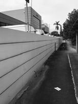
Although this remnant of mangrove forest has been designated as a ‘protected’ park space by URA plan 2014, the coastal habitats in Sungei Pandan has a high risk of extinction due to the relatively small size of the mangrove forest and development pressures by highly urbanized neighboring contexts. The forest lined much of the canalized banks of the Pandan and Jurong rivers being surrounded by factories (Jurong industrial zone), heavily used ports (Jurong port), and managed park land styled urban greenery (West Coast park). Like recent port development cases of Singapore, it has also a strong possibility to transform the port land into mixed urban development in the nearer future as similar as other cases of coastal redevelopment (Wong, 2006).
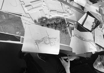
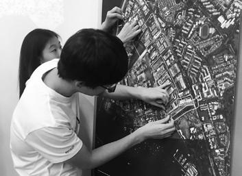
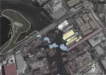
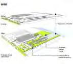
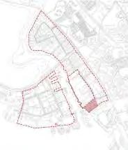
The Sungei Pandan was selected as a ‘landing’ site and serves as a point of reference for all design activities – sites selected were inspired by findings from the coastal landscape and its surrounding context. Students chose his/her own design boundary along Sungei Pandan or in its immediate periphery, based on problem statements and topics arising during the research period, aided by the various design exercises and input sessions.
RE-IMAGING SUNGEI PANDAN LANDSCAPE
How can we effectively conserve the existing coastal habitats while meeting the increasing human development demands? Given the future development requirement and sea level rise, how could initial infrastructure planning be guided towards a sustainable coastal ecosystem and the diversity of wildlife? Beyond simply preserving the site, can landscape
landscape architects propose design prototypes that can infuse greater ecological functions and diversity into the urban coastal context? How can design promote a healthier lifestyle that closer to nature for city dwellers? The studio aimed to answer these questions by devising new strategies and design applications of ecological principles, predicated on deep awareness of the multi-faceted nature of our city landscape and the intricate feedbacks between social and ecological factors in the city.
The studio highlighted the value of natural resources and ecological services, and propose ways to integrate them into our urban environments. We capitalized on the academic nature of the studio to develop ideas and schemes free of restrictions commonly faced in the practice, and beyond any constraints of political correctness. Multiple issues such as identity, multi-functionality, and livability have been examined.
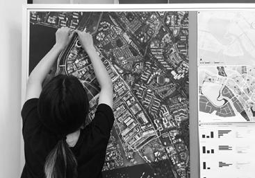
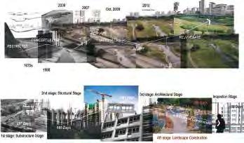
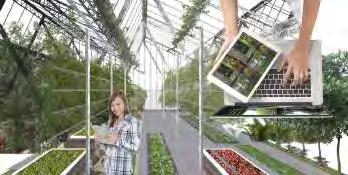
THIS BOOK is a compilation of works from the studio. The first half of the book documents the sequential studio process from the beginning of preliminary research, site analysis and prototyping. The fourteen-week logbook is a useful demonstration of how initial activities and resources can be transformed into viable design proposals. The studio started off with site analysis as group work, giving rise to backgrounds of and motivation for subsequent design topics. Four approaches are emphasized from the studio: 1) developing a strong awareness of site specificity; 2) deepening our understanding of urban ecology; 3) producing a wide ranging spectrum across scales; and 4) encompassing various functional layers. Lastly, the reflections address all that we have come away with from every single experience we had during the entire studio process.
Reference
Brook, B. W., Sodhi, N. S., & Ng, P. K. (2003). Catastrophic extinctions follow deforestation in Singapore. Nature, 424(6947), 420-426.
Burkett, V. (2012). Coastal Impacts, Adaptation, and Vulnerabilities: Springer. Corlett, R. T. (1992). The ecological transformation of Singapore, 1819-1990. Journal of biogeography, 411-420.
**Friess, D. A. (2016a). Ecosystem Services and Disservices of Mangrove Forests: Insights from Historical Colonial Observations. Forests, 7(9), 183.
Friess, D. A. (2016b). Mangrove forests. Current Biology, 26(16), R746-R748.
Mark, J. M., & Dave, K. (2015). The Ecology of Urban Forests Routledge Handbook of Forest Ecology: Routledge. Ng, P. K., Corlett, R., & Tan, H. T. (2011). Singapore biodiversity: an encyclopedia of the natural environment and sustainable development: Editions Didier Millet.
Tan, H. T., Chou, L., Yeo, D., & Ng, P. (2007). The natural heritage of Singapore. Pearson Prentice Hall. Wong, T.-C. (2006). Revitalising Singapore’s Central City through Gentrification: The Role of Waterfront Housing. Urban Policy and Research, 24(2), 181-199.
Yang, S., Lim, R. L., Sheue, C.-R., & Yong, J. W. (2011). The current status of mangrove forests in Singapore. Paper presented at the Proceedings of the Nature Society, Singapore’s Conference on ‘Nature Conservation for a Sustainable Singapore.
Yee, A., Ang, W., Teo, S., Liew, S., & Tan, H. (2010). The present extent of mangrove forests in Singapore. Nature in Singapore, 3, 139-145.
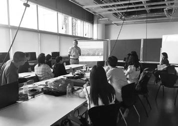
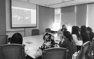
Our studio begun with a studio orientation by studio tutors, Ms. Hwang Yun Hye & Ms Melissa Yap. The students were assigned a couple of exercises to be completed throughout the course of the semester.
The first seminar was conducted by Dr Tan Puay Yok, Associate Professor of NUS Department of Architecture on Urban Greenery in Singapore. He explained the landscape planning policies and legal framework drafted out by the dedicated institutions in Singapore.
He left the students a little brainstorming question, whether do they think Singapore is really Ecologically Green?
14 Aug Studio Orientation & Seminar 1
15 Aug Visit to URA
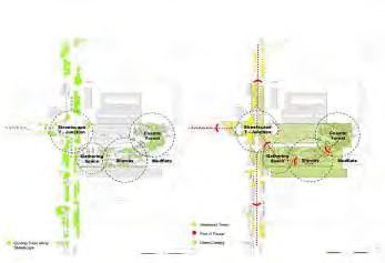
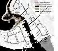
The studio visited URA and they were given a talk conducted by Ms Celine Tan, Executive Planner (East) & Ms Kitty Khoo, Executive Planner (Central West) has has kindly agreed to give a talk on the broad strategies for the Great Southern Waterfront, Singapore. The students understood the Coastal Development strategies for the Great Southern Waterfront in Singapore. In addition to the 5 main ideas URA had proposed.
Idea 1, Housing, Mixed-Use, Entertainment & Leisure _ Idea 2, Expanding Network of Public Space _ Idea 3, Capitalising the Blue Assests _ Idea 4 _ Continous Waterfront _ Idea 5 _ Connect Green & Open Space
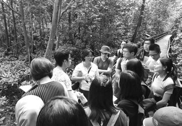
It was a well- planned and orientated focused seminar and field trip as it focuses on a specific topic which is, Singapore Mangroves. First half of the day, a seminar on "Singapore Mangroves" was conducted by Mr Dan Friess, Assistant Professor of NUS Department of Geography. He shares with Singapore Mangroves conditions & habitats. He also emphasized the importance of Mangroves.
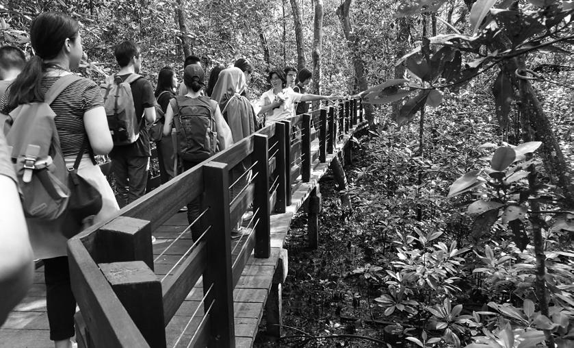
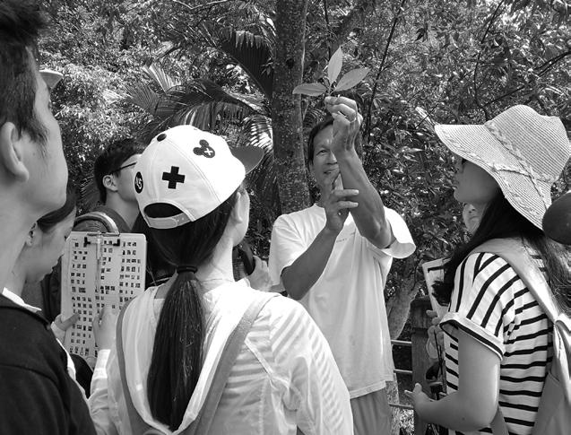
The session was followed by Ms Chih Min Boo, an Ecologist, whom conducted a field trip to Pasir Ris Mangrove Park where she discusses about The Past & Present Coastal Landscape in Singapore. They venture dthrough broadwalks to understand the different habitats of Mangroves & using the knowledge they had with Mr Dan Friess earlier of the day and tried to applied on site
21 Aug Seminar 3 with Mr Dan Friess & Field Trip 1 to Pasir Ris Mangrove Park with Ms Chih Min Boo
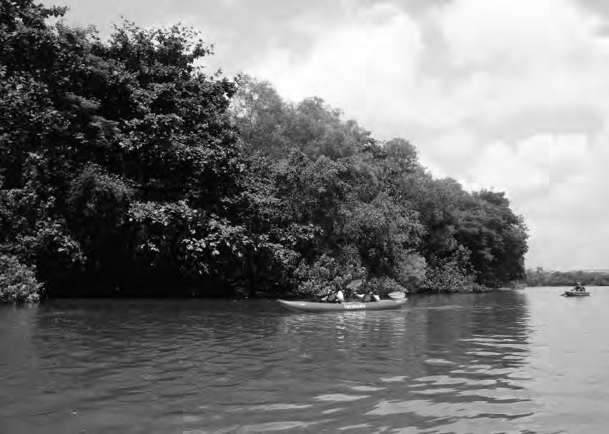
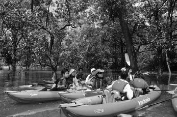
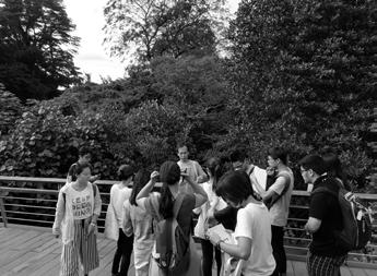
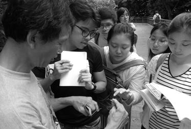
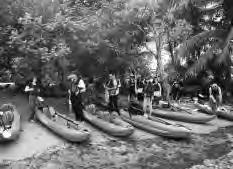
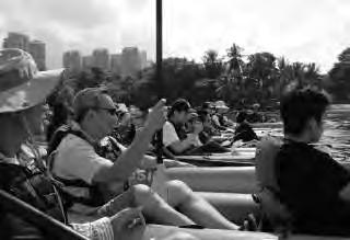
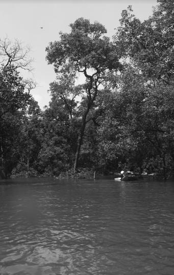
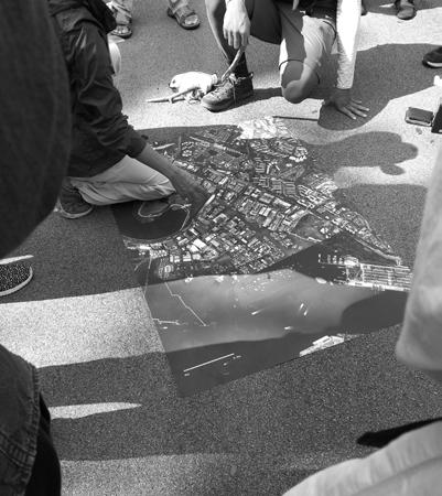
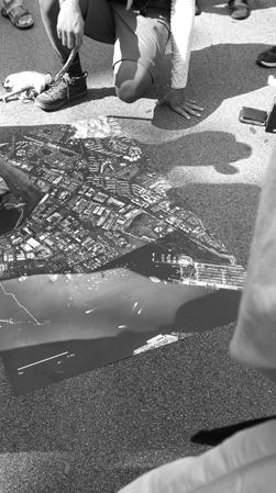
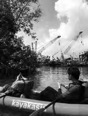
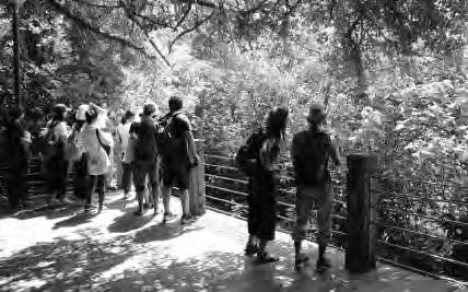
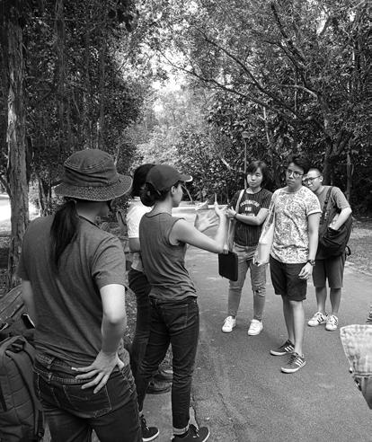
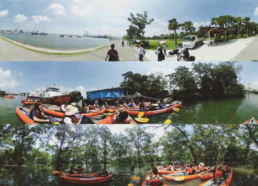
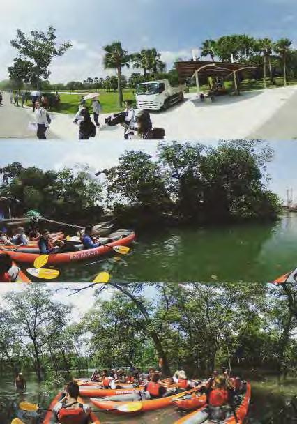
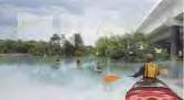
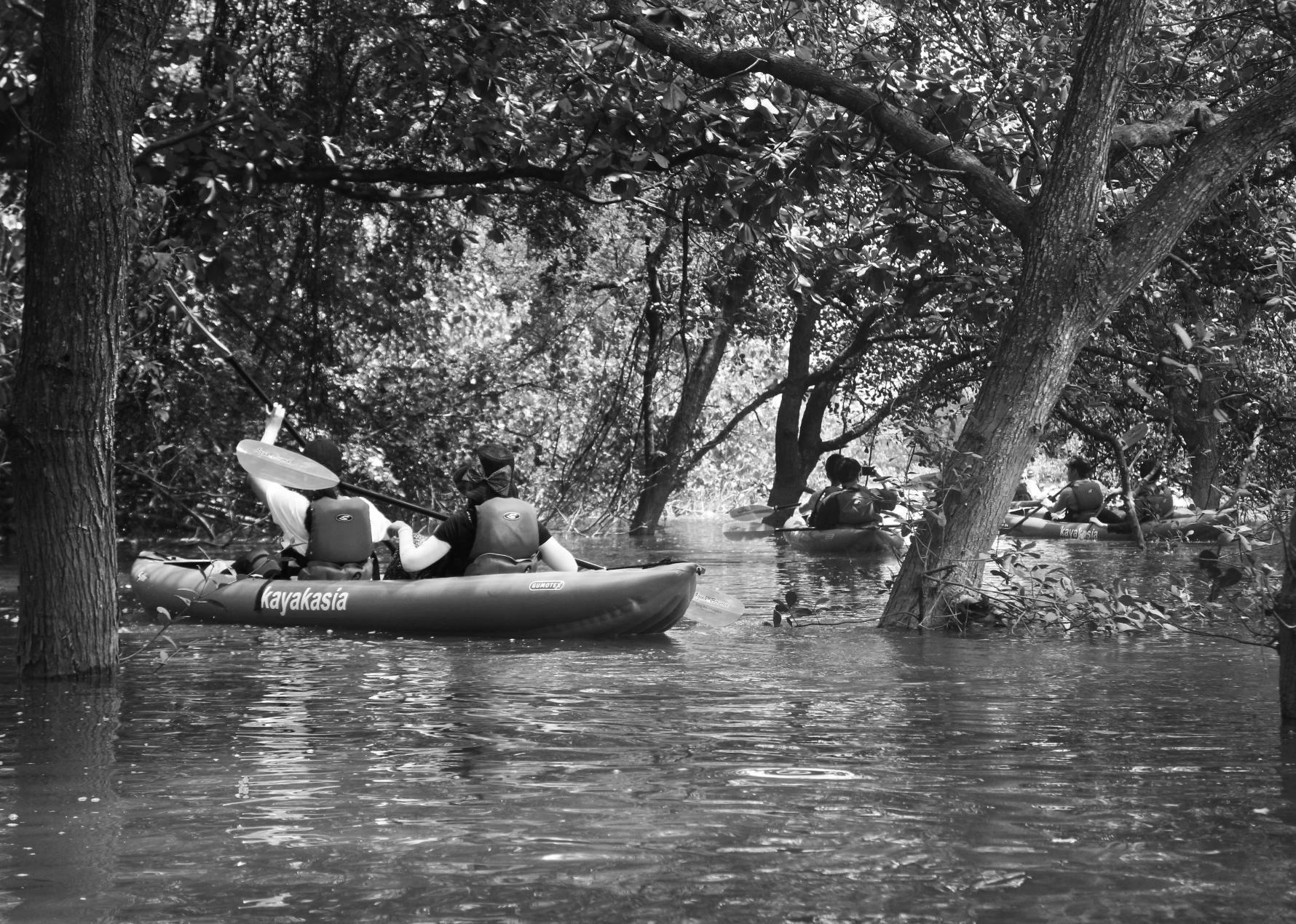
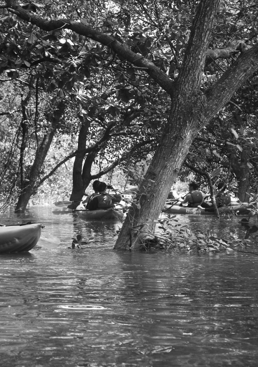
23 Aug Field Trip 2 to Sungei Pandan (Site) to Kayak with Kayakasia Singapore
2 guests was invited to join them on their site visit, namely, Dr Tan Puay Yok, Associate Professor of NUS Department of Architecture Dr Shawn Lam, Tropical Rainforest Ecologist, President of the Nature Society Singapore
They were taught basic kayaking tips and instructions in order to stay focused and vigilant while kayaking down Pandan River to explore Sungei Pandan. This activity gave them a larger persepctive on how to view its' site surrounding conditions and keeping in mind what are the strengths, weaknesses, opportunities and constraints.
The second half of day was led by Dr Shawn Lam. He conducted a short walk through the Mangroves in West Coast Park to better share with them the current Coastal Landscape within the site boundary.
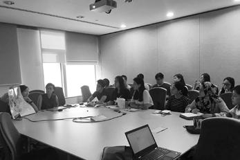
The session begun with Ms Lynette Loke, Postdoctoral Research Fellow, Department of Biological Sciences, NUS, who gave us an overview of Ecologically Engineering Singapore's Seawalls.
The session was followed by Mr Ryan Micheal Shubin, Landscape Architect from Ramboll Studio Dreiseitl, who provided the students with a seminar on designing with Bio-Engineering, as well as the design developments of Bishan Park.
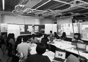
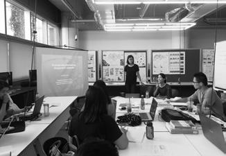
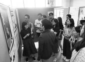
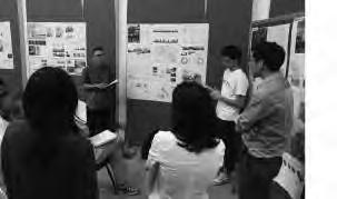
The seminar was followed by Exercise 1 and pin-ups of Exercise 2 whereby students share their site studies and research in their respective groups
28 Aug Seminar 5 & 6 by Ms Lynette Loke, NUS Biology and Mr Ryan Michael Shubin, RSD & Exercise 1 Presentation & Exercise 2 Pin-ups
2 guest reviewers were invited for Exercise 2 Presentation & individual Issues & Site Analysis Pin up, namely, Dr Jessica Cook, Associate Professor of NUS Department of Architecture
Mr Andrew Toland, Lecturer, School of Architecture, University of Technology Sydney
Students shared updated and improved verson of Exercise 2, where 2 guest reviewers also gave them constructive feedbacks where they could work on, to improve their research and site studies skills.
31 Aug Field Trip 3 to Labrador Park with Dr Shawn K.Y. Lum
The studio needed an extra field trip to learn and understand more about the habitats and species of coastal forest in Singapore which would be beneficial for their individual design ideas.
Dr Shawn Lum,Tropical Rainforest Ecologist, President of the Nature Society, took time off his busy schedule to conduct a field trip to Labrador Park where he patiently explained and discussed the different species of flora which could be found along the Coastal Forest
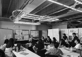
4 Sep Exercise 2 Presentation & Individual Issues & Site Analysis Pin up with Mr Andrew Toland & Dr Jessica Cook
11 Sep Site Analysis & Issues Presentation
Students were required to propose their issue statement and also look for suitable approaches to reslove them
Students presented their detailed Site Analysis & Issue statement across the studio, where they gave feedbacks and suggestion to each other
The session begun with Ms Melissa Yap, where she discusses about case studies in Singapore's future residential estate developments. Where it dealth with waterfronts, park connectors and broadwalks. Bringing people closer to the waterfront / river.
The seminar was followed by a briefing, regarding what students should work on and what they should present for their Mid Review.
18 Sep Seminar 7 by Ms Melissa Yap & Synthesis & Preparation for Mid Review
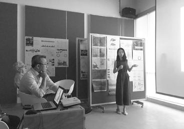
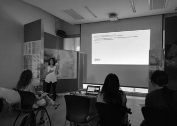
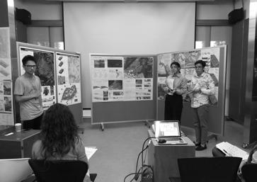
25 Sep Mid Review
3 guest reviewers were invited for the mid review session, namely, Dr Tan Puay Yok, Associate Professor of NUS Department of Architecture
Dr Mark McDonnell, Associate Professor of NUS Department of Architecture
Mr Kenya Endo, Landscape Architect of Ramboll Studio Dreiseitl
The reviewers gave the students a myriad of advice and offered design suggestions regarding their individual research and site issues and how the students could possibly progress towards design in their final review
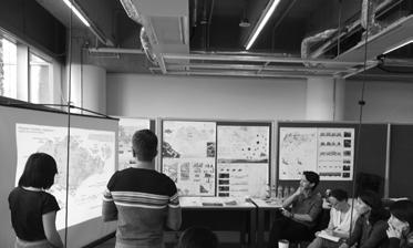
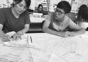
Students returned back to their site in order to retrieve detailed findings and observations to back up their studies and research
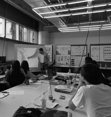
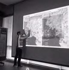
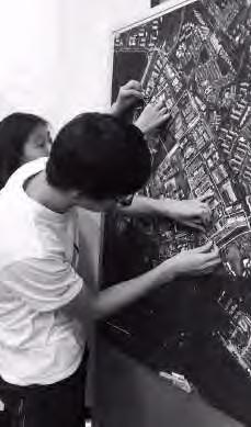
They did models to showcase the site's surrounding context for better understanding and visualization during consultation. Sketches of different schemes were important to showcase design development
2 Oct Studio Consult 1
9 Oct Studio Consult 2
During this period, the students focused on the development of their design strategies, making them more realistic and specific to their sites.
Students might have returned to their targeted site to confirm feasibility of their design proposal with studio tutor.
More intensive studio sessions were needed to further refine individual works.
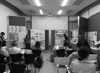
3 guest reviewers were invited for the final review session, namely, Dr Tan Puay Yok, Associate Professor of NUS Department of Architecture, Dr Jessica Cook, Associate Professor of NUS Department of Architecture, and Ms Liu Huei Lyn, Senior Landscape Architect Public Utilities Board (PUB), Singapore,
The reviewers gave the students a myriad of advice and offered design suggestions regarding their individual research and site issues and how the students could possibly progress towards design in their next semester.
16
20 Nov Final Review & Reflections
2 guests was invited to join them on their studio consultation, namely, Dr Shawn Lam, Tropical Rainforest Ecologist, President of the Nature Society Singapore Ms Liu Huei Lyn, Senior Landscape Architect, Public Utilities Board (PUB), Singapore
The students presented their design development and the session concluded on a favourable note whereby they gave advice crucial to the progress of their projects for their final review
Oct Internal Review with Ms Liu Huei Lyn & Mr Shawn Lum
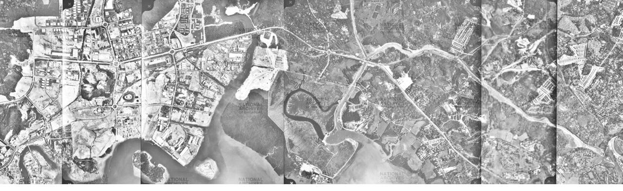
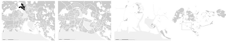
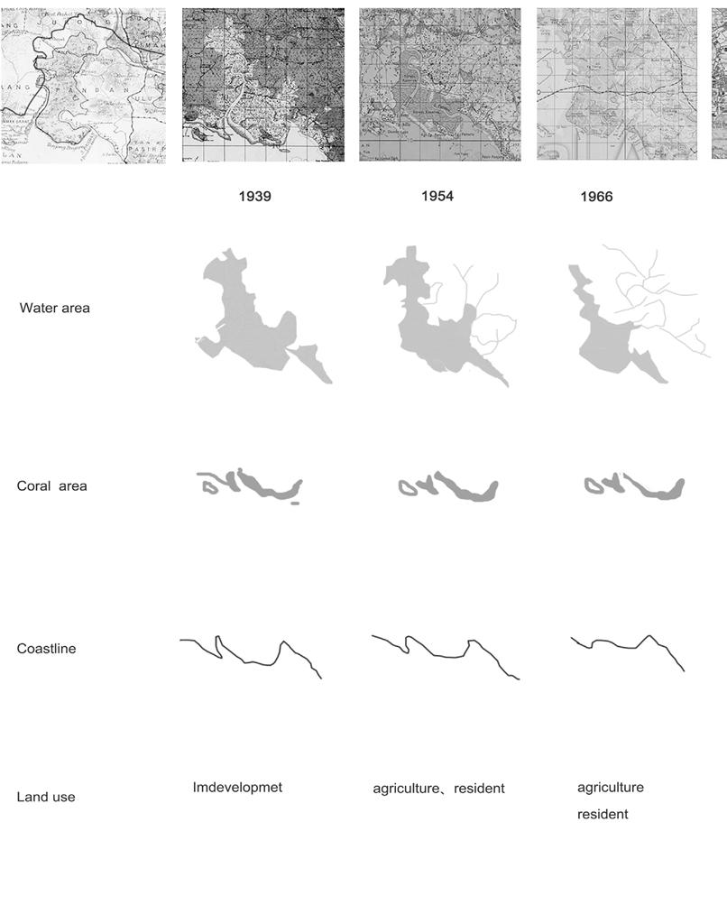
HISTORY OF JURONG DISTRICT
HISTORY OF JURONG DISTRICT
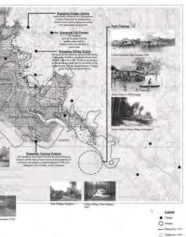
The Sungei Pandan mangroves, found along the stretch of river that lies between the Pandan Tidal Gates and the Sungei Pandan Bridge, is perhaps the last remnants of the lush mangrove forest that had once lined much of the banks of the Pandan and Jurong Rivers that had been offered protection as the Pandan Forest Reserve.
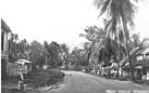
Before 1961, Jurong was a tangle of mangrove swamps, jungle, farms and small kampongs. Like many other parts of Singapore at that time, it was still a vast wilderness of jungle and wasteland with no metalled roads.
Source: National Archives of Singapore (http://www.nas.gov.sg/)
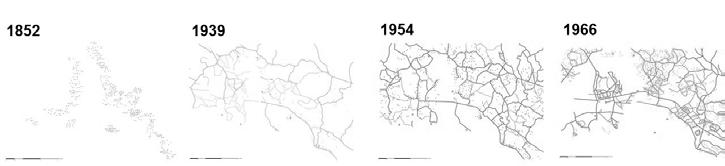
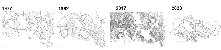
HISTORICAL TIMELINE
Research and study would primarily focus how on Human Intervention and Nature in regards to the past and present users activities, lifestyle, culture, stories, memories. A study on how Sungei Pandan and it’s neighbouring districts such as Jurong and Pasir Panjang has evolved and shifted over time
Human Interventions
The act of constructing infrastructures, roads, buildings where it allow people to live, meet, work & play.
Nature
The natural environment, such as waterbodies, vegetation, forest and mangroves which plays a part in provisioning ecosystem services.
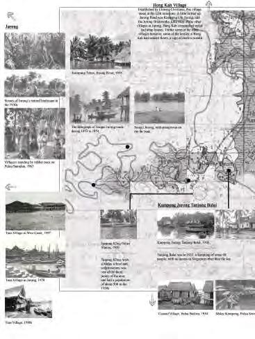
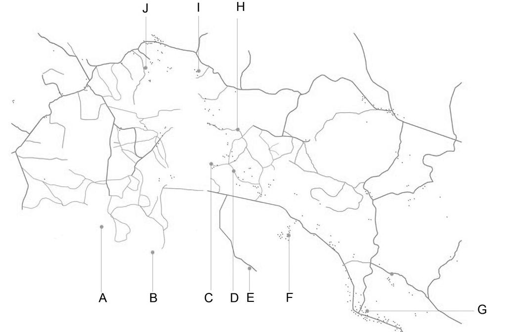
Location of Villages in Jurong District
A) Kampong Pulau Damar Darat / 1945 – 1963 / 50 People
B) Kampong Tanjong Balai / 1945 – 196340 People, which today sits Jurong Port
C) Kampong Java / 1945 - 1945
D) Kampong Java Tebar / 1945 - 1974
E) Kampong Tanjong Penjuru / 1863 – 1987This kampong was located between the coast at Tanjong Penjuru and the Jurong forest reserve and its multitude of tributaries and streams / 200 People, a mixture of Chinese (Prawn Farmers) & Malay (Fishermans)
F) Kampong Sungei Pandan / 1911 - 1974
G) Pasir Panjang Village / 1913 - 1914
H) Kampong Terbing Terjun / 1945 – 1974The name of this kampong hints at a fascinating origin story. In Malay, the phrase tebing terjun refers to a dive off a cliff. To add to the intrigue, the kampong was sited right by a tributary of the Sungei Jurongwith the macabre name of Sungei China Mati (Dead Chinese River)
I) Kampong Sungei Jurong / 1969 – 1974Sandwiched in between the Chithamparam Chettiar Estate and the Arunachalam Chettiar Estate, this kampong was on the 11th milestone of Jurong Road.
J) Kampong Ulu Jurong / 1944 - 1974
HISTORICAL TIMELINE
Changes of LandsCape and Landuse
HISTORICAL TIMELINE
1800s
1819
Orang Lauts settle into Kampongs (K.S.Pandan / K. Penjurur / Tanjong Kling / K.Damar.Duat) Kampongs were pirate hideouts
Mangroves, maze of islands and rivers used as escape routes for pirates
1820
Population grew exponentially
1826
Republic of Singapore Yacht Club –recreational & social club in Singapore
1830
Gambier Plantation was Booming
1840
600 Gambier plantations across the island –6000 Chinese labourers
1841
Pasir Panjang Road was built
1848
Sungei Jurong was described as “a large creek divided at the top 2 branches, East (Chinese Jurong) & West (Peng Kang)
Sungei Pandan was described as “a large creek with Chinese & Malays at the head)
Could see, large open boats, “pukats” (35pax per boat), transport goods such as, gambier/ pepper/agricultural products along the coastal & riverine towns to markets or port towns
1850
Pasir Panjang Road reached as far till Jurong River
1855
Plantations in Jurong was listed for clearing (600,000 Gambier/67,000 Pepper Vines/1700 Nutmeg)
Number of workers working in these 4 plantations were less than 300
5 plantations in Sungei Pandan
3 plantations in Sungei Jurong
20 plantations in Peng Kang
14 plantations in Pulau Damar Duat
1856
Lithograph of Jurong
1877
Introduction of Rubber 1880 Tuas Village was found 1884
Forestry Registration was set up to safeguard remaining forest
1900
Jurong was a successful crop in Singapore
Carp & prawn farmers carried out aquaculture
A worldwide demand for rubber due to automobile industry
1904
A raid broke out, currency counterfeiting operation deep in the jungles of Jurong
1908
Pasir Panjang was regarded as a rural area
1920
Singapore was rubber capital of the world Fresh pork was available at markets
Pasir Panjang wealth Chinese business man build seaside homes & bungalows along the coastline
1930
No roads, lack of roads & bus services
Pasir Panjang was known as “millionaire rows”
1936
Remaining Forest Reserve in Jurong was Pandan Reserve
Tanjong Balai was one of the most beautiful isolated seaside bungalows in Singapore
1940
2000 Chinese & Malay fisherman in Jurong
1942
Crop plantation in Jurong was destroy during Japanese Occupation
1950
There was 1000 acres of Prawn Ponds in Singapore, half of it was in Jurong
1956
190 hectares of Industrial Town was proposed
1959
Lack of jobs for growing population, a problem of economic & social dimensions
/20,000 people were jobless
1960
Jurong known as a “no mans’ island / Redevelopment of Jurong New Town
1961
Clearance of swampland, forested hills, prawn ponds and farmers plantation in Jurong
1964
National Iron & Steel Mills (Natseteel) started, 90 workers
Taman Jurong was developed
1965
Jurong Port began operations
1966
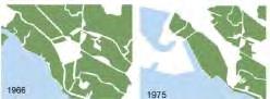
Mouth of the Sungei Pandan having hosted the Republic of Singapore Yacht Club (RYSC)
1967
Industrial Sector was set up, 5000 new jobs annually, however not sufficient to solve nation employment issues
1968
Jurong Town Corporation (JTC) was established
1969
270 factories were set up in Jurong, 20,000 workers
1970
Agriculture character of Jurong was gone
1974
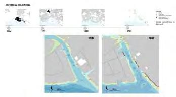
Padan Reservoir was built by enclosing swamp of Sungei Pandan with 6.2km earthen dyke
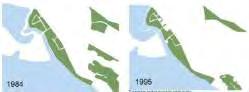
1979
Accomplished West Coast Park, 50 hectares
1992
Singapore 1st Business Park, International Business Park
1998
National Parks Board called for redevelopment of West Coast Park
1999
Republic of Singapore Yacht Club (RYSC) shifted to West Coast Ferry Road
2000s
2000
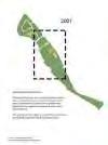
Public Housing started Started of Phase 1 West Coast Park revitalized & improvement infrastructure
2006
5-years Masterplan, to upgrade Jurong was revealed. Expanding playgrounds, improving fitness corners, ramps, covered walkways, rewiring & communal gardens
2008
URA unveiled extensive plans to improve quality life in Jurong
2010
Jurong Island Version 2.0 was launched
The Sungei Pandan project was officially launched in terms of the planting activity, Southwest Community Development Council (SWCDC) One Million Tree Planting Programme
2014
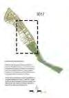
JTC unveiled 1st underground storage facility liquid hydrocarbons in Southeast Asia on Jurong Island
2030
Great Southern Waterfront, 1000 hectares
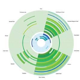
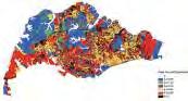
TABULATIONS OF COMMUNITY SURVEY RESULTS
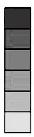
LANDUSE
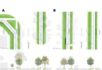
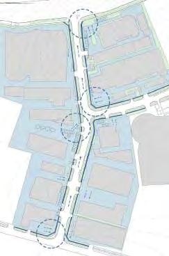
CIRCULATION & BARRIER
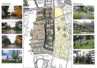
Studying the circulation in the industrial district in terms of vehicular and pedestrian.
Analysing the proximity to green spaces.
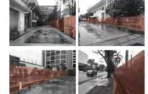
There are no access for users to transit across the plot of factory due to security reasons. Barriers suchs as fences, parapet wall, steel gates, wall are implemented to avoid trespassing.
The barriers varies in terms of visual and physical permeability.
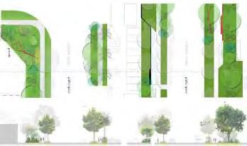
LIFESTYLE & CULTURE
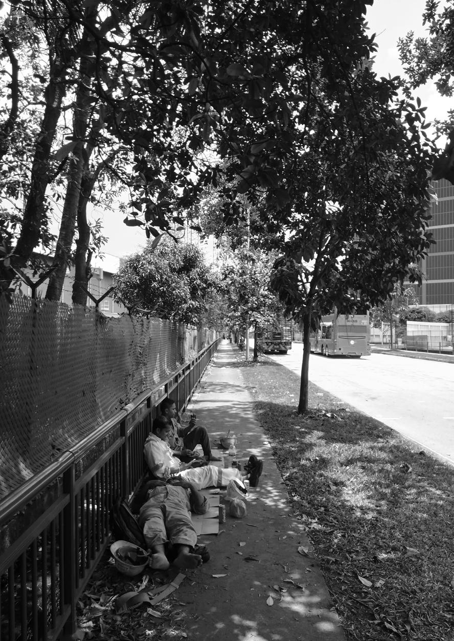
Creating spaces of migrant workers to relax, slow down, pause, catch a breathe to re-energise themselves in order to work efficiently and effectively
Typical Barrier within two buildings Opaque
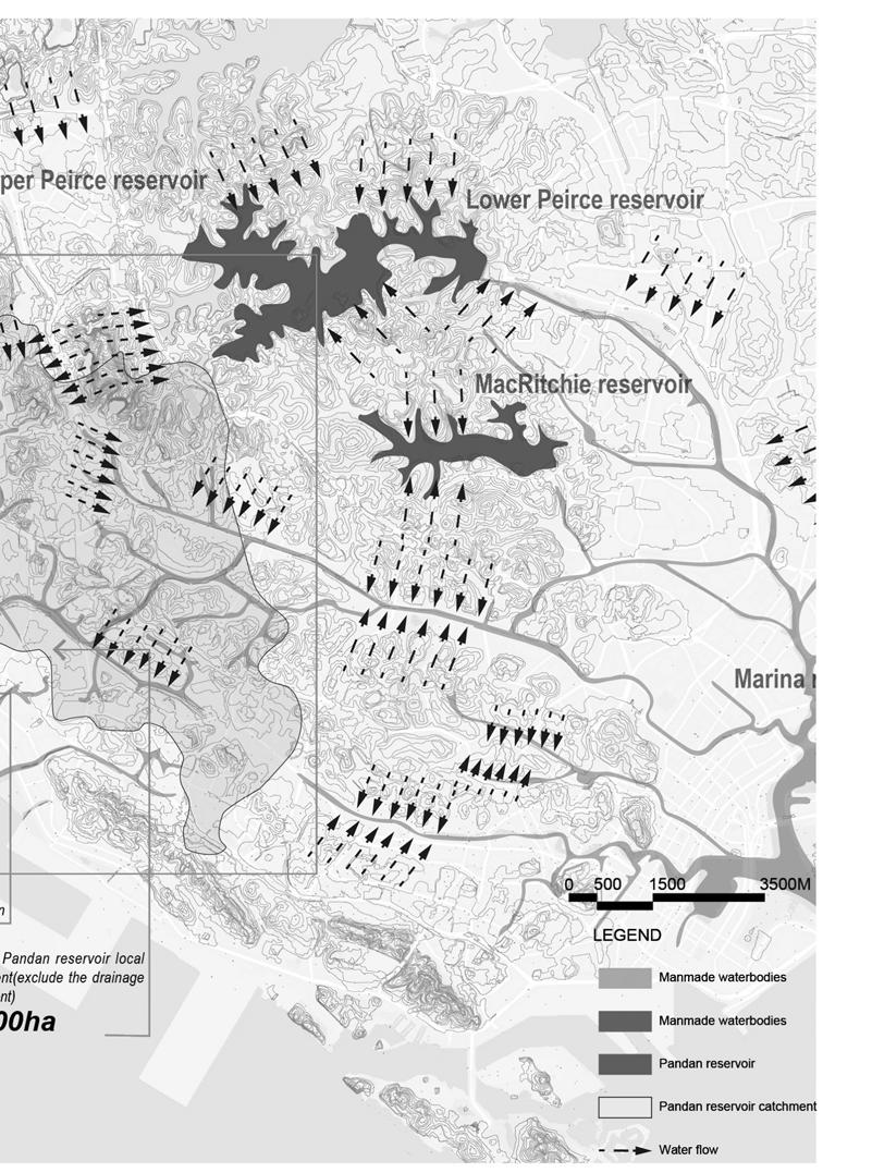
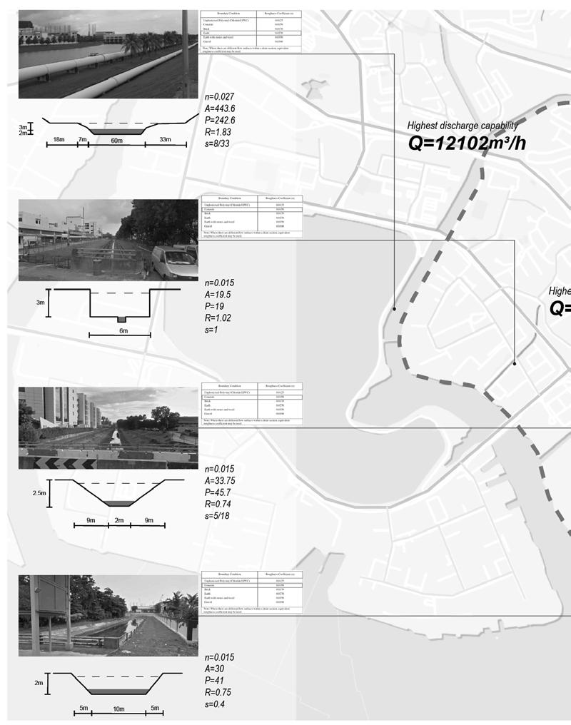
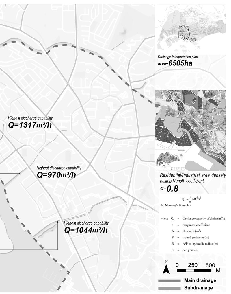
WATER CATCHMENTS ANALYSIS
CANAL DISCHARGING CAPACITY
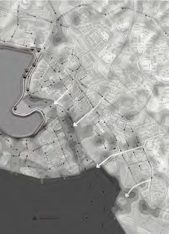
WATERFLOW
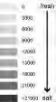
Saltwater average salinity: 0~35 parts per thousand(ppt)
Saltwater average conductivity: 0~40 millisiemens(ms)
Freshwater average salinity: <1-2 parts per thousand(ppt)
Freshwater average conductivity: <1-2 millisiemens(ms)
CONDUCTIVITY
Measure time: 4-5pm
RAINFALL & FLOODING
SEA LEVEL RISE SECTION OF AFFECTED AREA
Sea level rise reduces the capacity of the soil to absorb rainfall by raising the watertable. This results in increased runoff, which increases and the amount of surface flooding that occur during a rainfall event.
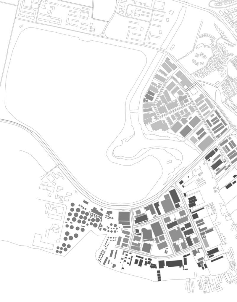
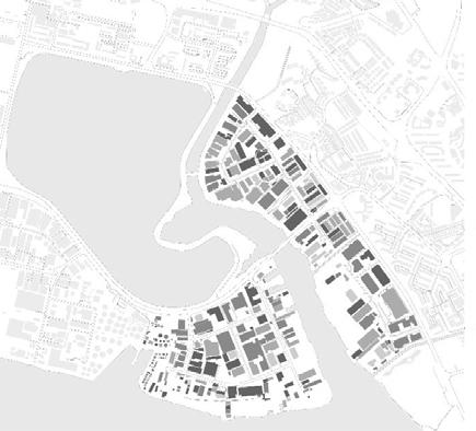
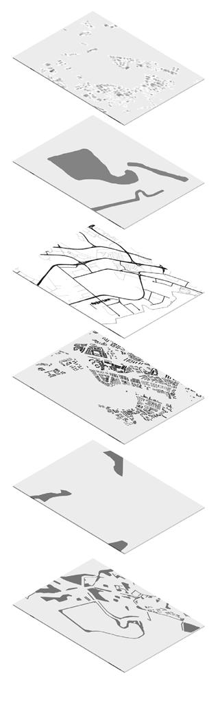
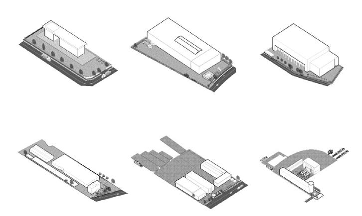
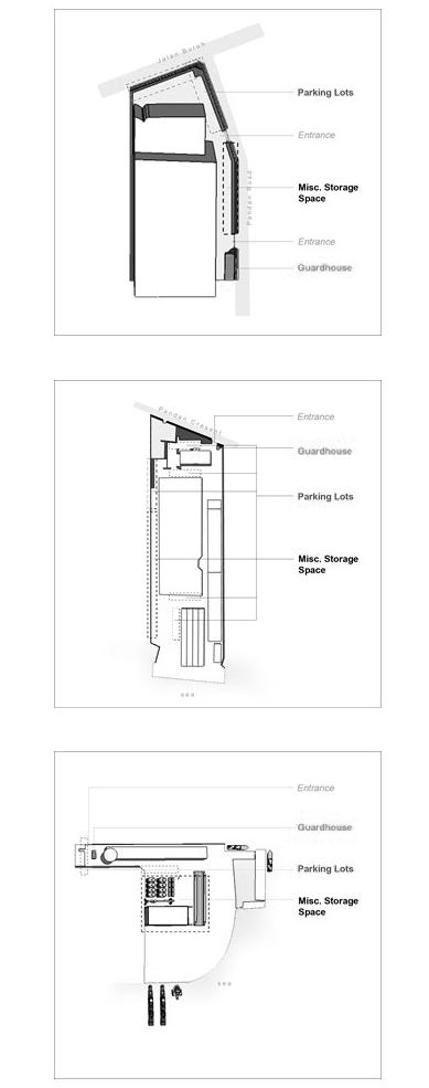
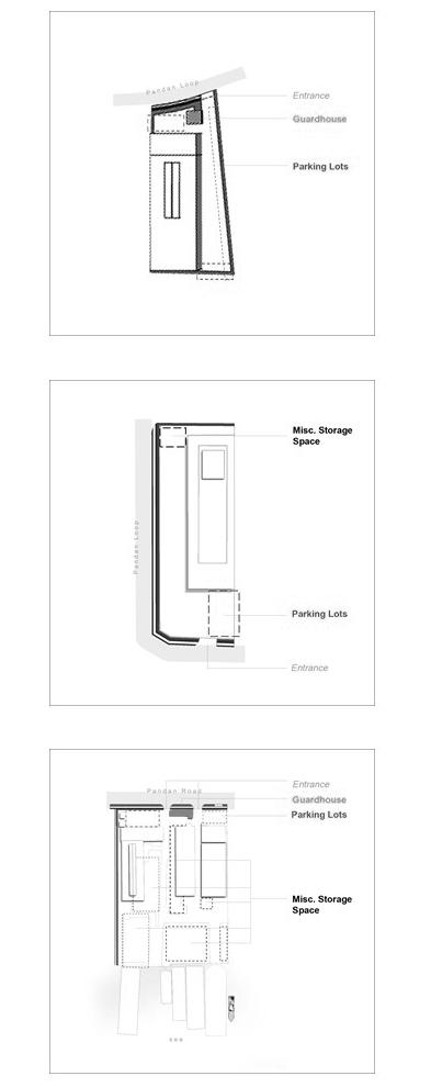
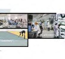
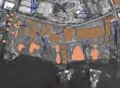
INDUSTRIAL TYPOLOGY
Studying 6 types of basic industrial typology in the industrial distritct, in terms of guard houses, building plot, orientation, vehicular and pedestrian circulation, storage spaces, green spaces and parking lots
FUNCTIONS OF INDUSTRIAL SPACES
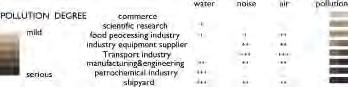
POLLUTION
Commerce
Scientific Research
Food Processing Industry
Industry Equipment Supplier
Transport Industry
Manufacturing Engineering
Petrochemical Industry
Shipyard
WaTer poLLuTion
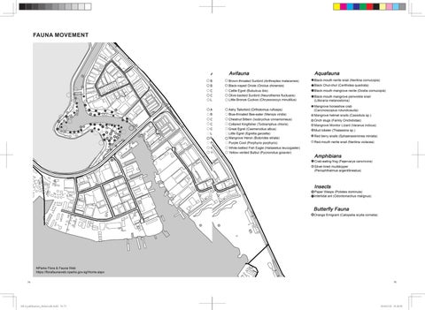
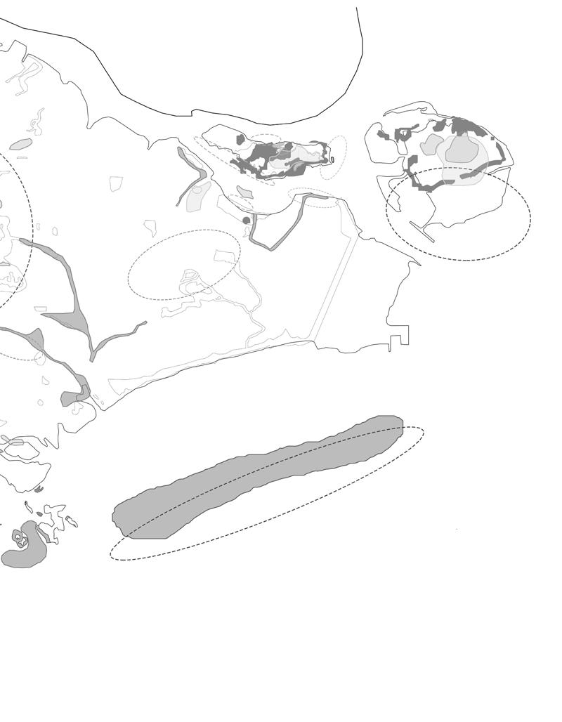
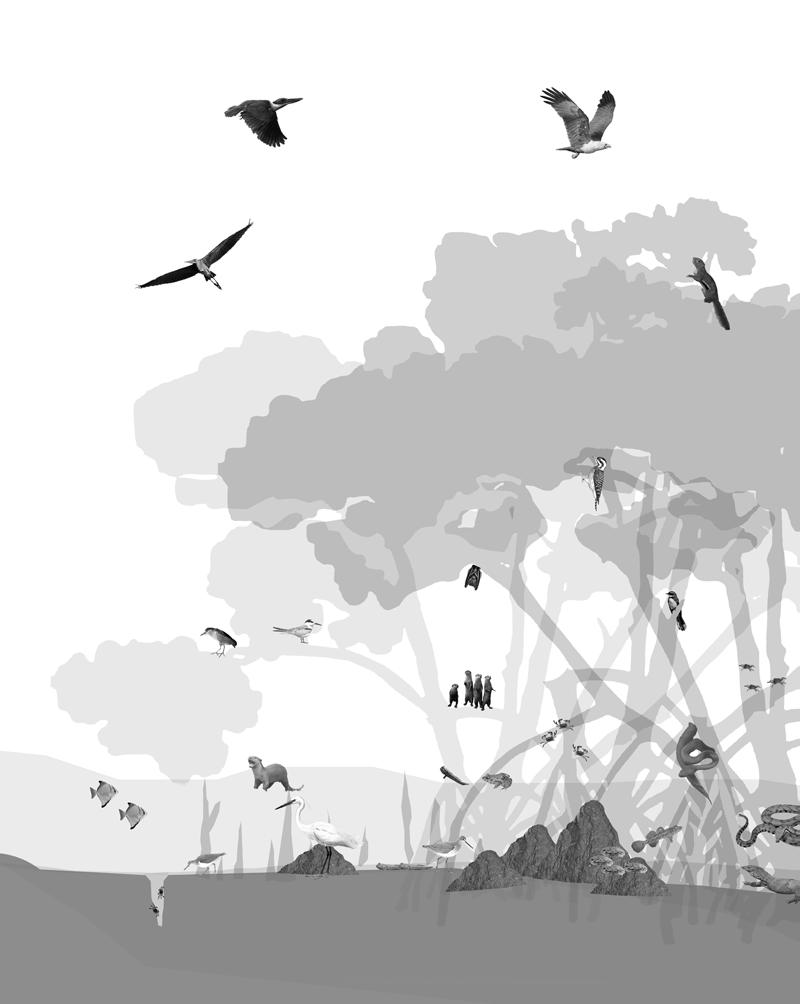
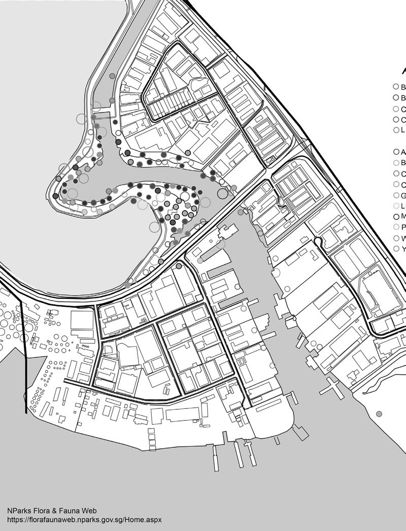
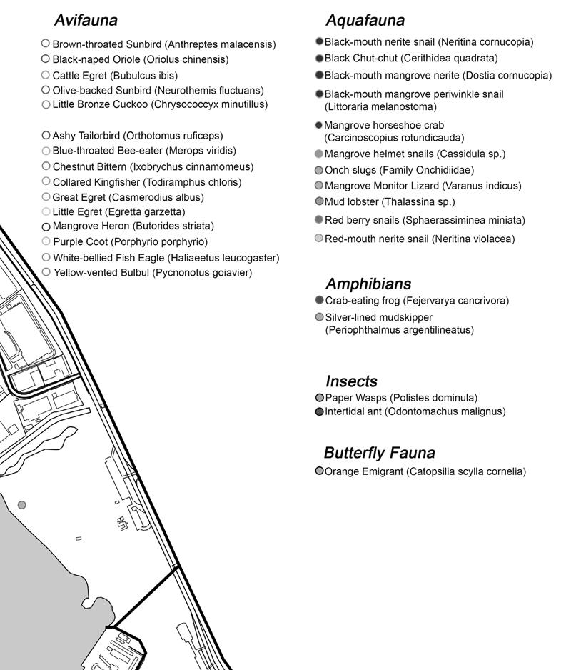
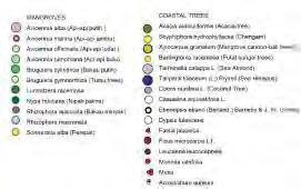
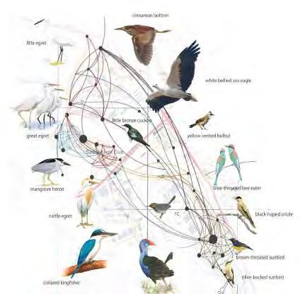
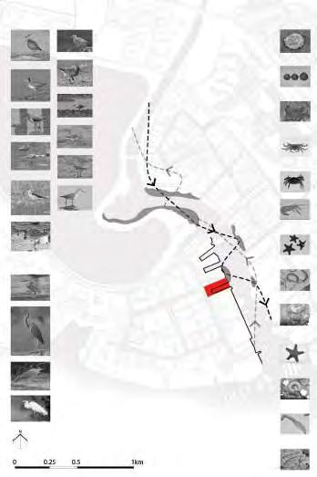
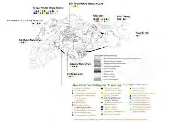
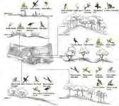
FAUNA MAP
Johor straits
Johor
Pasir Ris Park
Pulau Tekong
Pulau Ubin
Singapore Straits
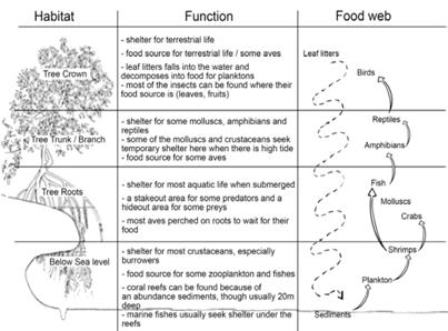
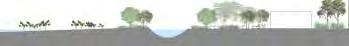
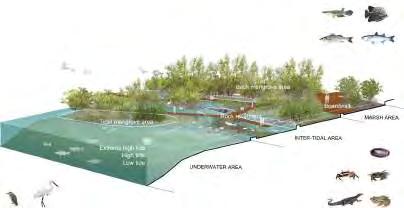
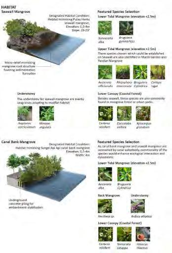
MANGROVE HABITAT
Collared kingfisher
Commonly found throughout Singapore, they feed on fishes, crustaceans, insect, mollusc and small snakes. They nests in holes excavated in large termite on the ground or in tree.
Purple heron
Uncommon resident that can be found in well-vegetated freshwater wetlands, marshes and lakes,ocassionally in coastal wetlands and mangroves
Brahminy kite
Found at the coasts and harbours and eats its food on the wing. Does not prefer fish but it is able to lunge into the waters and takes up heavier fish. Feeds on rubbish from the sea,frogs, rats, shellfish and fish
Sunda woodpecker
Common in the gardens, parks, scrubland & urban areas, it uses its sharp bill and tongue to probe into the bark looking for insects grubs
Pied fantail
Common resident breeder can be found in mangroves, parks and gardens.
Feeds on insects mainly under leaf covers and is known as a small active bird.
Lesser dog-faced fruit bat
Can be found on mangrove trees like Sonneratia & elsewhere. Feed on nectar & pollen from flowers. They can hide their small body & stands motionless hanging to avoid from any predators.
Asian small-clawed otter
The smallest of the otters that can be found commonly in the mangroves, feeding on fish, shellfish and crustaceans
Black-crowned night heron
Uncommon resident, the stocky birds live in fresh, salt and brackish wetlands and can be mostly seen at dawn or dusk
Smooth-coated otter
Usually in pairs or in groups, commonly found in the mangroves, mudflats and coastal areas and feeds on mainly fish, turtles, crustaceans, clams & snails
Silver moony
Found in large no.in open waters, under jetties and bay
Paddler crab
Found near the mangroves & freshwater streams, usually floating on flotsam or seaweed
Little terns
Common resident breeder or a winter visitor tha hovers over its prey and plunge-dive to catch it
Dusky-grilled mudskipper
Smaller than Giant mudskipper it can be commonly found near mangroves, seawalls & rocky shores
Little egret
Very common ard Sg & occurs in small flocks.
Dashed over the water spreading its wings to lure fishes with the shadow Common sandpiper
Tends to be solitary, migratory bird that can be seen on the ground or in shallow water, feeding in insects and invertebrates
Common statistics of a typical mangrove Matching fauna to habitat
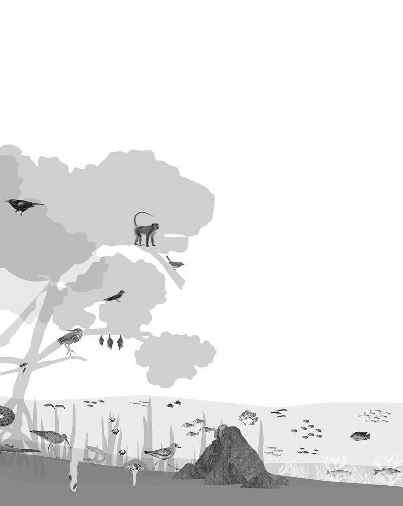
Plantain squirrel
Commonly spotted in trees near the shores, forests,parks & urban areas. Feeds on fruits, seeds, leaves, barks and insects, they lives like a bird, leaping from branches effortlessly
Copper-throated sunbird
Common in the mangrove forests around Singapore, the sunbird loved leaf-bathing, it is an uncommon resident breeder
Dog-faced water snake
Commonly found in mangroves but stays well hidden during the day, does not tolerate freshwater. Feeds on mainly fishes and hunts at night
Common redshank
Found at mudflats, prawn pods and mangroves. Feeds on polychaetes, crabs & molluscs
Purple climber crab Common on rocky shore, usually well hidden in crevices. Feeds on mainly algae and other scave geuos edible they find
Malayan water monitor
Found in forests,mangrovesand beaches. Feeds on small animal and fishes, crabs, frogs eggs, nestling birds & other reptiles
Stripe-nosed halfbeak
on water surface and swims in groups, feeds on insects
Mangrove cardinalfish
Feeds on small fishes, crabs,prawns and others, and mostly active at night
Long-tailed macaque
Native to Singapore, their original habitat is the mangroves, now widely spotted on the wild shores. Omnivorous, and also feeds on natural fruits and foods,which helps to regenerate and ensure a balance in it
Ashy tailorbird
Common resident breeder that can be found in the mangroves or coastal shrub.& hunts for insects in the undergrowth of the mangrove
Pacific swallow
Common resident breeder, feeds on offlying ants, flies, beetles & termites. They appear in flocks and often perched on exposed branches while preying
Striated heron
Feeds on insects, crabs, molluscs, fish, frogs, reptiles, birds and small mammals. its nests are in trees near water. They usually can be found standing still by the edge of water waiting for its prey
Longed tongue nectar bat
Can be found on mangrove trees like Sonneratia & elsewhere, they feed on nectar & pollen from flowers. They can hide their small body and stands motionless hanging to avoid from any predators.
Tilapia
Priapus fish
Found on the surface of water that feeds on zooplankton
Spotted scat
Found in muddy & seagrass area near mangroves. It tolerates freshwater.
Green chromide
Indigenuos fish found in mangrove lined estuaries
Tropical silverside
Mullet
Can survive in very low salt content.
Feeds on inverebrates,
Locally introduced species, widespread in rural urban streams, canals, drains,& reservoirs,in freshwater and brackish water
Tamban A type of herring travels in large school and feeds in zooplankton
Sea bass
Feeds on fish, crustaceans, mollusks, & invertebrates found in shallower regions of warm seas
FAUNA HABITATS
Fauna Species
High Flying Birds
Brahimy kite
Little egret
Grey Heron
House swift
Oriental Hornbill
Straited heron
Low Flying BIrds
Common kingfisher
Black-naped oriole
Pacific swallow
Asian glossy starling
Ashy tailorbird
Small minivet
Greater rackettailed drongo
Common emerald dove
Yellow-vented bulbul
White-breasted waterhen
Long tail parakeet
Yellow-breasted sunbird
Oriental magpie-robin
Land Animals
Smooth-coated otter
Plantain squirrel
Long-tailed macaque
Sea Animals
Malayan water monitor
Crab eating frog
Orange fiddle
Mangrove tree-dwelling crab
Singapore vinegar crab
Mudskippers
Mangrove flathead gudgeon
Mangrove cardinal
Seabass
Shore pit viper
Species Living range
Areca catechu 20m
Foliage suitable favourable for nesting. Commonly found by the road
Elaeis guineensis (Oil palm) 20m
Insect polinated. Usually planted along roadside and parks.
Cocus nucifera (Coconut tree) 30m
Food source for pollinators. Commonly found by the roadside and coastal area
Casuarina equisetifolia 30-40m
Fruits are eaten by some but mostly a nesting tree for soaring birds. Found coastal and land
Rhizophora sp (Bakau) 15m Exposed roots are used for perching for numerous animals.
Bruguiera cylindrica 20m
Flowers are insect-pollinated. Food source for butterflies and moths. Nesting for fauna.
Ficus microcarpa 30m Insect pollinated. Bird attracting. Its fruit is eaten by birds, monkey, squirrel.
Fragrea fragrans (Tembusu) 30-55m
Bird attracting. Fruits & seeds are dispersed by bats and birds.Heritage tree.
Alstonia angustiloba (Pulai tree) 40m Pagola shaped crown is favorable for roosting and nesting. Heritage tree.
Musa cultivar (Banana tree) 20m Ornamental foliage. Fruit attracts animals. Commonly planted in private gardens. Mangifera indica (Mango tree) 30-35m Bird attracting plant. Food source for caterpillars.
Dillenia suffruticosa (Simpoh ayer)
2-10m Native tree commonly found by the roadside. Bird attracting.
Macarang bancana 23m
Ants inhabits its hollow twigs. Fruit attracts animals. Nesting for some.
Ornamental foliage. Foliage offers refuge for animals.Heritage tree.
Artocarpus heterophyllus (Jackfruit) 16-30m Fruit attracts birds and mammals.
Fauna Species
High Flying Birds
Brahimy kite
Little egret
Grey Heron
House swift
Oriental Hornbill
Straited heron
Low Flying BIrds
Common kingfisher
Black-naped oriole
Pacific swallow
Asian glossy starling
Ashy tailorbird
Small minivet
Greater rackettailed drongo
Common emerald dove
Yellow-vented bulbul
White-breasted waterhen
Long tail parakeet
Yellow-breasted sunbird
Oriental magpie-robin
Land Animals
Smooth-coated otter
Plantain squirrel
Long-tailed macaque
Sea Animals
Malayan water monitor
Crab eating frog
Orange fiddle
Mangrove tree-dwelling crab
Singapore vinegar crab
Mudskippers
Mangrove flathead gudgeon
Mangrove cardinal
Seabass
Shore pit viper
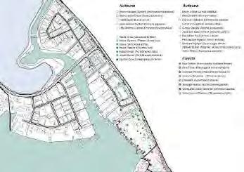
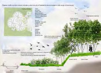
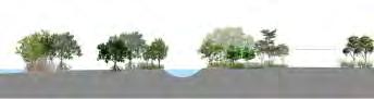
Coastal Mangrove
Tidal Mangrove
Mudflats
FAUNA MOVEMENT
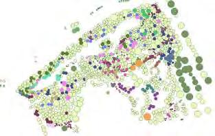
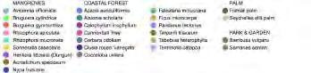
FLORAL SPECIES AND HABITAT
MANGROVE HABITAT CONDITION IN SINGAPORE
VEGETATION DENSITY IN SUNGEI PANDAN
Sungei Pandan Mangrove Habitat (Unmamaged man grove & coastal habitat)
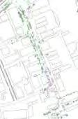
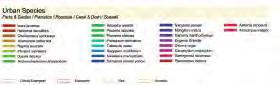
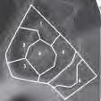
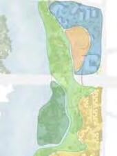
SPECIES MAP - ZOOM IN 1: PANDAN MANGROVE
Area A
LEGEND
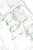
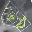
SPECIES MAP - ZOOM IN 2: URBAN HABITAT
Barringtonia racemosa, Pouteria obovata which coastal forest species are commonly identified on Pandan Road.
Rhizophora and back mangroves are establishing on seawall and canal mouth.Alstonia angustiloba on roadside.
Coastal forest species (Calophyllum inophyllum, Alstonia angustiloba, Talipariti tiliaceum, Terminalia catappa) are used for urban plantation in this area.
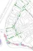
SPECIES MAP - ZOOM IN 3: MARSH GARDEN, WEST COAST PARK
Area C
Barringtonia racemosa Pouteria obovata
Seawall Vegetation
LEGEND
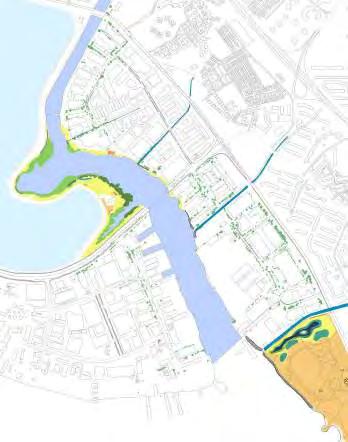
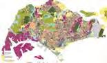
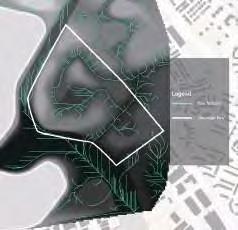
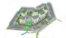
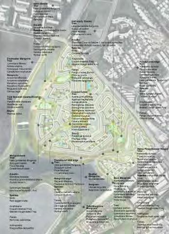
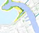
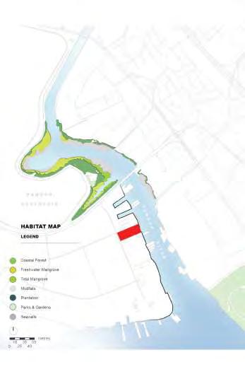
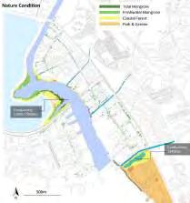
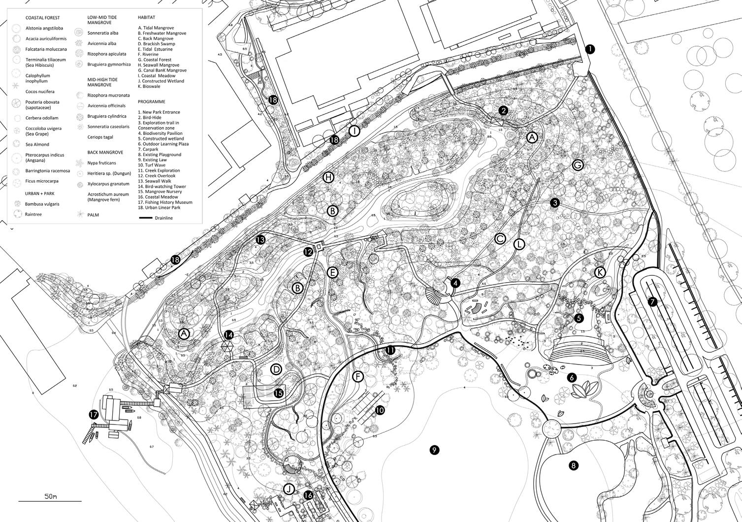
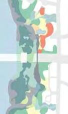
HABITAT MAP OF SUNGEI PANDAN
Tidal Mangrove Freshwater Mangrove
Brackish Swamp
Brackish Pond Coastal Forest Seawall
Tidal River Riverine
Drainage Canal
Park & Garden Plantation Roadside
HABITAT MAP OF SUNGEI PANDAN
Tidal Mangrove
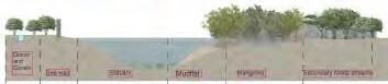
Often identified at tidal waterfront, impacted by salty seawater flow and inundations
[Pandan habitat A]
River River habitats are freshwater or tidal streams that undergoes a state of continuous physical changes of flowing water.
[Sungei Pandan river habitat]
Roadside
Trees are foundamental to roadside habitat. Epiphytes establishing on the tree truncks and shrubs and climbers further diversify this urban ecosystem.
[habitat B]
Freshwater Mangrove
Featuring mid-high tide mangroves and back mangrove species, less impacted by salt water intrusion
[Pandan habitat A, C]
Riverine
Riverine is the habitat along-side the river. Riverline in forest area are well-shaded by the canopy, and with waterway providing colling environment
[habitat A]
Canaland Drainage
Canals and drainages are concrete or gravel structures for rapid conveyance of urban surface runoff.
Waterbody isolated from its surroundings.
[habitat B]
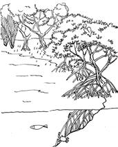
Coastal Forest
Seaside terrestrial habitat, with species tolerant of harsh coastal condition: salt spray, strong, seawater intrusion, and full sun.
[Pandan habitat A, C]
Seawall
Seawall are engineering structures for protection from wave-erosion. However, they are also supportive for spontaneous growth intertidal marine organisms.
[habitat A, C]
Park & Garden
Tamed landscape under management. Not only the vegetations are under human intervention, but there are also facilities and manmade structures integrated into this habitat.
[habitat A, C]
Brackish Swamp Water pond with static water level, has more salinity than freshwater, but not as much as seawater.
[Pandan habitat C]
Rocky Shore
A rocky shore is an intertidal area that consists of solid rocks. It is often a biologically rich environment and can include many different microhabitats type.
Plantation
Plantation are usually monocultured vegetation that serves as alternative food source for fauna.
[habitat A, B]
SPECIES ADAPTABILITY AND FAUNA ASSOCIATION
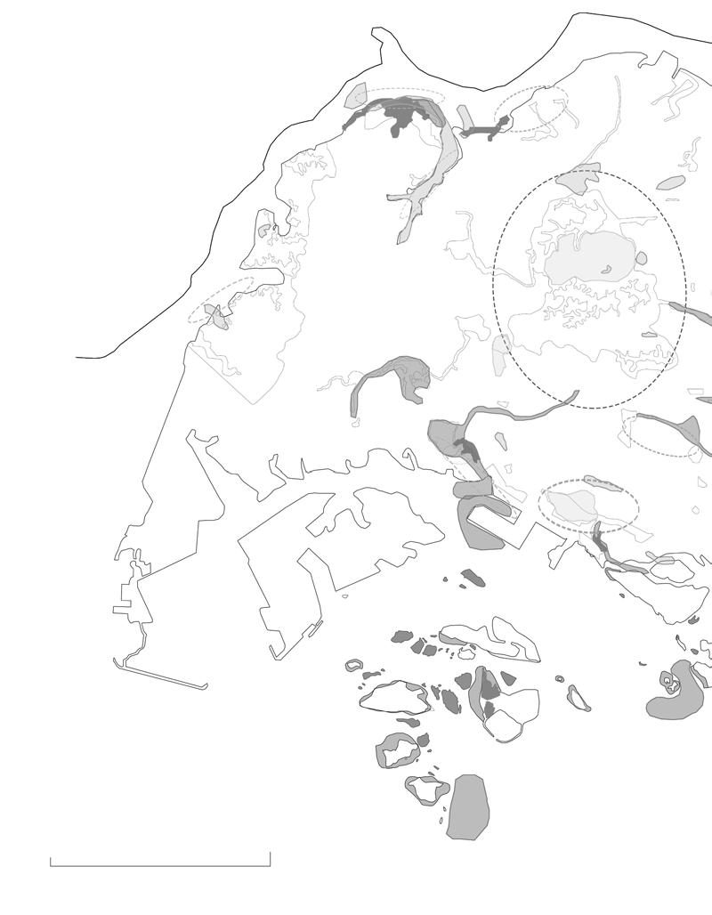
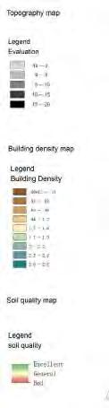
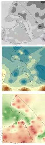
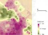
SOIL POLLUTION
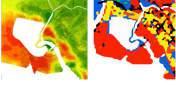
soiL poLLuTion anaLysis based on poLLuTion degree map
HARDSCAPE AND SOFTSCAPE ANALYSIS
hardsCape and sofTsCape map
Industrial
AND SOFTSCAPE ANALYSIS
Grass on steep slope
Bare packed soil
Grass on mild slope
Mixed grasses and trees
Relatively natural vegetation
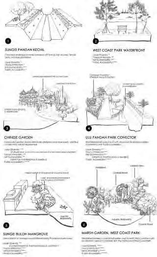
PROPOSALS
THE SYMBIOSIS OF COASTAL LANDSCAPE SUCCESSION IN A HIGH DENSE NEIGHBOURHOOD
Kuan Wai Tuck Victor P96
GROWING TOGETHERSEEDING COASTAL HABITAT INTO HIGH DENSE DEVELOPMENT AREA
Wang Zhe P108
COASTAL LANDSCAPE AS STORMWATER MANAGEMENT INFRASTRUCTURE
Kong Lingchang P120
THOUGHTFUL PLACEMENT OF GREEN SPACE FOR RESILIENT LANDSCAPE
Xu Yuexin P132
RECONNECTING THE INTERACTION BETWEEN THE WILDLIFE AND HUMAN ALONG THE COASTAL LANDSCAPE
Lam Si Yun Swan P144
IMROVING AQUATIC HABITAT
Liu Xiaolei P154
MORPHING FAUNA BARIER IN COASTAL AND URBAN LANDSCAPE
Nur Azilla Nazli P164
RETROFITTING INDUSTRIAL LANDSCAPE INTO EVERYDAY LIVES
Yong Keng - Whye, Raymond P174
M ITIGATING MICROCLIMATE IN THE INDUSTRIAL AREA
Gao Chenchen P190
NEW INDUSTRIAL LANDSCAPE AS A LIVING MACHINE
Wang Hanfeng P200
NATURING URBAN:
RESOLVE THE TENSION BETWEEN URBAN AND NATURE HABITATS, LEVERAGING ON NATIVE HABITAT STRUCTURES IN SUNGEI PANDAN
Fan Lei Helen P216
GENERATE AN INTEGRATED WATERFRONT BASED ON BROWN EARTHWORK
Xu Linxin P232
RESHAPING COASTAL EDGE LANDSCAPE IN A HIGH-DENSE TROPICAL CITY
Yao Haomu P244
THE SYMBIOSIS OF COASTAL LANDSCAPE SUCCESSION IN A HIGH DENSE NEIGHBOURHOOD
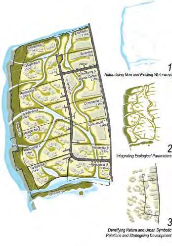
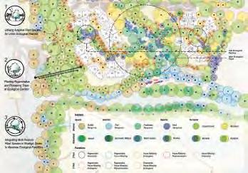
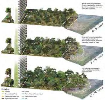
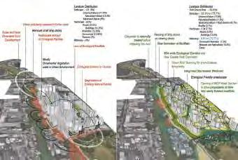
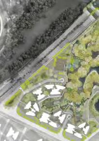
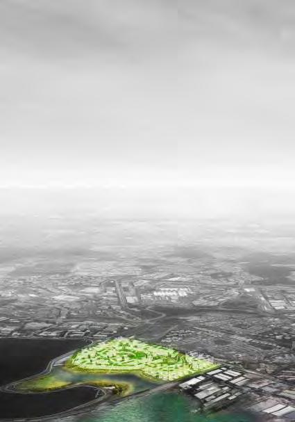
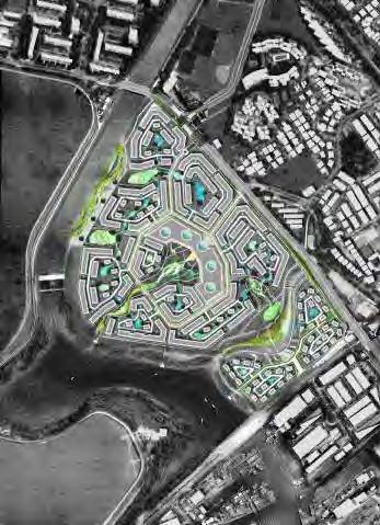
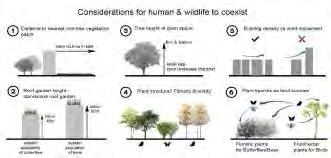
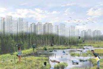
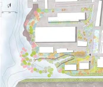
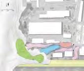
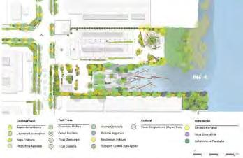
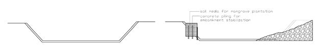
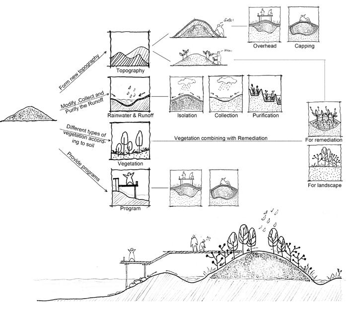
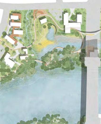
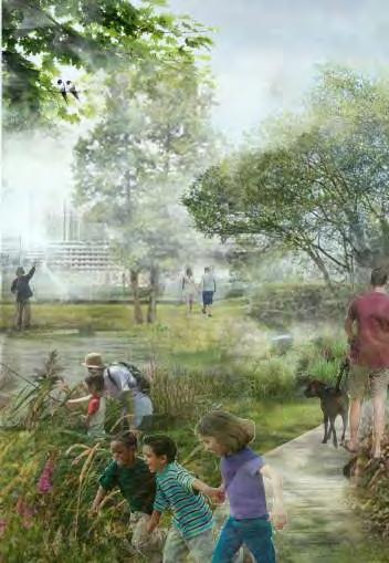
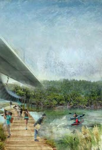
Sungei Pandan, a 2.8km river with fragments of mangrove fringes – one of the highest mangrove richness in Singapore – is surrounded by industrial factories that pose high environmental disturbance, limiting ecological linkage between Sungei Pandan Mangroves and West Coast Park. Demarcated as a future private high-dense residential waterfront development placing the current industrial site, the phases of construction, new land-use implementation and proposed programs are three significant factors that will greatly affect the conditions of the major green cores. Unconventional development with highly manicured urban greenery often swiftly constructed results in fragmentation of habitats and biodiversity loss due to poor development strategy to integrate existing habitats and drastic timescale difference which disallowing nature to “grow” with human intervention.
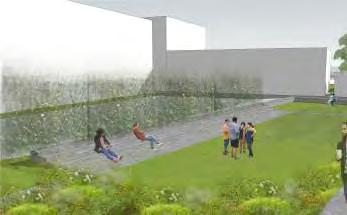
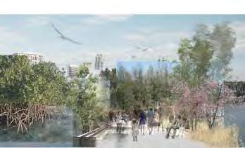
Ecociety Living, located at the waterfront and West Coast Park’s Marsh Garden serves as an alternative prototype for coastal ecological development to achieve a symbiotic relationship of coastal succession within a high-dense residential neighbourhood.
The design construction for both human intervention and provided ecological zones with planting strategies that multiplies social and ecological values are developed in phases to allow adaptation of existing ecology and accelerates ecological succession within the urban environment. Learning from the existing natural habitat in Sungei Pandan, constructing of new waterways and naturalising existing canals are strategies to tackle flooding concerns while introducing riparian conditions inland which integrates aquatic stratification to existing landscape densifying its ecological functionality. The project incorporates necessary environmental parameters which blend untamed vegetation with the naturalised urban landscape to strengthen biodiversity connectivity and provide ecological patches within every precinct. To create a biophilic experience for residents, communal programs, facilities and building design are oriented to maximise human and nature interaction, increasing residents to knowledge and appreciation in living within proximity with wildlife.
Ecociety Living aims to redefine future approaches in coastal development to rehabilitate coastal habitats within the urban environment and eradicate bio-phobic misconceptions while ensuring continual development growth.
Kuan Wai Tuck Victor
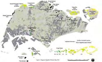
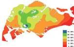
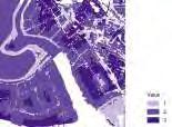
SINGAPORE VEGETATION EVALUATION MAP
VegeTaTion size and mangroVe riChness
Habitat Types in Modern Singapore, 2011
Source : The vegetation of Singapore - An updated map Yee Alex Thiam Koon (2011) National Parks Singapore
Coral reefs of Southern Island, Singapore
Loh et al. (2006).
Marine Science Institute
Tropical
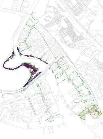
ECOLOGICAL CONDITIONS OF SUNGEI PANDAN
eCoLogiCaL neTWork of sungei pandan
Source: Dr Abdul Rahim HAMID National University of Singapore
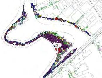
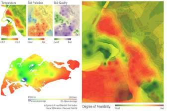
ENVIRONMENTAL CONDITIONS OF SUNGEI PANDAN
enVironmenTaL CirCumsTanCes of sungei pandan
Source: Gao Chen Chen National University of Singapore
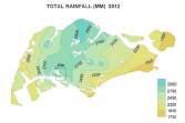
annuaL rainfaLL of singapore
Source: National Environmental Agency, 2011
ENVIRONMENTAL CONDITIONS OF SUNGEI PANDAN
VegeTaTion densiTy and zone eVauLaTion unTamed and Tamed VegeTaTion
Source: Estuarine Mangrove Squeeze in the Mekong Delta, Vietnam (2017) Son H.T., Ye Q. and Stive M.J.F.
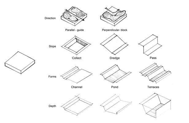
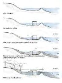
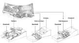
CONSTRUCTION PHASES ANALYSIS
naTuraLising of CanaL in bishan park
hdb ConsTruCTion proCess
Source: PUB, Singapore’s National Water Agency, National Parks Board, President Design Award, Ramboll Dreiseitl, Housing Development Board
Time-lapse: Transformation of Bishan Park to River Plains by Brice Li
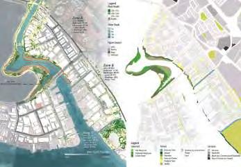
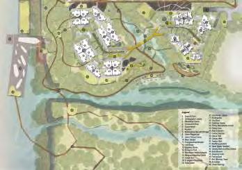
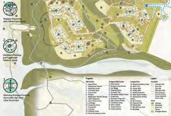
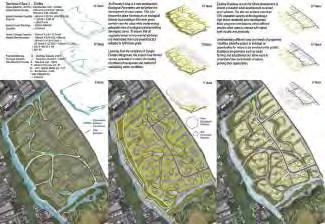
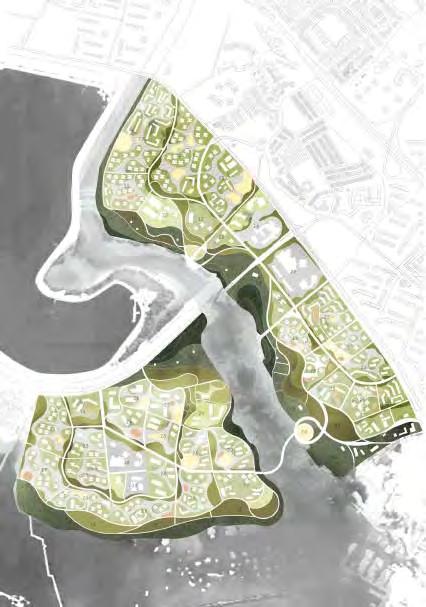
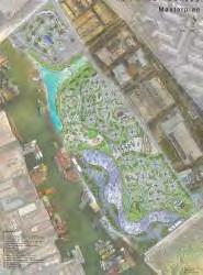
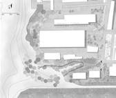
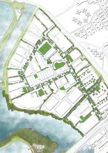
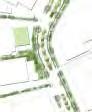
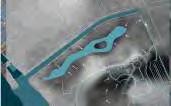
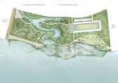
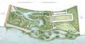
PROPOSED PRECINCT MASTERPLAN
50 m N
eCoCieTy LiVing residenTiaL esTaTe
MASTERPLAN OF ECOCIETY LIVING NEIGHBOURHOOD SCALE
0.5 km N
ConsTruCTion phases of design
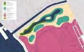
eCoCieTy LiVing residenTiaL esTaTe
ConVenTionaL
MASTERPLAN OF ECOCIETY LIVING NEIGHBOURHOOD SCALE
proposed sTraTegies
eCoCieTy LiVing residenTiaL esTaTe Land use pLanning
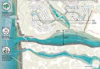
WATER FLOW AND PROCESS SYSTEM
Source : Investigation of Elevation - Vegetation Processes through High Precision Mapping of Nandai Mangrove Leong Chin Rick (2011)
WaTer managemenT sTraTegies
WaTer CanaL aLTeraTion
HABITAT AND FUNCTION MAP
NATURE AND HUMAN SYMBIOTIC RELATION PLANNING
PLANTING
STRATEGIES
phases of pLanTing impLemenTaTion
eCoLogiCaL parameTers
pLanning TaCTiCs
50 m N
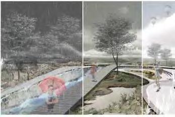
WATER AS SYMBIOTIC TOOL
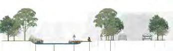
sTormWaTer WeTLand perspeCTiVe
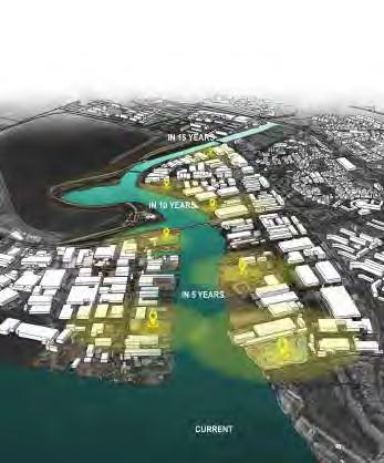
CONSTRUCTION PHASES OF ECOCIETY LIVING NEIGHBOURHOOD
VISION OF SUNGEI PANDAN IN 2032 (CAUSE AND EFFECT)
WaTer
ConVenTionaL masTerpLan
eCoCieTy LiVing masTerpLan
GROWING TOGETHER: SEEDING COASTAL HABITAT INTO HIGH DENSE DEVELOPMENT AREA
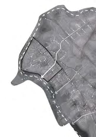
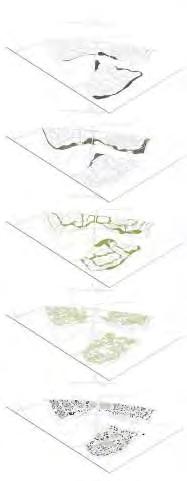
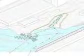
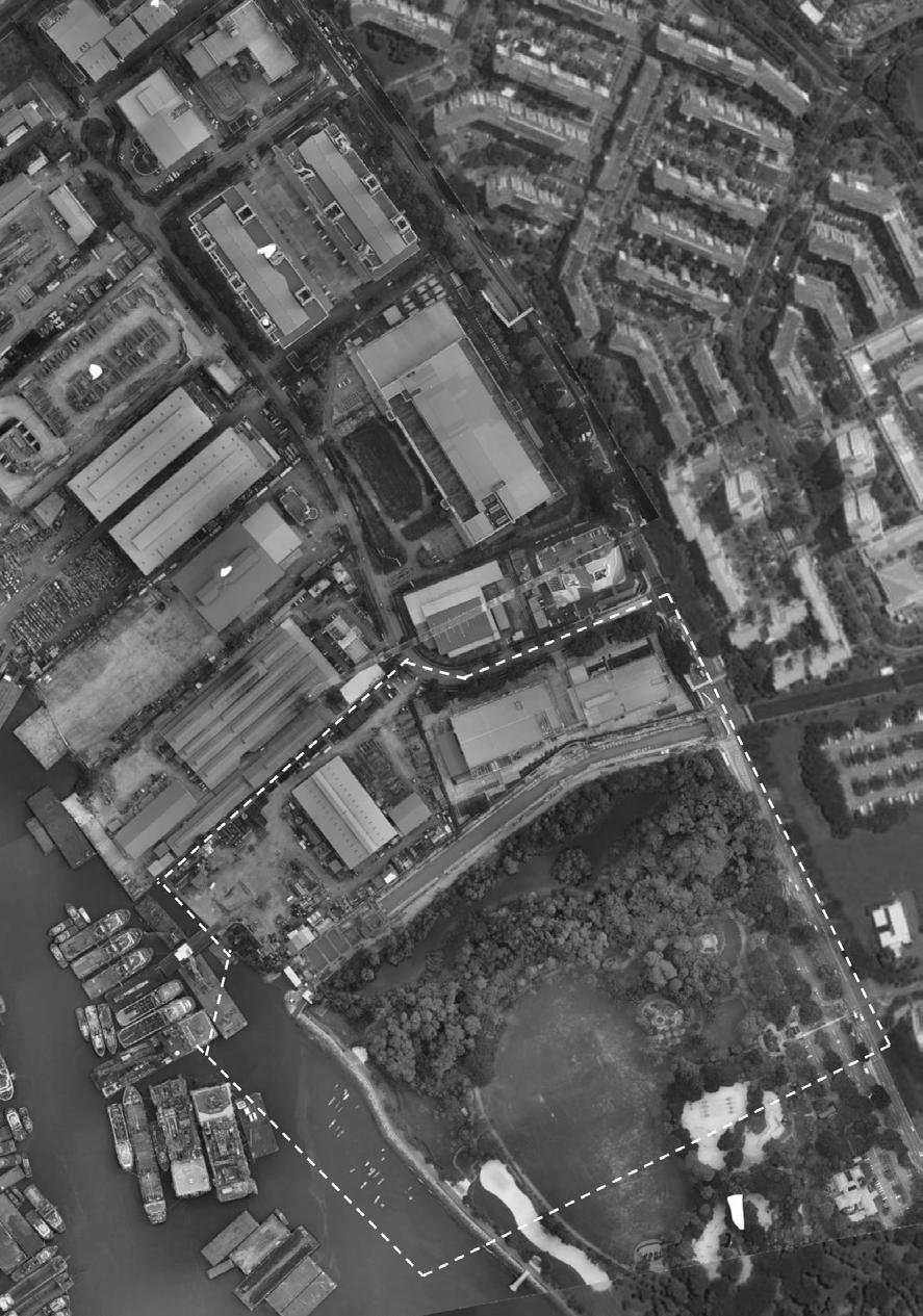
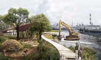
Mangroves, the forgotten fortune, are disappearing rapidly as the urban jungle encroaches on its existence and threatens its survival. The narrow slice of Pandan mangroves lies at the edge of Jalan Buroh Bridge, which has insufficient space to develop strong biodiversity and resilience due to the coexisting pressure from urban sprawl. Growing together tries to find a new relationship between coastal habitat and urban area under the new development. This project selects the highly critical area, which is near the bridge and located in the Southern bank of Panda River, as the first area for intervention.
On one hand, this project attempts to expand Sungei Pandan mangrove to strengthen it, enabling it to become a key refuge for the ecosystem. The first step is to create a suitable environment for new coastal habitat by preparing the soil, topology, and hydrology. Through creating unique landform, topology and flexible growing space, the new habitat will get a safe and stable environment to flourish. At the same time, with the strategic planting scheme, the site provides a unique habitat for back mangrove conservation while utilising urban infrastructure as a new habitat to connect current mangrove habitat and the seeding habitat.
On the other hand, this project tries to integrate ‘seed habitats’ - ecological succession patches - with high dense residential to ease the adaptation with urban intervention. Unique terrain is created as a transition zone to reduce the impact of urban for coastal habitat by using the 2.5 meters height difference from inland to tidal zone. Meanwhile, physical and intangible connections are created between seeding habitat and residential area by integrating human activities and coastal habitat with mixed land use, connecting inland drainage system, sea and designing plants for fauna flow.
In 25-30 years, the first ‘seed’ will grow up with a stable system where following coastal habitat successions will grow similarly like the first succession along with the urban developing. Finally, the strong ecosystem of Sungei Pandan will be established.
EXISTING CONDITION
The soil, hydrology, topography and tidal change condition is all processed.
STRATEGY 1 - CreaTe suiTabLe enVironmenT for CosTaL habiTaT by preparing The soiL, TopoLogy, and hydroLogy.
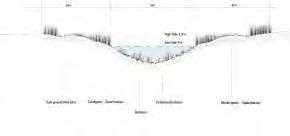
TACTIC01- CREATING SPECIAL LANDFORM
Waterflow-Ebbing
Waterflow-Rising
WATERFLOW-EBBING
WATERFLOW-RISINGPOTENTIAL EXPANDING
Initial width:15-20m
Final width(inlet):80-90m
discription:
TACTIC02- CREATING SPECIAL TOPOLOGY
TACTIC03- UTILIZING URBAN INFRASTRUCTURE AS A NEW HABITAT
Drainage system of Sungei Pandan Bridge
Potential area of Sungei Pandan Bridge
DEATIL PLAN OF BRIDGE
Multi-layer plant design on the bridge
Bio-engineering landscape under the bridge
Utilizing the drainage system well
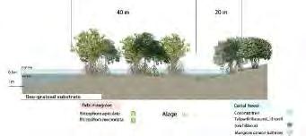
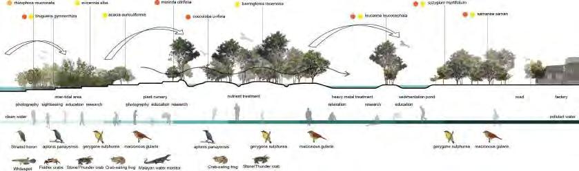
Mangrove speciesRhizophora apiculata=RA
Sonneratia alba =SA
Avicennia alba=AA
Avicennia marina=AM
Rhizophora mucronata=RM
Avicennia officinalis=AO
Avicennia rumphiana=AR
Coastal forest speciesTalipariti tiliaceum=TT
Terminalia catappa=TC
Ficus microcarpa=FM
Leucaena leucocephala=LL
Planation speciesAdinandra dumosa=AD
Cinnamomum iners=CI
Fagraea fragrans=FF
Macaranga heynei=MH
Vitex pinnata=VP
Melastoma=MM
Ficus heteropleura=FH
Dillenia suffruticosa=DS
Rhodomyrtus=RT
MASTERPLAN
1. Atrium
2.
3.
4.
5.
6.Pond
7.Platform
8.Basketball court
STRATEGY02-
FAUNA FLOW AND MIXED
TaCTiC 07 - CreaTing physiCaL and inTangibLe ConneCTion beTWeen seeding habiTaT and residenTiaL area
CONNECTION BETWEEN HUMAN ACTIVITIES AND HABITAT
Back mangrove
Fauna flow
Bird-watching tower
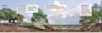
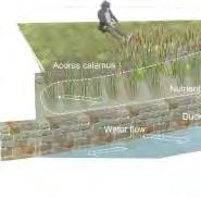
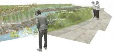
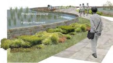
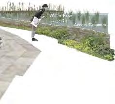
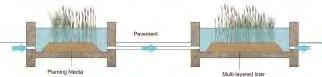
COASTAL LANDSCAPE AS STORMWATER MANAGEMENT INFRASTRUCTURE
Kong Lingchang
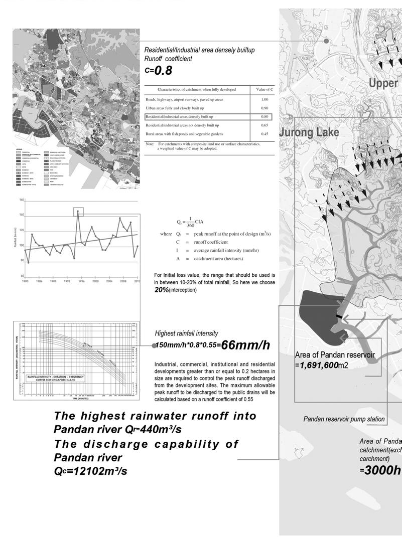
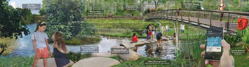
Over flooding of stormwater runoff is a common issue in highly developed urban areas where impervious surface treatment and hard engineering infrastructure for stormwater management often conflict with natural water flow. The project serves as a green-blue plan for the future residential area along the Pandan River to reorganize the problems regarding the water flow in high-dense urban context and mimicking the natural capacity of flood conveyance and storage of the land with three proposed strategies.
First, the design attempts to decentralizing stormwater management by diversifying water catchment areas based on natural water flows. Traditionally, as rainwater is unable to be absorbed by previous mediums, it will then become surface runoff which will be received by conventional drainage system on site, canalized to the main canal and finally get discharged into the sea. However, by discharging the surface runoff directly limits its potential for ecosystem services. A more ecological way is to retain the water on site and follow the natural water process which reduces the volume of surface runoff and its discharge rate, facilitating its infiltration. In this case, the design fully respects the natural landform and decentralized the catchments by following the nature catchment boundary.
Additionally, optimizing in the capacity of stormwater management by using strategic designs of the green-blue network directs water to water-centric zones. Different from conventional treatments which hide water channels, this project inserts green spaces combined with ABC water features to receive the surface run-off from buildings and pathways to form a greenblue network which is visible where people can appreciate.
Lastly, the project provides more habitat areas for coastal biodiversity through thoughtful plant selection. For a unique coastal land, the existing pump station of Pandan river separates the merged water conditions into freshwater and seawater which generates both constraints and opportunities for my design. With the unique mangroves growing on the tidal mudflat, these factors can potentially provide various species habitat which the project identifies to create additional buffer zones to mitigate the extreme flooding and provide more coastal habitat.
The project envisions Sungei Pandan to be an ecological and multifunctional urban community where the water feature could be integrated into the coastal infrastructure to effectively manage stormwater runoff.
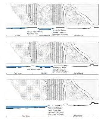
Tidal Mangrove Mangrove: Sonneratia alba Avicennia alba
Shurb:
Coastal Forest
Coastal Forest
THOUGHTFUL PLACEMENT OF GREEN SPACE FOR RESILIENT LANDSCAPE
Under the influence of global warming, sea level rise and abnormal climate threaten the coastal areas all over the world. Sea level rise causes a series of impacts on coastal habitats, species, and ecosystems. Heavy rainfall caused by abnormal climate has triggered intensive floods storm that affects the life of coastal residents.
Our site is located on the southern coast, and the previous industrial zone has 68.5% impervious surface the existing green space which covers only 18.3% of the site. According to the planning scenarios, our site will become a new residential area in the future. The rapid-growing population brings opportunities and challenges of the site development. My design starts from the green space, through reserving significant space for natural habitat and transforming the grey spaces to create additional functional green spaces. The design establishes a variety of ecological resilient, water resilient and social resilient landscape to cope with the changing climate and hydrology conditions with the rapidly growing population.
According to different site conditions and users’ needs, I use different design control to thoughtful place five kinds of green spaces. Firstly, biotic research, conservation areas, wildlife preservation and observation area are integrated to provide eco-resilient green space to supply sufficient riparian zones for existing species and potential species which increases the mangrove habitats from 9ha to 12ha.
Secondly, roadside green areas and buffer zone areas are mainly used for creating water-resilient green space to defence against the effects of sea level rise and intensive flood storm. Thirdly, recreation areas & urban development areas are used to establish activity spaces for people.
By thoughtfully placing the green spaces, the site will become more resilient to cope with issues regarding rising of sea level and abnormality of climate conditions. Also, under the impact of high population density, the site can provide more open spaces for people to have an intimate connection with nature.
Xu Yuexin
ISSUES & PLANNING SCENARIO
Sea level rise after 100 years
Heavy rain causes intensive flash storm
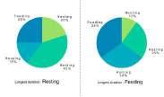
According to the future planning scenario, most of the factories will become residential areas, and 35,000 people will live in the venue. On the basis of government forecast, furture population composition is under the following two pie charts.
Reference: Source: http://www.citypopulation.de
Existing water-sensitive areas when sea level rise 3m
Existing species compared with the whole singapore’s. (Core species 1500)
Existing green space
Underutilized parcels
Existing impervious surface
Existing parks
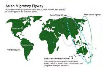
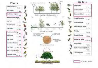
BIRD MIGRATION MAP
ConserVaTion areas
bioTiC researCh
WiLdLife preserVe
obserVaTion areas
roadside areas
buffer zone areas
semi-open spaCe open spaCe
seLeCTiVe urban deVeLopmenT areas
1.0-2.8 buiLding densiTy
roadside green area & buffer zone area seLeCTion
Vulnerable area
Important ecological corridor
Buffer zone
Conservation line
OPEN SPACE PLANNING
reCreaTion areas & urban deVeLopmenT areas seLeCTion
Mangrove
Irregular flash marsh
Regular flash marsh
Tidal flat
100 meters biological protection zone
Seawater erosion sensitive area
Mangrove seed trajectory
Conservation line
reCreaTion areas & urban deVeLopmenT areas seLeCTion
Recreation area
Residential area
STRATEGY 1. ECO RESILIENCE
reTreaTmenT of mangroVe
Most mangrove species flower and fruit regularly and the pmpagules are dispered by tide. The new mangrove habitats can improve the existing pollonation process and increase the mangrove succession rate. exisTing
Mangrove area: 9ha
STRATEGY 2. WATER RESILIENCE
50 years ago
level: 3m
Mangrove area: 10ha
100
Mangrove area: 12ha
10 m
The planning stratagy is to use different level of water management to face the intensive floods storm
Sedimentation basins and swales can provide temporary retention and a reduction of stormwater flow velocity to promote the settling of particles by gravity.
Constructure Wetlands can purify the stormwater
50 years fLood
100 years fLood
STRATEGY 3. MOTIVE FUNCTION FOR PEOPLE
Biotic rEsEarch & coNsErvatioN arEas
Protect mangroves and carry out related scientific research
·mangroVe ConserVaTion area
eCoLogiCaL ConserVaTion WeTLands
·pLanT and fLoriCuLTure area
soiL and WaTer ConserVaTion and produCTion researCh areas
beaCh ConserVaTion area
WiLDLifE prEsErvE & obsErvatioN arEas
Areas for flora and fauna to migration and live
seasonaL WaTerfoWL sanCTuary
·bird Life area
obserVaTion sTaTions
·fishing grounds
oCean fish nursery
RoaDsiDE aND buffEr zoNE arEas
Separate urban use areas and natural areas and protect natural areas from urban development
·roadWay
biCyCLe TraiLs
hiking TraiLs
naTuraL eduCaTion area
CounTry parks
REcrEatioN arEas
Recreation areas are mainly located in residential areas, buffer zone areas and observation areas which provide various places for human activities
·TenT Camping fishing area
·ouTdoor sporTs area resT area
LaWn
SELEctivE urbaN DEvELopmENt arEas
High-density urban development land includes commercial, entertainment and residential areas
residenTiaL area greenery
·CommerCiaL area greenery
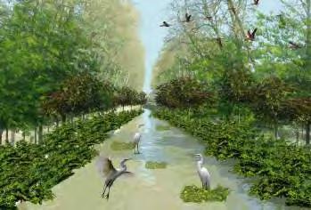
RECONNECTING THE INTERACTION BETWEEN THE WILDLIFE AND HUMAN
ALONG THE COASTAL LANDSCAPE
In a high-dense development, the strive for a balance between the living space for human and wildlife is always a challenge. Sungei Pandan has lost a large area of vegetation throughout the years due to industrialisation. The development of industrialisation has progressively destroyed the vegetation at a rate where the natural habitats could no longer replenish itself and be self-sufficient.
As there are already a substantial number of species had already been recorded to have shifted from their usual breeding grounds along the coastal landscape as well as migratory birds who have the potential to perch in Singapore in their migratory route. The design adopts two main strategies to create habitats ideal for the avifauna which encourages migratory birds to perch in Singapore and prospers the local birds’ population. Furthermore, by increasing mangrove swamps as the primary habitat, it also attracts aquafauna to inhabit and serve as the main food source for the migratory birds.
The first strategy is to restore nature element in the urban condition, such as naturalising of river canal to create riparian buffer zones which improve biodiversity and encourage avifauna to reside. The planting edge provides a green buffer for the aquatic habitat and aids in the removal of contaminants from canal water and stormwater runoff which also serves as a living filter for urban space. Furthermore, the project redirects migratory birds that pass Singapore when traveling to neighbouring countries to stopover at our coastal landscape. An opportunity of increasing species richness to the mangrove region by imprinting ideal living conditions which they can strive such as mimicking vegetation of their homeland.
The secondary strategy is to redefine boundary between human and nature. This method includes promoting nature appreciation by bringing people to be involved and interact with the avifauna through ecological activities. This creates ecologically friendly habitats in the managed built environment such as rooftop garden on residential building for avifauna to stay.
In conclusion, the project constructs ideal living conditions for the migratory birds at Sungei Pandan which creates new sightings for the locals and tourists that increases its economic value and improves the ecosystem of both wildlife and human to established in an urban environment.
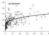
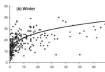
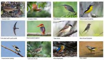
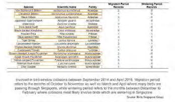
Source: Singapore Bird Group Migratory Bird Collisions in Singapore https:// singaporebirdgroup. wordpress.com/2015/05/15/ migratory-bird-collisions-insingapore/
MIGRATORY BIRDS IN SINGAPORE
The 18 speCies of birds migranTs VisiTing singapore during migraTory season
SITE CONDITION
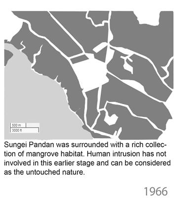
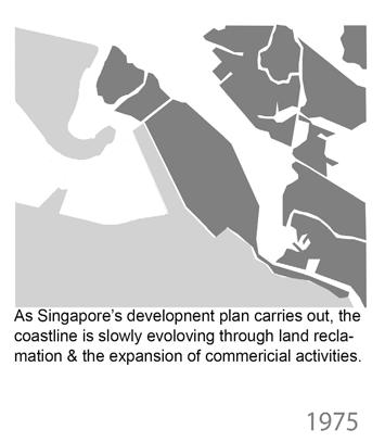
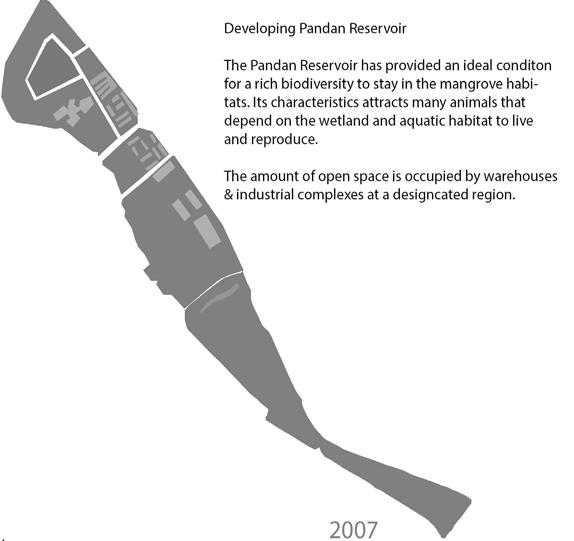
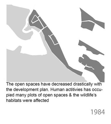
eVoLuTion of green spaCes aT sungei pandan
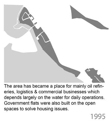
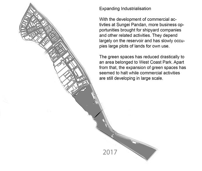
human inTrusion is noT inVoLVed, surroundedWiThriChmangroVehabiTaT The CoasTLine eVoLVed Through LandreCLamaTion&indusTriaLisaTion
human deVeLopmenT oCCupies open spaCes & WiLdLife LosT Their habiTaTs
mainLy oiL refinery, LogisTiCs businesses ThaTdepend on CoasTLine for deVeLopmenT
Site condition - Industrial zone & Neighbourhood Landscape
disTribuTion of WiLdLife aCross sungei pandan
DESIGN PHASE 1
anaLyse aVifauna’s behaViour and habiTaT requiremenTs
daybehaViour nighTbehaViour
DESIGN PHASE 2
Land funCTions Through soiL quaLiTy anaLysis
Geological Formation of the Coastal Landscape in Singapore
Soil condition is one of the contributing factors of zonation among animals and plants
The effeCT of sea LeVeL rise on siTe
Tide
STRATEGY 1
naTuraLize manmade CanaL To riparian buffer zone To inCrease biodiVersiTy
STRATEGY 2
inCLusion of naTuraL habiTaTs in human deVeLopmenT To enhanCe CoexisTenCe of WiLdLife & human
IMROVING AQUATIC HABITAT
As a result of urban development, the coastal habitat is fragmented and isolated which disrupts aquatic ecosystem process and decrease water quality. This project aims to create a new aquatic habitat to improve existing conditions. I choose the certain species – seabass as the project’s starting point -
As there is an abundance of them living here in marsh lagoon behind mangrove areas, serving as a protection for mangrove roots. But now the number of seabass is decreasing drastically. This project is located in a part of the industrial zone in Sungei Pandan area next to drains where fishes inhabit. This area has potential to be connected to the remaining mangrove zone that allows fauna to move through.
The first strategy of this project is to imitate aquatic habitat working process by providing different habitats for different growth stages of seabass that serves as food and shelter for aquatic animals. By creating a spawning area which satisfies the condition for seabass to grow with shallow water with low flowing speed and fine-grained substrate, this will allow related plant species to flourish.
The second strategy is to create fish nursery area, by planting new mangrove as shelter and food source for the juvenile fish. The design slows down the water speed by changing the water topography, planting of new mangroves and removing a part of the industrial area to let water in.
The last strategy of this project is to improve the connection between nature and urban environment by adding educational area and building a long path that extends into the mangrove for people to see the whole aquatic ecosystem process.
With the creation of new aquatic habitat, not only strengthen the ecological function, but also enhance the connection of the existing habitat, this provides a new habitat for seabass to regenerate that positively improves the conditions of all related coastal species.
Liu Xiaolei
MARINE HABITAT AND SPEICES
Tidal mangrove Riverine
Coatsal forest
Brackish water pond Road side Freshwater mangrove
Cannal&driange Seawall
HABITAT ISOLATION MAP
Tilapia
Tilapia
Tilapia
Tilapia Oyster Oyster
Mussel
Mussel
Mangrove jack Mangrove jack
Mangrove jack
Porcelain crab
Guppy
Guppy Guppy
Molly Molly Molly Molly Catfish Catfish
Catfish Stone crab Stone crab Signaller crab Orange signaller crab
crab
STRATEGY 1 CREATE SPAWNING AREA
Satisfy the condition for seabass to spawn,shadow water with low speed, finegrained substrate, related plant and species
Avicennia alba
Sonneratia alba. J. Smith
Bruguiera gymnorrhiza ( L. ) Lam .
Rhizophora apiculata Blume
Coccoloba uvifera ( L. ) L.
Terminal la catappa L.
Barringtonia racemosa (L . ) Spreng
Pandanus tectorius
Planchonella chartacea
Horsfieldia irya ( Gaertn. ) Warb.
Sindora Wallichii Benth.
Mallotus paniculatus
Manihot carthaginensis
Acaranga gigantea
Barringtonia Inophy lum
Samanea saman
Calopyllum inophyllum
Aartocaipus
STRATEGY 2: CREATE FISH NURSERY AREA
sLoW doWn The WaTer speed: Change The WaTer Topo, pLanT mangroVe, CuT doWn a parT of The indusTriaL area To LeT WaTer in
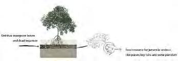
Detritus :mangrove leaves and dead organism
STRATEGY3: IMPROVE THE DRAIN
pLanT neW mangroVe as sheLTer and food sourCe of juVeniLe fish improVe The exisTing drain CondiTion by using WaTer purifiCaTion pLanT
food resource for junvenile seabass like prawn , tiny fishs and some plankton
Barringtonia inophyllum Samanea saman Calopyllum inophyllum Artocarpus
Cerbera manghas
Casuarina equisetifolia Pandanus tectorius
MORPHING FAUNA BARIER IN COASTAL AND URBAN LANDSCAPE
With the rapid growth of urban environment, spaces pose a challenge in this dense metropolis. Urbanization had undeniably caused landscape fragmentation, which in turn causes habitat isolation. This impedes movement of local fauna, as the harsh dense environment provides no room for them to live in. Further habitat isolation will cause great negative impact for our urban wildlife over time such as decreasing species population. So how does the City in a Garden resonate in an industrial landscape? This project focuses on morphing the barrier in the urban and coastal landscape, using the existing local habitat, as well as infrastructures, as part of its formula.
Landscape connectivity is the key factor for maintaining species diversity in a fragmented landscape.
The limited variety of habitats for animals isolated from one another due to developments and insufficient existing landscape where these animals rely on for movements are identified key issues this project strives to tackle.
The first strategy is to provide habitats in the dense urban areas. To achieve this, firstly, a continuous tree canopy will be maintained throughout the site to serve as stepping- stones for these fauna. Secondly, by mimicking the forest structure in suitable spaces to provide a more diversified habitat. Thirdly, strategic planting designs to accommodate the needs of different species. The second strategy is to integrate habitats in the built environment. This includes retrofitting of building structure and enhancing streetscapes to connect with nearby habitat.
“Morphing fauna barriers” is meant to provide a vision for initiating a solution to the imperative tension between biodiversity and urbanization. Through the implemented strategies and tactics, the overall site will have optimum ecologically viable spaces whilst achieving heterogeneity of species in the Southern part of Singapore. With an increase in habitat, heterogeneity leads to increase in species diversity, expanding Singapore’s biodiversity in our shared landscape.
Nur Azilla Nazli
GREEN
FRAGMENTED HABITAT
Source: Dr. Abdul Rahman
BARRIERS EVALUATION
EXISTING FAUNA
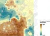
EXISTING HABITAT QUALITY
Pithcellobium
STRATEGY 1 - PROVIDE HABITAT IN URBAN DENSE AREA
STRATEGY 2
ConTinuiTy of
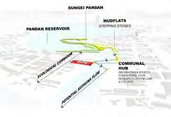
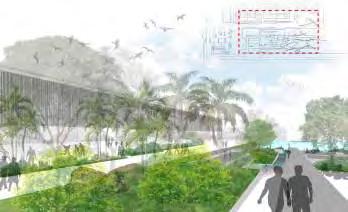
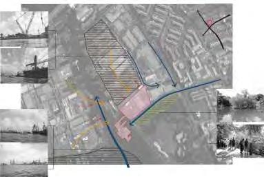
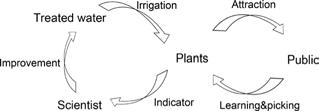
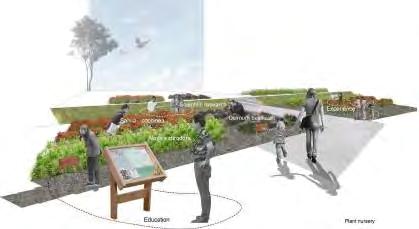
RETROFITTING INDUSTRIAL LANDSCAPE INTO EVERYDAY LIVES
Yong Keng - Whye, Raymond
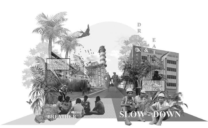
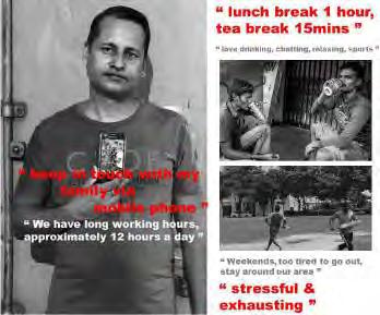
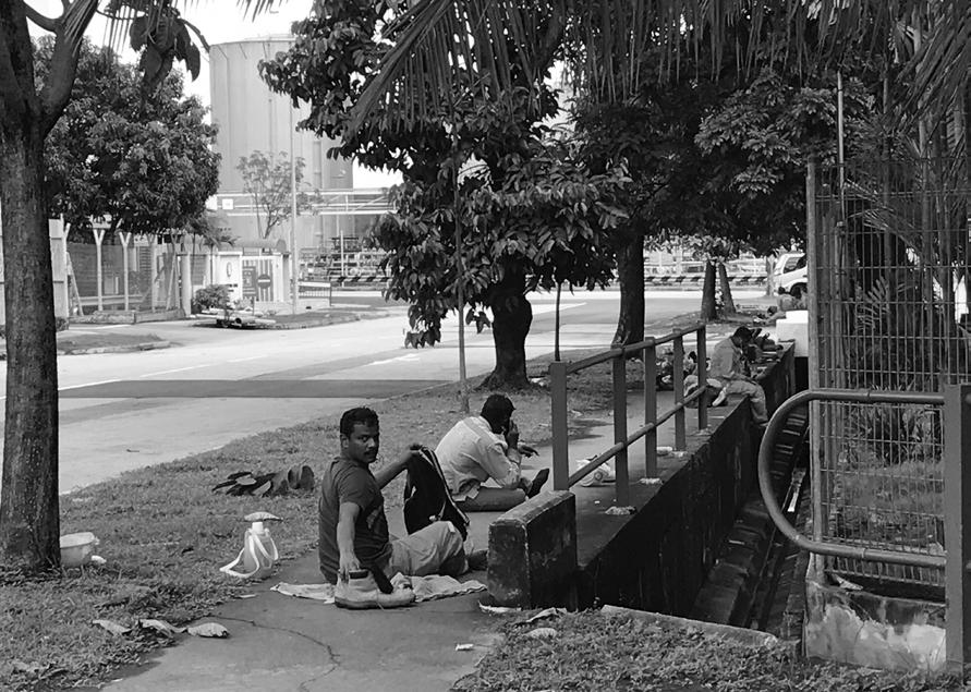
The perception of mangroves disservices was dominant in research reports. The way people perceive mangroves were mainly negative, treating them as a reservoir of disease, areas of danger and harbour of pests. The public only sees the alluring conditions of the coastal landscape but have not understood the important aspects of mangroves ecosystem services which are beneficial to our biodiversity and environment. Migrant workers being dominant in the industrial district allows the project to focus on their culture, stories, lifestyle to reform spaces which serves to educate and raise awareness of the importance of what coastal landscape while allowing them to enjoy implemented recreational activities.
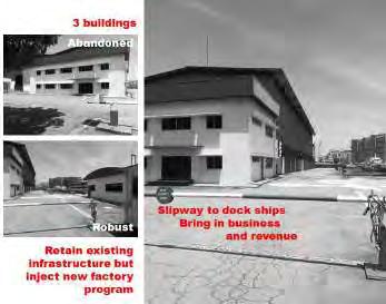
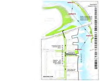
No.7 Pandan Road, currently an abandoned site is specifically selected for a variety of reasons, in terms of Nature & Human considerations through precise studies, observations & research of biodiversity, habitats especially mudflats and proximity of green spaces.
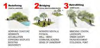
By adopting the Biophilia methodology, bridging social groups with green spaces and injecting activities helps to cultivate stronger and closer affiliations between humans and nature. Thus, elevating migrant workers working attitude, efficiency and efficacy which could be beneficial in their working prospect and the economy of the country
Redefining the coastal landscape where it allows a larger volume of sediments to be deposited, creating a larger area of mudflat, boosting feeding grounds and habitat for fauna and infauna species. Introducing patches of green spaces in the site and enhancing the existing slipway with recycled materials on site draw users closer to the coast physically and visually.
Retrofitting the longitudinal streetscape of Pandan Road, by mimicking the structure of the coastal forest, creates a green canopy framework that elevates fauna and flora habitats and their movement which will be beneficial for the biodiversity and ecology. With this implementation it helps to increase vegetation volume and create larger shaded area for workers commuting along Pandan Road.
These strategy aims to foster a greater appreciation of nature within a particular target audience and cultivate a stronger sense of ownership to the created landscape and at the same time boosting ecological and biodiversity value of the area which could leave a positive impact in the industrial environment and hopefully to the future generations.
CONTEXTUAL ANALYSIS
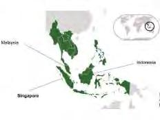
singapore, region
Understanding on a macro scale of the main stakeholders and studying the industrial land area in a regional map
HISTORICAL STUDY
reViVing ConneCTion WiTh naTure , fragmenTaTion of mangroVes & mudfLaTs
Employee Value Proptosition Work - Life - Harmony
“We take care of your health & wellness by providing flexible work arrangments, comprehensive benefits & other practical enablers”.
hisToriCaL TimeLine
diagrams iLLusTraTing The morphing of infrasTruCTure, LandsCape, aCTiViTies & LifesTyLe N
SOCIAL ISSUES OF SITE
PROSPOSED STRATEGIES
3 main sTraTegiC Layers
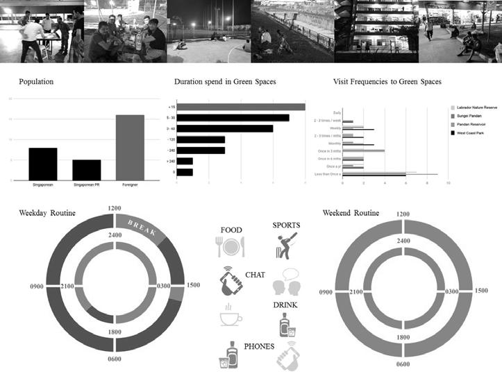
migranT Workers
migranT Workers LifesTyLe sCheduLe
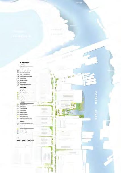
MASTERPLANNING
PLANTING STRATEGIES
masTerpLanning & pLanTing sTraTegies
ECOLOGICAL STUDY / ANALYSIS
eCoLogiCaL sTraTegy Showcasing potential avifauna flow from the coast into the site into the land (streetscape)
mudfLaTs sTudy & fauna moVemenT
ECOLOGICAL STUDY / ANALYSIS
Mudflats contribute significantly to the ecology of an area. Mudflats support a high abundance of infauna, or animals that are found within the mud. mudfLaTs sTudy & fauna moVemenT
The abundanCe of These animaLs Then supporT The many speCies of birds and oTher fauna in The area.
Many of the birds are migratory, and they feed on the animals in the mudflats to refuel.
Apart from their ecological value, mudflats are also able to prevent or reduce coastal erosion.
avifauNa
Waders
herons
iNfauNa
MACRO GREEN SPACE STUDY
proximiTy of green spaCes & aCTiViTies
PROGRAMMATIC CONFIGURATION
programs
CIRCULATION, NODES, ACCESS POINTS
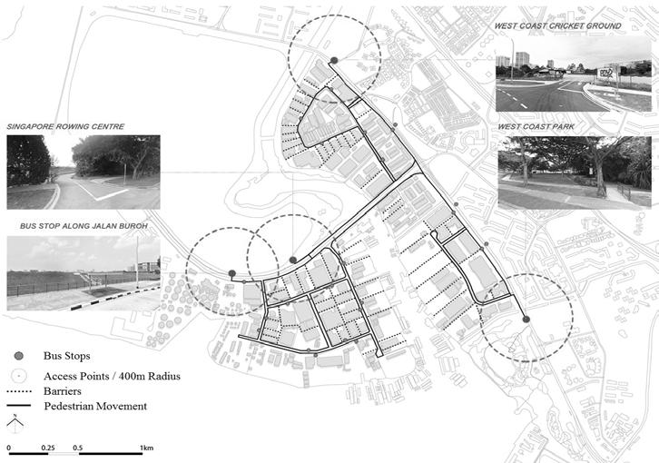
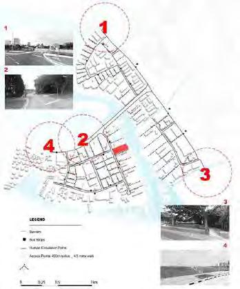
siTe is aCCessibLe by pubLiC TransporTaTion,hoWeVer,proximiTy To enTranCes of green spaCes are noTWiThinThe400mradiusWaLking disTanCe
Carpark & drop-off
indoor
CafeTeria
muLTi-purpose
sporTs haLL
gaThering & gardening
spaCe
CoasTaL foresT
sLipWay & mudfLaTs
arriVaLsquare
WesT CoasT CriCkeT ground
singapore roWing CenTre
WesT CoasT park pandan reserVior
aCCess poinTs To green spaCes & aCTiViTies
CirCuLaTion paTh
CONGREGATION HOTSPOTS / NODES STUDY
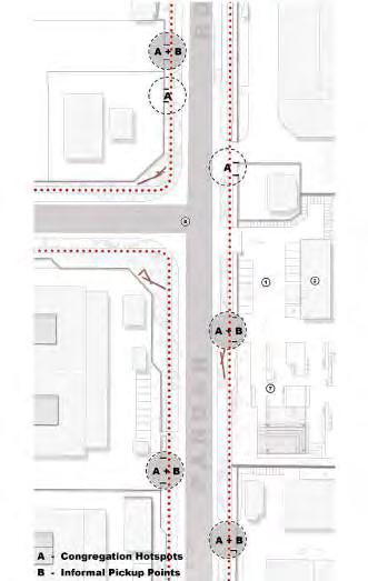
Migrant workers are being pickup by trucks to be send back to their dorm, far from their workplace a series of informaL spaCes
These are spots which represents informal pickup points and congregation spaces
STREETSCAPE STUDY & INTERVENTIONS
PHASE OF ECOLOGICAL CORRIRDOR
groWing & eVoLVing LandsCape
The design inTerVenTionof sTraTegiCaLLy pLanTing
VegeTaTion manage To improVe The green spaCes inTheindusTriaL LandsCape
When The LandsCape (VegeTaTion)
sTarTs To groW and maTure, T WouLd end up CoVering The siTeandmerges ouT aLong The sTreeTsCape, CreaTing a kind of green Canopy / umbreLLa
users Working in The indusTriaL area, CouLd noW enjoy green spaCe
WiThin Their ConVenienCe, They are W Thin The 400m radius To agreen spaCe
disTriCT VieW
pLaying a CruCiaL roLe in singapore’s eCoLogy & biodiVersiTy
VegeTaTion
WouLd be dense enough To proVide or CreaTesuiTabLe habiTaT for fauna, WhiCh Then aCTs as sTepping sTones inTo The sTreeTsCape
Change CouLd happen approximaTeLy 10 yearsLaTerWhenVegeTaTionsTarTsTomaTured and CreaTe a dense VegeTaTed Canopy aCTing Like agreen roof spreading aCross The enTire indusTriaL area
riCh in CommuniTy aCTiViTies, CommunaL bonding, aCTing as a CommuniTy hub bringing peopLe from aLL WaLks of Life To Learn and undersTand eVerydayindusTriaLWorking Life
deVeLop good Working eThiCs, good aTT Tude, soCiaL VaLues and physiCaL and menTaL WeLL - being
FUTURE PREDICTIONS
diagarm iLLusTraTing eCoLogiCaL aspeCTs of siTe
pLaTformforThetraNsfErofkNowLEDGE aND iNformatioN beyond The siTe and ineViTabLy, The region
broaDEN thE paraDiGm of CoasTaL LandsCape/mangroVesfromTheporTTooTher parTs of The WorLd
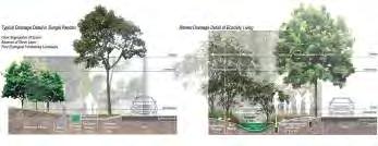
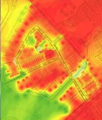
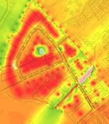
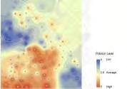
MITIGATING MICROCLIMATE IN THE INDUSTRIAL AREA
With the increasing world population and urbanization, the need for reducing urban temperature and their related health consequences is becoming more critical. The design of pandan road aims to investigate the magnitude and the potential of street space cooling to mitigate the heat caused by urban heat island effect. It is an attempt to reduce the impact of industrialisation on the surrounding environment for the future climate change.
The temperature in the site is relatively higher than its surroundings and the cause of the phenomenon is due to high hardscape percentage and reliance in drainage conventions to allow efficient discharge of surface runoff. The wall between the street and factory area creates a barrier that makes the streetscape fragmentized where there is inadequate space for tree planting to provide more shade to cool the area. In addition to the heat and barrier, the design of connecting public space is also required to be addressed.
Three strategies are used in creating a design solution and a plan for the site, the project aims to mitigate specific development impacts and compensate lost ecological functions. Firstly, by integrating the fragmentized green space and removing of existing barrier between the street and factory. The design will implement movable landscapes, private planting spaces and private car parking spaces to create a more continuous green space within the urban environment. Secondly, based on the topography and the precipitation, the design of bioswale is applied to slow down the rainwater while providing evaporation from plants to cool the area.
Lastly, the simplex structure of trees in the site is redesigned to provide more shade for the thermal comfort of people while enriching the biodiversity of the site, cooling the place for workers to commute and rest outdoors.
With these interventions, the design fully utilises the potential space in the street and change the existing impermeable area into a more resilient green space.
Gao Chenchen
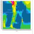
MICROCLIMATE CONDITION
TemperaTure map
SITE CONDITION
sofTsCape and hardsCape map
CLimaTe daTa
N
High runoff rate in industrial area
Degrees of Heat produced by factorys
60 m N
peak surfaCe runoff CoeffiCienT
SITE ANALYSIS
The climate in the urban canopy layer, below the roofs in the spaces between building can vary significantly within a distance of even a few metres. This means that the starting point will be the small scale level of the street.
TemperaTure
STRATEGY1
Based on the existing topography and soil condition, the design strategy is to utilize stormwater management to cool the area and increase the habitat condition of the area. Through the design of bioretention swale, rain garden for infiltration, lawn for purification and activities through these areas. The design of storm water system based on the process of rain water stream can effectively cool the area because the evaporation of the water and vegetaion can cool down the temperature. Meanwhile, the areas are designed combined with urban trees planted in consideration of the breeze wind.
Source: Lin Xin
Source: Ling Chang
eVaporaTion of WaTer and VegeTaTion
seCTion of rain garden
1.Shade street trees for thermal comfort 2.Cool esplanade 3. Rest area in rain garden
Bioretention swale 5. Waterscape 6. Pond and seatings 7. Rain garden and wooden platform for activity
Permeable paver
Purification lawn for roof water(grey water)
Raised lawn for infiltration
pLanTing sTraTegy
Trees are planted to provide more shade for the area, and in consideration of the wind corridor. The wind speed will up because of the open space and topography. The area will have more shade and cool breeze through.
Canopy trees
Acacia cincinnata
Pellacalyx axillaris
Peltophorum pterocarpun
Nephelium lappaceum
Calophy putcherrimum
Mid-canopy trees
Planchonella obovata
Acacia auriculiformis
Sea hibiscuis
Understorey trees
Agerstroemia speciosa
Hymenaea courbaril
Syzygium zeylanicum
Undergrowth trees
Structure of urban forest
Simulation of wind direction and speed
Plumeria obtusa Leea indica Mimosa pudica
NEW INDUSTRIAL LANDSCAPE AS A LIVING MACHINE
In Singapore, the 42% of coastline, which is occupied by the industrial area, is covered with man-made vertical seawall. In Sungei Pandan’s industrial area, there are lots of factories, including many seriously polluted shipyards. The contaminants flows into the sea with rainwater, causing a negative impact on the natural environment. The pollution analysis indicates that the factories along the Pandan River, which are shipyards and manufacturing industry, have the most serious pollution level. The project aims to propose a new prototype of industrial landscape that is beneficial for improving the ecological and environmental quality through biological purification system while serving recreational activities for the public.
Four strategies are used during the design process. Firstly, ensuring the space for water treatment plant by replacing the current factories in the site; secondly, establishing of water treatment process based on the principles of wetland ecology to purify the water sequentially from sedimentation pond to heavy metal treatment then pathogen treatment and nutrient treatment. The treated water will be used for plant nursery before flowing into the sea. Thirdly, increasing of public engagement by combining the water treatment process with education, enriching people’s space experience; fourthly, creating aquatic habitats by modifying the coastline and creating an inter-tidal zone for mangroves and other plants and animals.
The project envisions this new kind of prototype of the industrial landscape will be duplicated along the entire coastal industrial zone in a long-term plan to create an ecological coastline for purification, restoration and education.
Wang Hanfeng
SITE
RESIDENTIAL AREA
20.9%
The residential area is mainly occupied by HDBs. The precentage of openness is about 79% , just the same as that in industrial area. However, the buildings in this area are smaller and more seperated. So, compared to the industrial area, the open space here is more evenly distributed, which means that it is more fragmented and hard to be used.
INDUSTRIAL AREA
20.1%
This industrial area is mainly occupied by shipyards. The precentage of openness is about 80% and the buildings in this area are bigger but more concentrated. So it has a larger and more integrated open space for redeveloping.
SITE ANALYSIS
WATER POLLUTION SOURCE
1.heavy metals(Zinc)
2.chemicals(Alkalies, cleaning and paints stripping solvents)
3.organics(oil, organic solvents)
3.Suspended particle(paint chips)
A small patch of freshwater mangrove habitat in west coast park that near the canal.
Ensure the space for water treatment plant by replacing the current factories in the site.
STRATEGY I
The site is in the industrial area that is beside a canal and opposite the west coast park. Also, the site is located at the river mouth,. It is like the gate at the center of the cross.
The average rainfall(monsoon): 25.8mm/d
The whole site area: 1777908m2
The whole rainfall : 46164m3/d
The potential treated area: 173308m2
The potential treated rainfall: 4500m3/day
The site area: 34407m2
4500m3/day
The current building area: 7016m2
The current industrial type: shipyard
The new designed building area: 3000m2
The new designed industrial type: water industry
Marine pollution caused by ships and the polluted water from canal flows into Pandan river with high tide.
This area is surrounded by factories that have serious air pollution and noise pollution. These negative impacts can be found representively in the site.
STRATEGY II
Pathogen treatment Area: 4000m2
The third stage to treat the water by mostly using emergent plants to remove the pathogen when water flows through their roots.
Plant nursery Area: 750m2
The fifth stage is to use the treated water and it is also a comprehensive treatment.
Nutrient treatment Area: 1500m2
The forth stage to treat the water by using various types of plants to remove nitrogen and phosphorus from water.
Sedimentation pond
Area: 2000m2
The first stage to treat the water, letting the suspended solids settle down.
Heavy metal treatment Area: 2000m2
The second stage to treat the water by mostly using submergent plants to absorb the heavy metal in the water.
Establish a water treatment process based on the principles of wetland ecology to purify the water sequentially from sedimentation pond to heavy metal treatment then pathogen treatment and nutrient treatment.
Cat-tail
Lythrum salicaria Salvia coccineaAloysia citrodora Scirpus validus
SURFACE FLOW CONSTRUCTED WETLAND
Ottelia alismoides
Myriophyllum spicatium
Najas Duckweed
Potamogeton octandrous
Pontederia cordata Juncus effusus
water from drainage aerating
Nutrient treatment process
STRATEGY II
VERTICAL SUBSURFACE FLOW CONSTRUCTED WETLAND
STRATEGY III
Increase public engagement by combining the water treatment process with education, enriching people’s space experience.
In this area, people can see the process of pathogen treatment and have a aerial view to see the coastline.
In plant nursery, people will find some kinds of herbs that has beautiful flowers or comfortable smell. It is like an ornamental garden. The water used in here is comes from the polluted water after purification. Also, it has indicated the water quality.
The area is a part of mangrove area. People in here can see different kinds of mangroves and they can learn the knowledge about how the mangrove grows, its growing habits and its functions.
Main road
Secondary road
Potential animal corridor
Interaction area
Here is the place for people to rest. People can lie on the grass and see the process of nutrient treatment and the flowing stream, even small animals. This area is also a inter-tidal area but it is more for other aquatic plants and animals. People can observe and even touch the plants or the small animals in the water. It is a good place for people to experience.
Pathogen treatment process
STRATEGY III
PLANT NURSERY
STRATEGY IV
STRATEGY IV
Create aquatic habitats by modifying the coastline and creating a inter-tidal zone for mangroves and other plants and animals.
PLANTATION STRATEGY
STRATEGY IV
INTER-TIDAL AREA
Current channel is made of concrete.
Change the bank into a terracing for bioengineering, slowing down the water.
Change the degree of bending and create more gentle slope for species to settle down.
Change the seawall into a gentle slope for the accumulation of mud.
revetments
retain water and species.
Current coastline is man-made vertical seawall.
Enigma
Enigma
Fiddler crabs
Fiddler crabs
Whitespot
Malayan water monitor
Malayan water monitor
Crab-eating frog
Crab-eating frog
Estuarine catfish
Stone/Thunder crab
Stone/Thunder crab
Spotted scat
Striated heron Little egret
Sea bass Mullets
Clams
NATURING URBAN:
RESOLVE THE TENSION BETWEEN URBAN AND NATURE HABITATS, LEVERAGING ON NATIVE HABITAT STRUCTURES IN SUNGEI PANDAN
In the highly industrialized area of Sungei Pandan, there are two narrow patches of mangrove/ coastal forest habitat remnants, one at the upper stream of Sungei Pandan river is preserved from the original Pandan Forest Reserve, the other is the rejuvenated mangrove at West Coast Park. However, their conditions are compromised by the urbanized context, with constrained space for establishment and disconnected from external ecological connections. To tackle the increasingly intensive relationships between urban and nature, the existing ecosystem of Marsh Garden and the neighbouring concretized canal - Sungei Pandan Kechil - and adjoined urban park space of West Coast Park are chosen for intervention. The design intention is to dissolve and transform the edges between urban and nature, modify barriers and thresholds hindering human-nature interactions, ultimately creating new urban-nature relationships and reforming the interconnection between nature ecosystem and human social system.
Existing urban attributes (landform, drain line, edges) would be utilized through feasible treatments to create conditions for nature to thrive. Leveraging on the established habitat structure of Marsh Garden, more diversified habitats are planned to be developed in phases. Toning between these different habitats is strategized for amplifying nature process and improving the resilience of the ecosystem, meanwhile enabling nature to be woven into urban fabrics.
The thriving ecosystem also function as sustainable landscape infrastructure. Multi-layered and multi-functional spaces serving as transitions between urban and nature improve people’s access and spontaneous interaction with nature. Dynamic programmes are integrated to cater to the needs of surrounding community (particularly urban workers, residents, schools, research institutes, etc.) and further create opportunities for social practice of ecosystem service value articulation. The narratives of new human-nature relationship are conveyed through design, for reshaping regional human ecosystem and morphing new sense of place and sense of nature. Retrofitted into vibrant space for coastal habitat research, learning and recreation where a new identity for West Coast Park is to be derived.
This project is envisioned to realize wider regional impacts through reviving of nature, both ecologically and socially. The co-existence and mutual benefit between urban and nature is to be addressed in a broader sense.
Fan Lei Helen
SITE CONDITION & ISSUE
Land use and VegeTaTion densiTy in sungei pandan
The existing land use condition in Sungei Pandan resulted in isolatons of urban environment and nature habitats, with narrow patches of coastal habitat patches and sparse vegetation in urbanized context.
Sungei Pandan Mangrove Habitat (Unmamaged man grove & coastal habitat)
Urban Habitat (managed vegetation)
West Coast Park (mixed managed and unmanaged habitat)
Land Use Map. The segregation of different land use areas Source: URA Masterplan 2014 Sungei Pandan Vegetation Density Map
impaCTs from CurrenT forms of Land use
Biodiversity Potential Map. Habitat suitability analysis based on 5 birds and 5 mammals. (Purple indicating lower potential for biodiversity). Source: Dr.
boundary CondiTion for The TWo major naTuraL habiTaTs
EXISTING HABITAT CONDITION
Investigation into the coastal habitat condition of the three key areas, A) Sungei Pandan Mangrove; B) Pandan Urban Habitat; C) Marsh Garden at West Coast Park
Species
Habitat Structure for A)
Tidal Mangrove Freshwater Mangrove Coastal Forest
Habitat Structure for B)
Freshwater Mangrove Brackish Swamp Park & Garden
Habitat Structure for C )
Roadside Plantation Canal vegetation
Sungei Pandan Mangrove
Area 1:
Rhizophora Mucronata Avicennia officinalis
Rhizophora apiculata Acacia avriculaformis
Area 2:
Bruguiera Cylindrica Sonneratia alba
Rhizophora apiculata Avicennia Alba
Leucaena leucocephala
Area 3: Rhizophora apiculata Avicennia rumphiana Avicennia officinalis
Inspite of the small area, West Coast Park is hosing 35 bird species, using mangrove, wetland, park or urban habitats. Some birds detected here are also using other coastal / mangrove habitats or nature reserves.
PHOTOGRAPHIC DOCUMENTATION OF SITE CONDITION
Park map elaborated based on URA Masterplan 2014
Map of Coastal Condition and water depth, 1989 2009
Elaborated based on historical map, National Archives
Open park space ourside Marsh Garden
Park footpath bordering Marsh Garden
Concretized Water Canal bordering dense vegetation
Sungai Pandan Kechil Canal mouth and Seawall
Brackish water pond of Marsh Garden
Rhizophora and magrove fern established at pond bank Pond bank vegetation
Brackish / freshwater swamp at Marsh Garden pond bank
PHASAL ESTABLISHMENT
Design interventions are strategized for mitigating the disruption of existing habitats, meanwhile creating spaces and conditions favoring the emergence of new habitat and nature process to take place.
EXISTING CONDITION
Marsh Garden pond waterbody: consistent water height 3m
The height of tidal gate would gradually decreae to create tidal conditions
Lower topo area 1: central turf, water ponding happen after the rain, utilize for the creation of riverine habitat
Lower topo area 2: area around carpark, where drainlines are intensively constructed, this site bordering marsh garden forest is chosen for Constucted Wetland
Freshwater Mangroves are identified towards the sea direction
IN LONG TERM - POND BEING TRANFORMED TO TIDAL ESTUARINE
Ultimately, the height of tidal gate is 1m, the brackish pond would be transformed to tidal estuarine
Riverline establishment towards the park sapce
Designated tidal zone 30-50m wide
With the established urban habitat in earlier stage, nature habitats development is to be improved River line flowing into park space, creating transitioning habitat conditions
Establishment of back mangrove forest as transitioning habitat
STAGE 1 - PREPARE FOR OPENING
First start with new habitats establishment in the urbanized context
Canal Mounth is widen for improving sedimentation formation
Tidal Gate of 2.9m height is built to continue maintain the water level at Marsh Garden
Introducing seawall mangrove habitat and canal bank mangrove by transform the impermeable canal bank to condition feasible for mangrove and other coastal vegetation to thrive
Tidal condition is also introduced into urban
Surface runoff collected in the extensive drainline would be collected in the nearby Constructed Wetland
In conjuction with Constructed Wetland, Bio-swale are designed, leveraging on existing topography, to prapare the furture establishment of Back Mangrove (which requires salinty gradient created by tidal and freshwater input)
Treatment Methodolgy of concretized canal bank to create habitats for mangrove:
The habitat of Constructed Wetland is designed as a transition from Coastal Forest, which also could function as a buffer, protecting conserved habitat from urban context
HABITAT EMERGENCE
Existing Habitats
Freshwater Mangrove Brackish Swamgp
Coatal Forest Park & Garden
Stage 1
Seawall Mangrove
Tidal Estuarine
Tidal ForestConstructed Wetlanf
Bio=swale Mudflat
Completely established
Back Mangrove
RiverineTransitioning Habitat
DESIGNATED HABITAT CONDITION AFTER ESTABLISHEMENT
Tidal Estuarine: Length 150m / width 6m
Elevation range: 1.5-3m
Tidal Mangrove: Mangrove zone width of 58m
Elevation range: 1m – 3.5m
Slope 2.8°
Seawall / Canal Bank
Mangrove: Length 530m width 4-14m
Elevation range: 0-4m
Tidal Swamp:
Area: 1,127msq
Elevation Range: 1.5-3m
STRATEGY
1 COASTAL NATURE TO THRIVE IN CONTROLLED SETTINGS OF URBAN CONTEXT
STRATEGY
SECTION A-A’ - EXISTING & DESIGNATION
SECTION B-B’ - DESIGNATION
Park & Garden Canal Bank Mangrove
(Nature thrival is chonstrained)
(Mangrove establishement in compromised condition)
Tidal Mangrove Back Mangrove Bioswale Coastal Forest
Constructed Wetland
(Bio-swale provides freshwater input for Back Mangrove)
Coastal Forest Freshwater Mangrove
Coastal Forest Brackish Swamp Park & Garden
Seawall Mangrove Coastal Forest Back Mangrove Tidal Mangrove Tidal Mangrove Back Mangrove Brackish Swamp Mangrove Nursery
(Dense vegetation forms threshold between urban & nature)
(Transitioning into urban space, and provides buffer for Coastal Forest)
Proposed Habitat Map for Marsh Garden
STRATEGY 3
GENERATE AN INTEGRATED WATERFRONT BASED ON BROWN EARTHWORK
Singapore is facing the impacts of high-density urban development. One of these impacts is the contamination of residues in urban brownfields. Being an important node of Sungei Pandan, Pandan river mouth’s waterfront is a nexus of river-based industry, transportation, commerce and maritime activity at the current stage. The site is located in Pandan waterfront industrial area, which is working as a shipyard with a high level of soil contamination, a mixture of organic and inorganic contaminants. Thus, this project seeks a comprehensive way to restore the waterfront area by pollution treatment process and reshape the relationship between ecology and urban system.
The surface runoff in current situation brings contaminants from factories, urban traffic and residential areas to the waterfront area where there is no hardscape to prevent the bare ground from being polluted by these contaminants. The contaminants in the soil are hard to be filtered or degraded with a very low level of vegetation density in the site. While treating the polluted soil, we need to dig out the hot spot and cap the polluted soil. It is a chance to generate a new landform by fully utilizing the brown earthwork.
There are three main strategies in this project, namely, mitigating soil pollution, utilizing nature succession, providing potential for habitats and social programs. The strategy of mitigating soil pollution happens on the whole site with the application of two tactics for this strategy: cutting and filling brown earthwork and using phyto-techniques. On the cut shoreline, the strategy utilizing nature succession is aiming to generate a new shoreline by sediment baffles, which will be set in the water edge and cutting out area for the tide to work for it. Additionaly, the project provides potential habitats and social programs that locate in different types of elevation, slopes of the new topography that is generated by the new brown earthwork.
By introducing these strategies, the proposal integrate Pandan waterfront to a vibrant and active place by dealing with the brown earthwork, so that it can provide the potential for both habitats establishment and people’s need for safe and stable waterfront space, and additionally adapt to the extreme weather.
Xu Linxin
LANDUSE ANALYSIS
In new development, residential area: 1750793 m2
Residential FAR: 2.8; Ratio of green space: 26%
Total green space area: 1750793 * 26% = 45.52 ha
Existing green space area: 31.4 ha; So the new park need to be 14 ha
SOIL CONDITION ANALYSIS
From the historic map, we can know that this area has the potential to become habitat.
Coral reef Sand with some coral
with mudflat
ConTaminanTs TypoLogy and runoff
FRAMEWORK
frameWork of ConsTruCTing LandsCape based on broWn-earThWork
STRATEGY 1: MITIGATE SOIL CONTAMINATION
remediaTe soiL poLLuTion by managing sTorm runoff
STRATEGY 1: MITIGATE SOIL CONTAMINATION
Source: Data.gov.sg
2:
STRATEGY 3: PROVIDE HABITATS& PROGRAMS
The park will work as an eco-connector between the two patches, and provide ecological services for the surrounding areas.
B. Observing and being educated from purification process
A. Wandering in coastal habitats, and playing with nature
West Coast Park
Eco-Connector
Eco-Connector Mangrove Site
C. Nursery transformed from industrial building to show soil remediation process
RESHAPING COASTAL EDGE LANDSCAPE IN A HIGH-DENSE TROPICAL CITY
Due to urbanization and land reclamation, Sungei Pandan, once the largest mangrove habitat in Singapore, has witnessed a dramatic change of shoreline condition, which caused intertidal habitat loss and fragmentation. With current land use function and edge condition, the lifestyle around Sungei Pandan is detached from the original coastal characteristics, which leads to lack of public awareness for coastal habitats conservation. The project aims to revive coastal habitats under high-density urban context, by shaping a more diverse coastal edge along the Pandan River at the most representative and critical site of the whole area, the middle part between two canals, as a coastal park to benefit the whole community.
The project applies three strategies to reshaping the coastal edge landscape. Firstly, to diversify landform and shoreline, a shallow branch of water is introduced into the site where both shoreline and waterfront are redefined into natural forms. This creates a heterogeneous hydro condition such as brackish pond and riverine estuaries which expands the intertidal zones.
Secondly, by accommodating various habitats, the whole site is divided into active/passive recreation and restoration zone. Coastal, freshwater and urban habitats are then placed to accommodate the hydrological conditions which engage urban with natural area.
Lastly, the project integrates development into coastal habitats with both education and recreation activities that are arranged closely with nature based on habitats distribution. Community activities happen mostly in the northern part of the site, while housing and passive recreations are placed in the southern part. Mangrove restoration project is mainly placed on the new island. Jogging and biking tracks connect the whole site and implementation of boardwalks, treetop walk and aerie tower allow people to go through these coastal habitats.
The project provides a showcase of coastal habitat for public, in which human activities and coastal landscape are integrated together. A biophilic lifestyle would become widespread while people are unconsciously influenced here.
Yao Haomu
BACKGROUND
of CoasTLine _ Losing of CoasTaL idenTiTy
STRATEGY 1
diVersifying Land form and shoreLine
Diagram for edge treatment
Topography and TidaL range
Mean high water neap(sea level:2.2m)
Mean sea level(sea level:1.7m)
Mean low water neap(sea level:1.2m)
Reference: Tidal Condition in Tuas
STRATEGY 2
aCCommodaTing Various habiTaTs
Condition
Cyrtostchys lakka
Homalomena
Licualaspinosa
Ardisia elliptica
Callisia repens (Jacq.) L
Diospyrosblancoi
Ficus Lyrata
Mangiferaindica
Tetragoniatetragonioides
Grevillea baileyana
PentadesmabutyraceaSabine
Ardisia elliptica
Callisia repens (Jacq.) L
Diospyrosblancoi
Acacia avriculaformis
Avicenniaalba
Avicennia officinalis
Taliparititiliaceum
Lumnizerarazemosa
Lysimachianummularia L.
Nymphaeacultivar
Pandanustectorius cultivar
Pontederiacordata
Victoria amazonica
Acacia avriculaformis
Avicenniaalba
Avicennia officinalis
Taliparititiliaceum
Lumnizerarazemosa
Calophylluminophyllum
Cerbera odollam
Excoecaria agallocha
Eryngium maritimum
Hibiscus tiliaceus
Lumnitzera recemosa
Lumnitzera littorea
Cassia surattensis
LivistonaChinensis
Medinilla speciosa
Pandanussanderi
Veitchia merillii
Avicenniarumphiana
Avicenniamarina
Lysimachianummularia
Nymphaeacultivar
Pandanustectorius
Pontederiacordata amazonica
Acacia avriculaformis
Avicennia officinalis
Bruguieragymnorrhiza (L.) Lam
Cocosnucifera
Lumnizerarazemosa
Shrub:
Acanthus ebracteatus
Plucheaindica
Groundcover:
Leucaenaleucocephala
Rhizophoraapiculata
Taliparititiliaceum
Aegicerascorriculatum
Metropeangulate
Nypa fruticans
Rhizophoraapiculata
Rhizophoramucronata
Taliparititiliaceum
Chaetomorpha
SalicorniaeuropaeaL.
Tetragoniatetragonioides
Shrub:
Habitat
Albizia saman
seCTion b seCTion C
seCTion d
mudflat mangrove coastal forest riparian scrub
STRATEGY 3
inTegraTing deVeLopmenT inTo CoasTaL habiTaTs
TraffiC and aCTiViTies
aCTiViTies and suiTabLe habiTaTs
This semester’s studio gave me a new perspective when approaching design. We were taught about the importance of site research and how it helps and informs the progress of our design. Detailing the issues about the site helps to make the project more personal, in my opinion. That is why tackling the problems I saw on site encouraged me to make a change in the urban fabric. I had enjoyed being on site and studying the faunas and their behaviours. It was an eye-opener for me, as previously birds and other animals were never taken into consideration as part of the landscape. Although it was a struggle at first, I loved how the studio encouraged each other and pull it through until the end. It was a bittersweet victory, and I can’t wait to see what’s in store for us in the future.
Nur Azilla
The studio has been a fruitful and memorable experience as my first learning exposure through the design process of landscape architecture. Thanks to all the teamwork, guidance, and sharing from studio colleagues, experts and practitioners, I was enabled to derive more comprehensive and consolidated perspectives concerning coastal habitats and their compromised condition incurred by high-dense urban development, simultaneously, exploring into ecological potentials that we could leverage on for resolutions of such tensions. Through this studio, I start to be inspired by dealing with diversified opportunities and challenges, as our role of being landscape architects, in creating social and ecological impacts in progressive ways, and to really think critically for achieving the optimisation of both sides (urban and nature) of values, through design interventions.
Fan Lei Helen
Though it is not an easy journey understanding the phenomenon of our depleting coastal landscape of Singapore, it was fulfilling to discover, investigate and imply on our gained knowledge to create different solutions that tackle critical issues of the site which other parts of the tropics are potentially facing. The importance of landscape architecture is apparent particularly on how we strive in balancing the ecology, economics and social aspects of Sungei Pandan, in both the existing and new development conditions to create various design proposal that serves as alternatives which our highly-advanced country can adopt when responding to such valuable sites with great ecological attributes. Overall, this experience has taught me to be courageous in exploring new landscape design ideas, pushing my creativity and analytical skills which is an essential attitude that I will carry throughout my design education and career.
Victor Kuan
This module aims to restore the coastal landscape in a future high-dense residential area by following the natural process which is an important concept for landscape architects to learn. Since uprising spread of hard surface in the modern urban area, the natural resource like the lake, soil, grassland, mudflat, marshland are all replaced by the concrete and steel, where natural succession is no longer familiar to urban dwellers and the species habitats are disappearing dramatically. It’s the call of duty for landscape architects to remind people what’s the natural environment looks like by mimicking the natural process. And meanwhile, dealing with environment issue and mitigate the conflict between human and nature is exactly what we are doing. I hope I can find more innovative way to build more ecological, vibrant and safety urban environment in the future.
This module gives me a vital experience in engaging issues related to landscape architecture in super urban cities. It pushed me to learn the land, people and vegetation in this dense environment. It helps me to know how intensive site research is and how it forms our design. Also, I have gained a new perspective on landscape design by learning to design ecologically.
Liu Xiaolei
Kong Lingchang
This first MLA studio gave me a quite different learning experience, and I have learned a lot. Firstly, this studio taught me the importance of the way of thinking. Critical thinking was needed during the whole design process and keep asking myself why made my design more logical. Secondly, this studio focused on ecology, which I did not pay much attention before. It was meaningful to learn how to coordinate the relationship between nature and human, and it is also a new angle for me to see problems. Thirdly, I tried to use geodesign method during the design process and learned lots of knowledge about the constructed wetland with the push of the tutors. Also, I think my presentation skill still need to be improved, and I believe that everything I learned will be useful for me to explore in the future study.
Wang Hanfeng
The first studio in MLA is quite different from what I learned during my undergraduate period, and it really gives me a new way of thinking and designing.Moreover, this studio mainly focuses on ecological landscape design, which is a new field for me, and I found it is quite tricky in the beginning. Facing the conflicts of habitat loss and high-density urban development, I learned to find out the most suitable strategies based on site researchers. What I focused on in this studio is brownfield restoration. As I attempted to utilise the remediated brown earthwork to manage storm runoff while to provide potentials for habitats and recreation programs, I began to know that landscape does not just mean beautiful things, we should add more values and functions to it. Lastly, I believe these gains will help me explore more knowledge in the landscape field in the future.
Xu Lin Xin
This is the first design studio in MLA program, which mostly focuses on ecology. After we found our issue, we tried our best to find a new harmonious relationship between human and nature, with a hope of contributing to Sungei Pandan. In this studio, I learned how to fully utilise the existing resource in our hands, how to make full use of the data we have and how to think critically, then we can turn the constraints into opportunities and do a more innovative design. Not only in Singapore, we need to do like this, but also in the world with an increased acute contradiction between human and nature, we still need to do this, this is the responsibility of a landscape architect.
Wang Zhe
Undergoing the very first MLA Ecological studio which is very relevant in today’s’ Singapore context, gave me a wider scope of lens on how I could view, think, process and design landscape critically in a holistic manner. was intrigued by how important our coastal landscape is in Singapore, on how it has morphed and depleted. Most importantly how we as landscape designers could do our part to preserve, enhance and enrich our evolving coastal landscape which is in the phase of depletion. The site visits were beneficial and refreshing as it allowed myself to experience the coast, get immersed in the atmosphere and environment and stay connected with the people in the district. The process of this studio was the most important to me as it showcases the consistency, progression and development through the various mediums such as specific research, site study and essay reading. I would apply what I’ve learned to the upcoming studios in the next few semesters.
Raymond Yong
This semester’s experience was to me a definite ‘culture shock’. It has broadened my horizon by letting me peek into the world of landscape. It is mind-blowing to me regarding how much intricate details and data go into the whole planning process. Previously thought that landscape was all about design and that having the artistic sense would be fundamental to its success. Having gone through one semester, however, realised that the logical and practical aspects of it matter so much more. Its multi-faceted thinking required for a thorough planning stretched me beyond what would have imagined. I have come to appreciate and respect the fact that humans do not lord over nature. In fact, the wildlife is very much an essential part of the ecosystem, and hence we should take special care to share the same space in harmony, and this is precisely where landscape design can play such a vital role in finding that delicate balance in dividing the area between wildlife and human.an.
This studio gave me a new understanding of ecological design. The completion of the design does not mean that the project is completed, whether it achieves the desired goal and the ecological evolution in the process is also something that we need to focus on. The ecological design should be a process of science, and science is to find the characteristics of a general rule, so regarding design results, a reasonable design should include a complete set of ecological design evaluation standards. Also, our design should adapt to the site over time. Therefore, the ecological design should be based on the site, not just stay on the papers.
Xu Yuexin
I’m glad that survived since there were so many challenges throughout the studio. It’s the first time that nature becomes the main priority where green spaces are no longer simply labelled as green visual like my previous learning experience of urban planning. By understanding the site condition in numerous dimensions, we learned how the natural process works in the high-density urban context. Based on these analyses, we formed individual narratives in imagining a new Pandan Coast. It’s quite tricky to implement measures to coastal landscape due to its dynamic tidal conditions and changes. As I try to prove with my design that it’s possible for us to accommodate with the natural process and blurred boundary rather than separating the coastal nature and our daily life by putting a solid seawall everywhere. In all, this studio expanded my understanding towards nature and design, I’m expecting to explore more detailed environmental issues in the following semesters.
The first MLA studio is a challenge for me, and it gave me an entirely different view towards landscape architecture. We started with the research of the site by kayaking in the pandan river, and I never feel such close to the nature like this before. think it is a good experience from which we can learn the natural process, the animals, the vegetation and feel the relationship between them in ourselves. What I also learned from the studio is that ecosystem must be emphasised and considered when we start our design because even a small area can affect the system and people are also as a part of the system. Moreover, the critical and logical thinking has always been emphasised during the studio process, I try to express myself in every presentation, and through this, I become a little confident to express myself. All in all, although the study process may be a hard challenge for me, will keep on going.