Study Guide G07 ~ Social Sciences: Geography
Unit
1
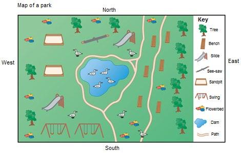
LESSON 1: LOCAL MAPS AND STREET MAPS The types of maps below contain different details and are used to communicate specific information to the user. Each type of map will be discussed in detail during the lesson. The lesson will outline what each map is used for, as well as what type of information it provides to the user. 1.1
Types of maps
A map is a picture or representation of the earth’s surface, showing how things are related to each other by distance, direction, and size. There are many different types of maps and each map is used for a specific purpose.
•
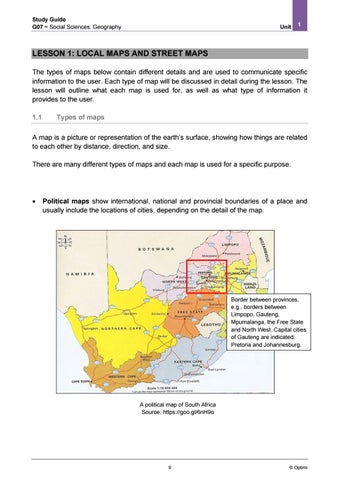
Political maps show international, national and provincial boundaries of a place and usually include the locations of cities, depending on the detail of the map.
Border between provinces, e.g., borders between Limpopo, Gauteng, Mpumalanga, the Free State and North West. Capital cities of Gauteng are indicated: Pretoria and Johannesburg.
A political map of South Africa Source: https://goo.gl/6nH9o
9
© Optimi